Property Record
13252 Harney Ave, Port Charlotte, FL 33981

This Property Is For Sale
NEARBY LISTINGS FOR SALE OR LEASE
Property Detail
13252 Harney Ave
Punta Gorda, FL
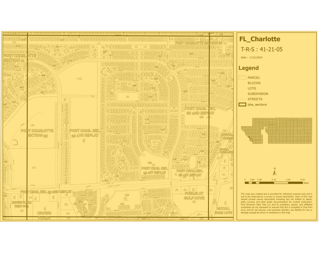
Port Charlotte
412105453001
PORT CHARLOTTE SEC 95 BLK 5120 LTS 1 THRU 17 INC SV439/126 1751/1832 1857/1673 1903/1656 3270/2067 3345476 PCH 095 5125 0024 PORT CHARLOTTE SEC95 BLK5125 LT 24 1041/1376 1908/1375 3270/2067 3345476 PCH 095 5125 0022 PORT CHARLOTTE SEC
Residentialacreage
Charlotte
AE
Florida
12015C0211G
1-17
2024
9.73 AC
2025
Charlotte County
030102
Southwest Florida
DEMOGRAPHICS near 13252 Harney Ave
1 Mile
3 Mile
5 Mile
2024 Total Population
2,380
20,572
45,713
2029 Population
2,875
24,983
55,574
Pop Growth 2024-2029
+ 20.80%
+ 21.44%
+ 21.57%
Average Age
53
54
56
2024 Total Households
1,134
9,447
21,415
HH Growth 2024-2029
+ 20.99%
+ 21.60%
+ 21.76%
Median Household Inc
$61,719
$62,304
$62,417
Avg Household Size
2.10
2.20
2.10
2024 Avg HH Vehicles
2.00
2.00
2.00
Median Home Value
$235,829
$277,971
$284,601
Median Year Built
1987
1997
1998
Nearby Places
Map Layers
Map Styles
 Street
 Aerial
- Restaurants
- Banks
- Shops
- Fitness
- Groceries
PUBLIC TRANSPORTATION
AIRPORT
Punta Gorda
DRIVE
WALK
Distance
Punta Gorda
36 min
21.2 mi
Freight Ports
Port Manatee
DRIVE
WALK
Distance
Port Manatee
85 min
62.6 mi
Nearby Properties
Address
Land Use
TOTAL SIZE
Lot Size
Zoning
Address
Land Use
TOTAL SIZE
Lot Size
Zoning
99,840 SF
7.60 AC
IG
Address
Land Use
TOTAL SIZE
Lot Size
Zoning
67,466 SF
16.30 AC
CG
Address
Land Use
TOTAL SIZE
Lot Size
Zoning
27.65 AC
RMF15
Address
Land Use
TOTAL SIZE
Lot Size
Zoning
108,048 SF
14.84 AC
CG
Address
Land Use
TOTAL SIZE
Lot Size
Zoning
132.79 AC
PKR
Address
Land Use
TOTAL SIZE
Lot Size
Zoning
2,016 SF
315.56 AC
PD
Address
Land Use
TOTAL SIZE
Lot Size
Zoning
51,683 SF
7.16 AC
CG
Address
Land Use
TOTAL SIZE
Lot Size
Zoning
100,910 SF
22.85 AC
RSF3.5
Address
Land Use
TOTAL SIZE
Lot Size
Zoning
34.11 AC
CG
Address
Land Use
TOTAL SIZE
Lot Size
Zoning
20.12 AC
CG
Address
Land Use
TOTAL SIZE
Lot Size
Zoning
38.14 AC
IG
Address
Land Use
TOTAL SIZE
Lot Size
Zoning
6,055 SF
2.74 AC
RMF15
Address
Land Use
TOTAL SIZE
Lot Size
Zoning
12,300 SF
5.02 AC
IG
Address
Land Use
TOTAL SIZE
Lot Size
Zoning
11,509 SF
12.06 AC
RSF3.5
Address
Land Use
TOTAL SIZE
Lot Size
Zoning
0.20 AC
RSF3.5
Address
Land Use
TOTAL SIZE
Lot Size
Zoning
6,476 SF
17.26 AC
II
Address
Land Use
TOTAL SIZE
Lot Size
Zoning
560 SF
10.23 AC
IG
Address
Land Use
TOTAL SIZE
Lot Size
Zoning
16.53 AC
CG
Address
Land Use
TOTAL SIZE
Lot Size
Zoning
8,510 SF
2.25 AC
CG
Address
Land Use
TOTAL SIZE
Lot Size
Zoning
5,222 SF
85.60 AC
RMF10
Address
Land Use
TOTAL SIZE
Lot Size
Zoning
3,864 SF
2 AC
CG
Address
Land Use
TOTAL SIZE
Lot Size
Zoning
12,907 SF
165.69 AC
RSF5
Address
Land Use
TOTAL SIZE
Lot Size
Zoning
18,599 SF
1.96 AC
IG
Address
Land Use
TOTAL SIZE
Lot Size
Zoning
10.88 AC
CG
Address
Land Use
TOTAL SIZE
Lot Size
Zoning
11,708 SF
9.99 AC
II
Address
Land Use
TOTAL SIZE
Lot Size
Zoning
3,767 SF
88.50 AC
RSF2
Address
Land Use
TOTAL SIZE
Lot Size
Zoning
4,000 SF
7.78 AC
RMF10
Address
Land Use
TOTAL SIZE
Lot Size
Zoning
3,589 SF
1.47 AC
CG
Address
Land Use
TOTAL SIZE
Lot Size
Zoning
6,116 SF
7.30 AC
PKR
The World's #1 Commercial Real Estate Marketplace
Connect with us
© 2026 CoStar Group
The information above has been obtained from sources believed reliable. While we do not doubt its accuracy we have not verified it and make no guarantee, warranty or representation about it. It is your responsibility to independently confirm its accuracy and completeness. Any projections, opinions, assumptions, or estimates used are for example only and do not represent the current or future performance of the property. The value of this transaction to you depends on tax and other factors which should be evaluated by your tax, financial, and legal advisors. You and your advisors should conduct a careful, independent investigation of the property to determine to your satisfaction the suitability of the property for your needs.