Property Record
6921 Industrial Dr, Mebane, NC 27302


NEARBY LISTINGS FOR SALE OR LEASE
-
-
View all Mebane listings for sale on LoopNet.com
Property Detail
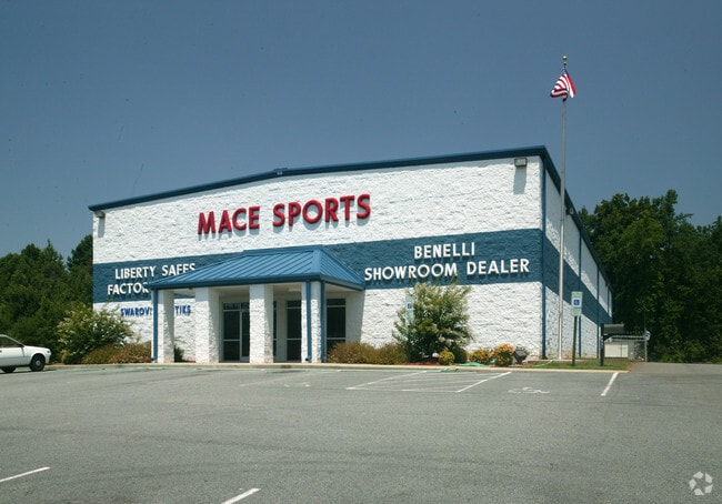
6921 Industrial Dr
9824980078
1 BYRD FAMILY LIMTED PARTNERSHIP & PYTHON ENTERPRI
Industrialgeneral
Orange
X
North Carolina
3710982400L
10.66 AC
2025
Orange County
2025
Raleigh/Durham
011103
Durham-Chapel Hill, NC
20,660 SF
DEMOGRAPHICS near 6921 Industrial Dr
1 Mile
3 Mile
5 Mile
2024 Total Population
825
16,072
32,066
2029 Population
765
16,151
32,938
Pop Growth 2024-2029
(7.27%)
+ 0.49%
+ 2.72%
Average Age
41
40
40
2024 Total Households
333
6,563
12,992
HH Growth 2024-2029
(7.21%)
+ 0.64%
+ 2.89%
Median Household Inc
$80,577
$74,356
$73,596
Avg Household Size
2.50
2.40
2.40
2024 Avg HH Vehicles
2.00
2.00
2.00
Median Home Value
$204,938
$225,975
$237,444
Median Year Built
1987
1998
1997
Nearby Places
Map Layers
Map Styles
 Street
 Aerial
- Restaurants
- Banks
- Shops
- Fitness
- Groceries
PUBLIC TRANSPORTATION
AIRPORT
Raleigh-Durham International
DRIVE
WALK
Distance
Raleigh-Durham International
44 min
34.3 mi
Freight Ports
Virginia Port Authority - Richmond
DRIVE
WALK
Distance
Virginia Port Authority - Richmond
189 min
165.7 mi
Nearby Properties
Address
Land Use
TOTAL SIZE
Lot Size
Zoning
Address
Land Use
TOTAL SIZE
Lot Size
Zoning
144.79 AC
Address
Land Use
TOTAL SIZE
Lot Size
Zoning
36,234 SF
13 AC
CR
Address
Land Use
TOTAL SIZE
Lot Size
Zoning
54,882 SF
52 AC
Address
Land Use
TOTAL SIZE
Lot Size
Zoning
8,024 SF
20.22 AC
R6
Address
Land Use
TOTAL SIZE
Lot Size
Zoning
173,178 SF
100.75 AC
Address
Land Use
TOTAL SIZE
Lot Size
Zoning
26,916 SF
14.76 AC
PUD
Address
Land Use
TOTAL SIZE
Lot Size
Zoning
375,000 SF
25.74 AC
Address
Land Use
TOTAL SIZE
Lot Size
Zoning
330,000 SF
22.83 AC
Address
Land Use
TOTAL SIZE
Lot Size
Zoning
169,091 SF
6.76 AC
B1
Address
Land Use
TOTAL SIZE
Lot Size
Zoning
37,242 SF
10.50 AC
CR
Address
Land Use
TOTAL SIZE
Lot Size
Zoning
47,648 SF
18.48 AC
R8
Address
Land Use
TOTAL SIZE
Lot Size
Zoning
265,200 SF
23.95 AC
Address
Land Use
TOTAL SIZE
Lot Size
Zoning
125,554 SF
65.50 AC
EDD
Address
Land Use
TOTAL SIZE
Lot Size
Zoning
23,114 SF
19.21 AC
ME
Address
Land Use
TOTAL SIZE
Lot Size
Zoning
210,000 SF
31.13 AC
Address
Land Use
TOTAL SIZE
Lot Size
Zoning
76,224 SF
12.22 AC
Address
Land Use
TOTAL SIZE
Lot Size
Zoning
205,500 SF
20.59 AC
Address
Land Use
TOTAL SIZE
Lot Size
Zoning
29,400 SF
9.02 AC
B2
Address
Land Use
TOTAL SIZE
Lot Size
Zoning
384,137 SF
17.22 AC
ME
Address
Land Use
TOTAL SIZE
Lot Size
Zoning
59,564 SF
21.33 AC
R20
Address
Land Use
TOTAL SIZE
Lot Size
Zoning
41,811 SF
40.31 AC
ME
Address
Land Use
TOTAL SIZE
Lot Size
Zoning
9,408 SF
8.47 AC
Address
Land Use
TOTAL SIZE
Lot Size
Zoning
180,000 SF
11 AC
ME
Address
Land Use
TOTAL SIZE
Lot Size
Zoning
11,850 SF
83.37 AC
Address
Land Use
TOTAL SIZE
Lot Size
Zoning
82,075 SF
21 AC
Address
Land Use
TOTAL SIZE
Lot Size
Zoning
184,419 SF
20.85 AC
B2
Address
Land Use
TOTAL SIZE
Lot Size
Zoning
63,948 SF
10.55 AC
O&I
Address
Land Use
TOTAL SIZE
Lot Size
Zoning
67,500 SF
10.42 AC
ME
Address
Land Use
TOTAL SIZE
Lot Size
Zoning
23,739 SF
31.21 AC
MER1
Address
Land Use
TOTAL SIZE
Lot Size
Zoning
9,408 SF
5.18 AC
The World's #1 Commercial Real Estate Marketplace
Connect with us
© 2026 CoStar Group
The information above has been obtained from sources believed reliable. While we do not doubt its accuracy we have not verified it and make no guarantee, warranty or representation about it. It is your responsibility to independently confirm its accuracy and completeness. Any projections, opinions, assumptions, or estimates used are for example only and do not represent the current or future performance of the property. The value of this transaction to you depends on tax and other factors which should be evaluated by your tax, financial, and legal advisors. You and your advisors should conduct a careful, independent investigation of the property to determine to your satisfaction the suitability of the property for your needs.