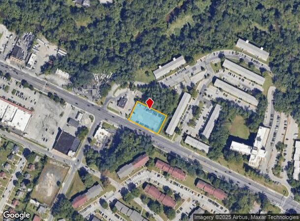
Property Record
6922 Liberty Rd, Gwynn Oak, MD 21207

NEARBY LISTINGS FOR SALE OR LEASE
Property Detail
6922 Liberty Rd
Baltimore-Columbia-Towson, MD
Sun-Mar Company Property
02-1600002397
LOT 2 SUN-MAR COMPANY PROPERTY
Storebuilding
Baltimore
X
Maryland
2400100380G
2
2024
0.57 AC
2025
Reisterstown Rd Corridor
402305
Baltimore
496 SF
DEMOGRAPHICS near 6922 Liberty Rd
1 Mile
3 Mile
5 Mile
2024 Total Population
16,445
130,399
321,388
2029 Population
16,194
126,836
313,619
Pop Growth 2024-2029
(1.53%)
(2.73%)
(2.42%)
Average Age
43
41
41
2024 Total Households
6,462
52,226
128,552
HH Growth 2024-2029
(1.62%)
(2.88%)
(2.58%)
Median Household Inc
$67,615
$59,680
$64,384
Avg Household Size
2.50
2.40
2.40
2024 Avg HH Vehicles
2.00
2.00
1.00
Median Home Value
$250,913
$238,680
$252,703
Median Year Built
1962
1963
1962
Nearby Places
Map Layers
Map Styles
 Street
 Aerial
- Restaurants
- Banks
- Shops
- Fitness
- Groceries
PUBLIC TRANSPORTATION
COMMUTER RAIL
West Baltimore (PENN - WASHINGTON - Maryland Area Regional Commuter Trains (The MARC), Penn Line - Maryland Area Regional Commuter Trains (The MARC))
DRIVE
WALK
Distance
West Baltimore (PENN - WASHINGTON - Maryland Area Regional Commuter Trains (The MARC), Penn Line - Maryland Area Regional Commuter Trains (The MARC))
16 min
6.2 mi
Penn Station (PENN - WASHINGTON - Maryland Area Regional Commuter Trains (The MARC), Penn Line - Maryland Area Regional Commuter Trains (The MARC), Penn Station & Camden Yards - Maryland Area Regional Commuter Trains (The MARC))
DRIVE
WALK
Distance
Penn Station (PENN - WASHINGTON - Maryland Area Regional Commuter Trains (The MARC), Penn Line - Maryland Area Regional Commuter Trains (The MARC), Penn Station & Camden Yards - Maryland Area Regional Commuter Trains (The MARC))
19 min
7.2 mi
AIRPORT
Baltimore/Washington International Thurgood Marshall
DRIVE
WALK
Distance
Baltimore/Washington International Thurgood Marshall
24 min
14.8 mi
Freight Ports
Port of Baltimore
DRIVE
WALK
Distance
Port of Baltimore
25 min
15.3 mi
SALE & LEASE HISTORY
LISTING DATE
SALE/LEASE

Apr 11, 2019
For Sale
Nearby Properties
Address
Land Use
TOTAL SIZE
Lot Size
Zoning
Address
Land Use
TOTAL SIZE
Lot Size
Zoning
941,727 SF
36.89 AC
TOD-3
Address
Land Use
TOTAL SIZE
Lot Size
Zoning
1,809,709 SF
50 AC
DR3.5
Address
Land Use
TOTAL SIZE
Lot Size
Zoning
883,140 SF
57.77 AC
MLR
Address
Land Use
TOTAL SIZE
Lot Size
Zoning
608,642 SF
56.37 AC
DR3.5
Address
Land Use
TOTAL SIZE
Lot Size
Zoning
34.99 AC
R-5
Address
Land Use
TOTAL SIZE
Lot Size
Zoning
271,096 SF
6 AC
02
Address
Land Use
TOTAL SIZE
Lot Size
Zoning
173,057 SF
17.22 AC
Address
Land Use
TOTAL SIZE
Lot Size
Zoning
278,271 SF
55.16 AC
DR5.5
Address
Land Use
TOTAL SIZE
Lot Size
Zoning
233,082 SF
10.98 AC
Address
Land Use
TOTAL SIZE
Lot Size
Zoning
29.11 AC
DR16
Address
Land Use
TOTAL SIZE
Lot Size
Zoning
27.75 AC
DR16
Address
Land Use
TOTAL SIZE
Lot Size
Zoning
184,320 SF
13.37 AC
DR5.5
Address
Land Use
TOTAL SIZE
Lot Size
Zoning
16.75 AC
MLR02
Address
Land Use
TOTAL SIZE
Lot Size
Zoning
325,203 SF
6.24 AC
DR5.5
Address
Land Use
TOTAL SIZE
Lot Size
Zoning
16.70 AC
Address
Land Use
TOTAL SIZE
Lot Size
Zoning
26.88 AC
DR16
Address
Land Use
TOTAL SIZE
Lot Size
Zoning
29.14 AC
DR16
Address
Land Use
TOTAL SIZE
Lot Size
Zoning
19.10 AC
DR16
Address
Land Use
TOTAL SIZE
Lot Size
Zoning
3,032 SF
87 SF
H
Address
Land Use
TOTAL SIZE
Lot Size
Zoning
14.41 AC
Address
Land Use
TOTAL SIZE
Lot Size
Zoning
22.99 AC
DR16
Address
Land Use
TOTAL SIZE
Lot Size
Zoning
194,844 SF
14.33 AC
ML
Address
Land Use
TOTAL SIZE
Lot Size
Zoning
12.07 AC
DR16
Address
Land Use
TOTAL SIZE
Lot Size
Zoning
140,286 SF
11.71 AC
BR
Address
Land Use
TOTAL SIZE
Lot Size
Zoning
190,243 SF
3.28 AC
R-9
Address
Land Use
TOTAL SIZE
Lot Size
Zoning
13.68 AC
DR16
Address
Land Use
TOTAL SIZE
Lot Size
Zoning
8.76 AC
RAE1
Address
Land Use
TOTAL SIZE
Lot Size
Zoning
162,386 SF
30.68 AC
DR5.5
Address
Land Use
TOTAL SIZE
Lot Size
Zoning
116,645 SF
9.86 AC
Address
Land Use
TOTAL SIZE
Lot Size
Zoning
12.69 AC
DR16
The World's #1 Commercial Real Estate Marketplace
Connect with us
© 2025 CoStar Group
The information above has been obtained from sources believed reliable. While we do not doubt its accuracy we have not verified it and make no guarantee, warranty or representation about it. It is your responsibility to independently confirm its accuracy and completeness. Any projections, opinions, assumptions, or estimates used are for example only and do not represent the current or future performance of the property. The value of this transaction to you depends on tax and other factors which should be evaluated by your tax, financial, and legal advisors. You and your advisors should conduct a careful, independent investigation of the property to determine to your satisfaction the suitability of the property for your needs.