Property Record
6922 W 10Th St, Greeley, CO 80634
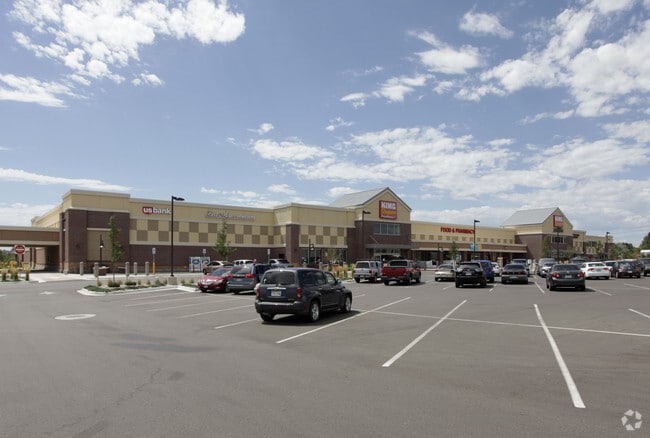


Property Detail
6922 W 10Th St
Greeley, CO
LOT 1 BLOCK 1 NORTHGATE VILLAGE
R6777757
Weld
Commercialnec
Colorado
B and X Area of moderate flood hazard, usually the area between the limits of the 100-year and 500-year floods.
1
2024
11.40 AC
2025
Greeley
001412
Denver
125,372 SF
NEARBY LISTINGS FOR SALE OR LEASE
DEMOGRAPHICS near 6922 W 10Th St
1 mile
3 mile
5 mile
2025 Total Population
6,280
47,778
111,271
2030 Population
7,026
52,780
122,595
Pop Growth 2025-2030
+ 11.88%
+ 10.47%
+ 10.18%
Average Age
42
40
38
2025 Total Households
2,546
17,905
40,428
HH Growth 2025-2030
+ 12.37%
+ 10.78%
+ 10.58%
Median Household Inc
$96,803
$98,537
$76,575
Avg Household Size
2.40
2.60
2.70
2025 Avg HH Vehicles
2.00
2.00
2.00
Median Home Value
$501,189
$459,683
$405,142
Median Year Built
2008
2001
1995
Nearby Places
Map Layers
Map Styles
 Street
 Aerial
Layers
 Traffic
 Biking
Places
Listings with unknown addresses are not visible on the map
- Restaurants
- Banks
- Shops
- Fitness
- Groceries
SALE & LEASE HISTORY
LISTING DATE
SALE/LEASE

Jan 18, 2022
For Lease
Nearby Properties
Address
Land Use
TOTAL SIZE
Lot Size
Zoning
Address
Land Use
TOTAL SIZE
Lot Size
Zoning
315,937 SF
22.73 AC
Address
Land Use
TOTAL SIZE
Lot Size
Zoning
669,727 SF
180.71 AC
Address
Land Use
TOTAL SIZE
Lot Size
Zoning
270,965 SF
99.08 AC
Address
Land Use
TOTAL SIZE
Lot Size
Zoning
46,025 SF
5.32 AC
Address
Land Use
TOTAL SIZE
Lot Size
Zoning
142,317 SF
34.34 AC
Address
Land Use
TOTAL SIZE
Lot Size
Zoning
67,456 SF
40.89 AC
Address
Land Use
TOTAL SIZE
Lot Size
Zoning
151,418 SF
16.96 AC
Address
Land Use
TOTAL SIZE
Lot Size
Zoning
611,456 SF
29.25 AC
Address
Land Use
TOTAL SIZE
Lot Size
Zoning
146,843 SF
12.80 AC
Address
Land Use
TOTAL SIZE
Lot Size
Zoning
138,446 SF
14.40 AC
Address
Land Use
TOTAL SIZE
Lot Size
Zoning
88,284 SF
5.80 AC
Address
Land Use
TOTAL SIZE
Lot Size
Zoning
214,594 SF
22.70 AC
Address
Land Use
TOTAL SIZE
Lot Size
Zoning
289,203 SF
12.28 AC
Address
Land Use
TOTAL SIZE
Lot Size
Zoning
437,527 SF
17.54 AC
Address
Land Use
TOTAL SIZE
Lot Size
Zoning
105,705 SF
9.24 AC
Address
Land Use
TOTAL SIZE
Lot Size
Zoning
252,025 SF
10.15 AC
Address
Land Use
TOTAL SIZE
Lot Size
Zoning
80,202 SF
6 AC
Address
Land Use
TOTAL SIZE
Lot Size
Zoning
48,544 SF
7.92 AC
Address
Land Use
TOTAL SIZE
Lot Size
Zoning
71,614 SF
5.99 AC
Address
Land Use
TOTAL SIZE
Lot Size
Zoning
45,141 SF
12.15 AC
Address
Land Use
TOTAL SIZE
Lot Size
Zoning
240,821 SF
14.53 AC
Address
Land Use
TOTAL SIZE
Lot Size
Zoning
58,754 SF
5.77 AC
Address
Land Use
TOTAL SIZE
Lot Size
Zoning
124,456 SF
10.72 AC
Address
Land Use
TOTAL SIZE
Lot Size
Zoning
22,012 SF
3.30 AC
Address
Land Use
TOTAL SIZE
Lot Size
Zoning
133,978 SF
12.51 AC
Address
Land Use
TOTAL SIZE
Lot Size
Zoning
184,724 SF
7.21 AC
Address
Land Use
TOTAL SIZE
Lot Size
Zoning
257,002 SF
12.39 AC
Address
Land Use
TOTAL SIZE
Lot Size
Zoning
85,760 SF
13.09 AC
Address
Land Use
TOTAL SIZE
Lot Size
Zoning
124,475 SF
11 AC
The World's #1 Commercial Real Estate Marketplace
Connect with us
© 2026 CoStar Group
The information above has been obtained from sources believed reliable. While we do not doubt its accuracy we have not verified it and make no guarantee, warranty or representation about it. It is your responsibility to independently confirm its accuracy and completeness. Any projections, opinions, assumptions, or estimates used are for example only and do not represent the current or future performance of the property. The value of this transaction to you depends on tax and other factors which should be evaluated by your tax, financial, and legal advisors. You and your advisors should conduct a careful, independent investigation of the property to determine to your satisfaction the suitability of the property for your needs.