Property Record
6923 Unknown Rd, Vacaville, CA 95687

NEARBY LISTINGS FOR SALE OR LEASE
Property Detail
6923 Unknown Rd
0141-010-160
BK-BG 00-00
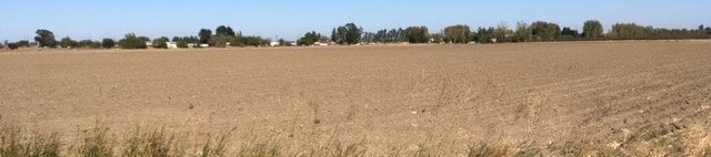
Orchard
Solano
A
California
06113C0700G
36.86 AC
2024
Vacaville/Dixon
2025
North Bay/Santa Rosa
253106
Vallejo-Fairfield, CA
DEMOGRAPHICS near 6923 Unknown Rd
1 Mile
3 Mile
5 Mile
2024 Total Population
121
7,968
58,703
2029 Population
114
7,740
58,017
Pop Growth 2024-2029
(5.79%)
(2.86%)
(1.17%)
Average Age
43
42
40
2024 Total Households
43
3,143
21,277
HH Growth 2024-2029
(6.98%)
(2.70%)
(1.17%)
Median Household Inc
$77,778
$92,510
$98,350
Avg Household Size
2.80
2.50
2.70
2024 Avg HH Vehicles
3.00
2.00
2.00
Median Home Value
$762,499
$653,610
$624,567
Median Year Built
1976
2000
1989
Nearby Places
Map Layers
Map Styles
 Street
 Aerial
- Restaurants
- Banks
- Shops
- Fitness
- Groceries
PUBLIC TRANSPORTATION
AIRPORT
Sacramento International
DRIVE
WALK
Distance
Sacramento International
45 min
34.1 mi
Freight Ports
Port of Richmond
DRIVE
WALK
Distance
Port of Richmond
66 min
50.1 mi
SALE & LEASE HISTORY
LISTING DATE
SALE/LEASE

Oct 25, 2017
For Sale
Nearby Properties
Address
Land Use
TOTAL SIZE
Lot Size
Zoning
Address
Land Use
TOTAL SIZE
Lot Size
Zoning
Address
Land Use
TOTAL SIZE
Lot Size
Zoning
47.87 AC
Address
Land Use
TOTAL SIZE
Lot Size
Zoning
35.69 AC
Address
Land Use
TOTAL SIZE
Lot Size
Zoning
831,193 SF
68.78 AC
Address
Land Use
TOTAL SIZE
Lot Size
Zoning
241,629 SF
9.99 AC
Address
Land Use
TOTAL SIZE
Lot Size
Zoning
332,571 SF
8.35 AC
Address
Land Use
TOTAL SIZE
Lot Size
Zoning
332,571 SF
9.55 AC
Address
Land Use
TOTAL SIZE
Lot Size
Zoning
11.52 AC
Address
Land Use
TOTAL SIZE
Lot Size
Zoning
173,016 SF
13.79 AC
Address
Land Use
TOTAL SIZE
Lot Size
Zoning
321,651 SF
21.29 AC
Address
Land Use
TOTAL SIZE
Lot Size
Zoning
224,654 SF
6.06 AC
Address
Land Use
TOTAL SIZE
Lot Size
Zoning
42.62 AC
Address
Land Use
TOTAL SIZE
Lot Size
Zoning
224,654 SF
4.24 AC
Address
Land Use
TOTAL SIZE
Lot Size
Zoning
159,297 SF
7.40 AC
Address
Land Use
TOTAL SIZE
Lot Size
Zoning
77,249 SF
2.42 AC
Address
Land Use
TOTAL SIZE
Lot Size
Zoning
86,705 SF
6.83 AC
Address
Land Use
TOTAL SIZE
Lot Size
Zoning
67,000 SF
14.79 AC
Address
Land Use
TOTAL SIZE
Lot Size
Zoning
88,284 SF
8.13 AC
COMM
Address
Land Use
TOTAL SIZE
Lot Size
Zoning
46,710 SF
3.03 AC
Address
Land Use
TOTAL SIZE
Lot Size
Zoning
35,944 SF
7.67 AC
Address
Land Use
TOTAL SIZE
Lot Size
Zoning
53.96 AC
Address
Land Use
TOTAL SIZE
Lot Size
Zoning
125,760 SF
6.91 AC
Address
Land Use
TOTAL SIZE
Lot Size
Zoning
85,029 SF
4.42 AC
Address
Land Use
TOTAL SIZE
Lot Size
Zoning
92,273 SF
2.63 AC
IP
Address
Land Use
TOTAL SIZE
Lot Size
Zoning
51,563 SF
5.22 AC
Address
Land Use
TOTAL SIZE
Lot Size
Zoning
31,992 SF
3.93 AC
Address
Land Use
TOTAL SIZE
Lot Size
Zoning
19,755 SF
3 AC
COMMERCIAL
Address
Land Use
TOTAL SIZE
Lot Size
Zoning
247,100 SF
14.34 AC
Address
Land Use
TOTAL SIZE
Lot Size
Zoning
43,400 SF
2.95 AC
Address
Land Use
TOTAL SIZE
Lot Size
Zoning
37,719 SF
4 AC
HIGHWAY CO
The World's #1 Commercial Real Estate Marketplace
Connect with us
© 2025 CoStar Group
The information above has been obtained from sources believed reliable. While we do not doubt its accuracy we have not verified it and make no guarantee, warranty or representation about it. It is your responsibility to independently confirm its accuracy and completeness. Any projections, opinions, assumptions, or estimates used are for example only and do not represent the current or future performance of the property. The value of this transaction to you depends on tax and other factors which should be evaluated by your tax, financial, and legal advisors. You and your advisors should conduct a careful, independent investigation of the property to determine to your satisfaction the suitability of the property for your needs.