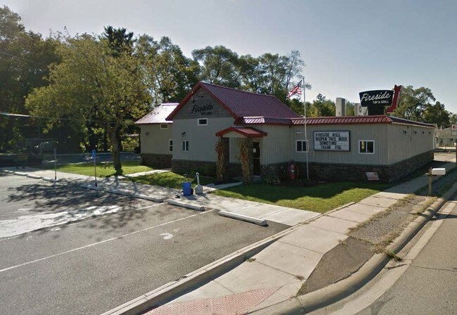
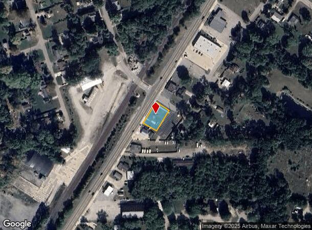
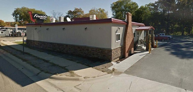
Property Record
69245 Maple St, Edwardsburg, MI 49112
NEARBY LISTINGS FOR SALE OR LEASE
Property Detail
69245 Maple St
South Bend-Mishawaka, IN-MI
0175 V 8S-15W COM AT INTERSEC OF WLY LINE RR ST WITH SLY LINE OF ST HWY M 62, SWLY ALONG S LINE SD M 62 165 FT, SELY AT RIGHT
14-091-108-048-00
Cass
Commercialnec
Michigan
X
5
18039C0015D
0.58 AC
2024
Cass County
2025
South Bend/Mishawaka
001802
DEMOGRAPHICS near 69245 Maple St
1 Mile
3 Mile
5 Mile
2024 Total Population
1,618
9,366
26,301
2029 Population
1,576
9,179
25,915
Pop Growth 2024-2029
(2.60%)
(2.00%)
(1.47%)
Average Age
39
40
40
2024 Total Households
625
3,487
9,308
HH Growth 2024-2029
(2.72%)
(2.04%)
(1.57%)
Median Household Inc
$52,608
$79,980
$99,060
Avg Household Size
2.60
2.70
2.80
2024 Avg HH Vehicles
2.00
2.00
2.00
Median Home Value
$181,685
$229,741
$259,437
Median Year Built
1974
1981
1986
Nearby Places
Map Layers
Map Styles
 Street
 Aerial
- Restaurants
- Banks
- Shops
- Fitness
- Groceries
PUBLIC TRANSPORTATION
AIRPORT
South Bend International
DRIVE
WALK
Distance
South Bend International
41 min
24.7 mi
SALE & LEASE HISTORY
LISTING DATE
SALE/LEASE

Aug 29, 2019
For Sale
Nearby Properties
Address
Land Use
TOTAL SIZE
Lot Size
Zoning
Address
Land Use
TOTAL SIZE
Lot Size
Zoning
35,063 SF
87 SF
Address
Land Use
TOTAL SIZE
Lot Size
Zoning
191,022 SF
9.60 AC
Address
Land Use
TOTAL SIZE
Lot Size
Zoning
161,884 SF
8.30 AC
Address
Land Use
TOTAL SIZE
Lot Size
Zoning
22,750 SF
1.47 AC
Address
Land Use
TOTAL SIZE
Lot Size
Zoning
87,056 SF
4.22 AC
Address
Land Use
TOTAL SIZE
Lot Size
Zoning
88,328 SF
47.92 AC
Address
Land Use
TOTAL SIZE
Lot Size
Zoning
393,455 SF
174 SF
Address
Land Use
TOTAL SIZE
Lot Size
Zoning
3,008 SF
186 AC
Address
Land Use
TOTAL SIZE
Lot Size
Zoning
2,960 SF
4.15 AC
Address
Land Use
TOTAL SIZE
Lot Size
Zoning
60,084 SF
3.30 AC
Address
Land Use
TOTAL SIZE
Lot Size
Zoning
147,884 SF
9.40 AC
Address
Land Use
TOTAL SIZE
Lot Size
Zoning
3,584 SF
2.47 AC
Address
Land Use
TOTAL SIZE
Lot Size
Zoning
24,000 SF
1.59 AC
Address
Land Use
TOTAL SIZE
Lot Size
Zoning
26,342 SF
6.12 AC
Address
Land Use
TOTAL SIZE
Lot Size
Zoning
195.13 AC
Address
Land Use
TOTAL SIZE
Lot Size
Zoning
123,800 SF
10.97 AC
Address
Land Use
TOTAL SIZE
Lot Size
Zoning
105,770 SF
30.32 AC
Address
Land Use
TOTAL SIZE
Lot Size
Zoning
7,772 SF
0.95 AC
Address
Land Use
TOTAL SIZE
Lot Size
Zoning
Address
Land Use
TOTAL SIZE
Lot Size
Zoning
12,000 SF
1.36 AC
Address
Land Use
TOTAL SIZE
Lot Size
Zoning
10,100 SF
1.39 AC
Address
Land Use
TOTAL SIZE
Lot Size
Zoning
6,912 SF
1.08 AC
Address
Land Use
TOTAL SIZE
Lot Size
Zoning
22,864 SF
1.63 AC
Address
Land Use
TOTAL SIZE
Lot Size
Zoning
64,100 SF
13.75 AC
Address
Land Use
TOTAL SIZE
Lot Size
Zoning
81,500 SF
4.99 AC
Address
Land Use
TOTAL SIZE
Lot Size
Zoning
6,300 SF
7.55 AC
Address
Land Use
TOTAL SIZE
Lot Size
Zoning
138.14 AC
Address
Land Use
TOTAL SIZE
Lot Size
Zoning
10,000 SF
1.36 AC
Address
Land Use
TOTAL SIZE
Lot Size
Zoning
33,840 SF
2.95 AC
Address
Land Use
TOTAL SIZE
Lot Size
Zoning
122.90 AC
The World's #1 Commercial Real Estate Marketplace
Connect with us
© 2025 CoStar Group
The information above has been obtained from sources believed reliable. While we do not doubt its accuracy we have not verified it and make no guarantee, warranty or representation about it. It is your responsibility to independently confirm its accuracy and completeness. Any projections, opinions, assumptions, or estimates used are for example only and do not represent the current or future performance of the property. The value of this transaction to you depends on tax and other factors which should be evaluated by your tax, financial, and legal advisors. You and your advisors should conduct a careful, independent investigation of the property to determine to your satisfaction the suitability of the property for your needs.