Property Record
6926 E 16Th St, Indianapolis, IN 46219

NEARBY LISTINGS FOR SALE OR LEASE
Property Detail
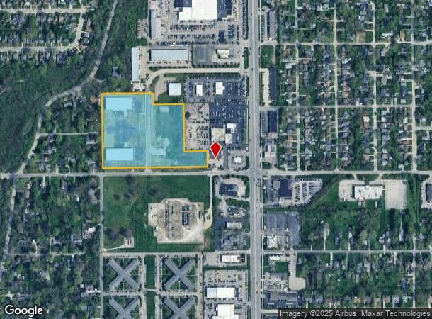
6926 E 16Th St
49-07-35-119-008.000-700
G 11.404AC
Gymhealthspa
Marion
X
Indiana
18097C0166F
10.97 AC
2023
Lawrence/East County
2024
Indianapolis
360800
Indianapolis-Carmel-Greenwood, IN
DEMOGRAPHICS near 6926 E 16Th St
1 mile
3 mile
5 mile
2024 Total Population
8,688
81,857
237,537
2029 Population
8,598
81,155
237,148
Pop Growth 2024-2029
(1.04%)
(0.86%)
(0.16%)
Average Age
41
38
37
2024 Total Households
3,811
33,899
94,568
HH Growth 2024-2029
(0.97%)
(0.91%)
(0.21%)
Median Household Inc
$38,541
$42,963
$44,677
Avg Household Size
2.10
2.30
2.40
2024 Avg HH Vehicles
1.00
2.00
2.00
Median Home Value
$128,498
$131,172
$138,882
Median Year Built
1959
1956
1962
Nearby Places
Map Layers
Map Styles
 Street
 Aerial
Transit
 Traffic
 Biking
Places
Listings with unknown addresses are not visible on the map
- Restaurants
- Banks
- Shops
- Fitness
- Groceries
PUBLIC TRANSPORTATION
COMMUTER RAIL
Drive
Walk
Distance
15 min
8.2 mi
AIRPORT
Indianapolis International
Drive
Walk
Distance
Indianapolis International
38 min
22.2 mi
Nearby Properties
Address
Land Use
TOTAL SIZE
Lot Size
Zoning
Address
Land Use
TOTAL SIZE
Lot Size
Zoning
1,202,700 SF
77.25 AC
ZO01
Address
Land Use
TOTAL SIZE
Lot Size
Zoning
25,146 SF
28.58 AC
ZO01
Address
Land Use
TOTAL SIZE
Lot Size
Zoning
47.10 AC
ZO01
Address
Land Use
TOTAL SIZE
Lot Size
Zoning
6,000 SF
8.79 AC
ZO01
Address
Land Use
TOTAL SIZE
Lot Size
Zoning
4,588 SF
24.33 AC
ZO01
Address
Land Use
TOTAL SIZE
Lot Size
Zoning
768,000 SF
29.62 AC
ZO03
Address
Land Use
TOTAL SIZE
Lot Size
Zoning
713,497 SF
69.91 AC
ZO01
Address
Land Use
TOTAL SIZE
Lot Size
Zoning
536,804 SF
25.94 AC
ZO01
Address
Land Use
TOTAL SIZE
Lot Size
Zoning
3,132 SF
20.50 AC
Address
Land Use
TOTAL SIZE
Lot Size
Zoning
5,620 SF
36.95 AC
ZO01
Address
Land Use
TOTAL SIZE
Lot Size
Zoning
118,126 SF
6.31 AC
ZO01
Address
Land Use
TOTAL SIZE
Lot Size
Zoning
1,768 SF
30.88 AC
ZO01
Address
Land Use
TOTAL SIZE
Lot Size
Zoning
76,663 SF
1.91 AC
ZO01
Address
Land Use
TOTAL SIZE
Lot Size
Zoning
925,384 SF
49.48 AC
ZO01
Address
Land Use
TOTAL SIZE
Lot Size
Zoning
150,929 SF
28.61 AC
ZO01
Address
Land Use
TOTAL SIZE
Lot Size
Zoning
167,808 SF
14.95 AC
ZO01
Address
Land Use
TOTAL SIZE
Lot Size
Zoning
268,930 SF
20.55 AC
ZO01
Address
Land Use
TOTAL SIZE
Lot Size
Zoning
5,512 SF
19.05 AC
ZO01
Address
Land Use
TOTAL SIZE
Lot Size
Zoning
269,450 SF
5.85 AC
Address
Land Use
TOTAL SIZE
Lot Size
Zoning
8,054 SF
20.62 AC
Address
Land Use
TOTAL SIZE
Lot Size
Zoning
1,490 SF
14.21 AC
ZO01
Address
Land Use
TOTAL SIZE
Lot Size
Zoning
5,560 SF
10.88 AC
ZO01
Address
Land Use
TOTAL SIZE
Lot Size
Zoning
278,338 SF
14.80 AC
Address
Land Use
TOTAL SIZE
Lot Size
Zoning
254,641 SF
29.53 AC
Address
Land Use
TOTAL SIZE
Lot Size
Zoning
6,252 SF
17.02 AC
ZO01
Address
Land Use
TOTAL SIZE
Lot Size
Zoning
77,518 SF
11.69 AC
ZO01
Address
Land Use
TOTAL SIZE
Lot Size
Zoning
616,065 SF
51.20 AC
ZO01
Address
Land Use
TOTAL SIZE
Lot Size
Zoning
1,594 SF
6.47 AC
ZO01
Address
Land Use
TOTAL SIZE
Lot Size
Zoning
6.53 AC
ZO01
Address
Land Use
TOTAL SIZE
Lot Size
Zoning
60,640 SF
13.76 AC
The World's #1 Commercial Real Estate Marketplace
Connect with us
© 2026 CoStar Group
The information above has been obtained from sources believed reliable. While we do not doubt its accuracy we have not verified it and make no guarantee, warranty or representation about it. It is your responsibility to independently confirm its accuracy and completeness. Any projections, opinions, assumptions, or estimates used are for example only and do not represent the current or future performance of the property. The value of this transaction to you depends on tax and other factors which should be evaluated by your tax, financial, and legal advisors. You and your advisors should conduct a careful, independent investigation of the property to determine to your satisfaction the suitability of the property for your needs.