Property Record
693 Covered Bridge Rd, Covington, GA 30016
NEARBY LISTINGS FOR SALE OR LEASE
Property Detail
693 Covered Bridge Rd
Atlanta-Sandy Springs-Roswell, GA
Covered Bridge Estates
0017B00000016000
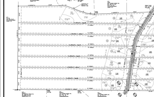
LOT 14 COVERED BRIDGE ESTATES
Residentialacreage
Newton
X
Georgia
13217C0115D
14
2025
5.04 AC
2025
Newton County
100904
Atlanta
DEMOGRAPHICS near 693 Covered Bridge Rd
1 Mile
3 Mile
5 Mile
2024 Total Population
646
11,978
39,178
2029 Population
718
13,330
43,264
Pop Growth 2024-2029
+ 11.15%
+ 11.29%
+ 10.43%
Average Age
37
37
37
2024 Total Households
228
4,001
13,016
HH Growth 2024-2029
+ 11.40%
+ 11.62%
+ 10.70%
Median Household Inc
$96,874
$83,405
$81,775
Avg Household Size
2.90
2.90
3.00
2024 Avg HH Vehicles
2.00
2.00
2.00
Median Home Value
$165,714
$186,357
$186,967
Median Year Built
2000
2001
2000
Nearby Places
Map Layers
Map Styles
 Street
 Aerial
- Restaurants
- Banks
- Shops
- Fitness
- Groceries
PUBLIC TRANSPORTATION
AIRPORT
Hartsfield - Jackson Atlanta International
DRIVE
WALK
Distance
Hartsfield - Jackson Atlanta International
58 min
40.9 mi
Freight Ports
Georgia Ports - Savannah
DRIVE
WALK
Distance
Georgia Ports - Savannah
269 min
234.7 mi
SALE & LEASE HISTORY
LISTING DATE
SALE/LEASE

Aug 01, 2023
For Sale
Apr 09, 2025
For Sale
Nearby Properties
Address
Land Use
TOTAL SIZE
Lot Size
Zoning
Address
Land Use
TOTAL SIZE
Lot Size
Zoning
1,158,095 SF
161.26 AC
Address
Land Use
TOTAL SIZE
Lot Size
Zoning
1,158,095 SF
0.01 AC
Address
Land Use
TOTAL SIZE
Lot Size
Zoning
65,360 SF
30.63 AC
E6
Address
Land Use
TOTAL SIZE
Lot Size
Zoning
2,052 SF
571.86 AC
RA
Address
Land Use
TOTAL SIZE
Lot Size
Zoning
58,892 SF
17.52 AC
E6
Address
Land Use
TOTAL SIZE
Lot Size
Zoning
19,363 SF
4 AC
AR
Address
Land Use
TOTAL SIZE
Lot Size
Zoning
394.98 AC
AR
Address
Land Use
TOTAL SIZE
Lot Size
Zoning
1,800 SF
153.90 AC
RA
Address
Land Use
TOTAL SIZE
Lot Size
Zoning
9,100 SF
3.25 AC
Address
Land Use
TOTAL SIZE
Lot Size
Zoning
1,036 SF
347.75 AC
AR
Address
Land Use
TOTAL SIZE
Lot Size
Zoning
133.92 AC
AR
Address
Land Use
TOTAL SIZE
Lot Size
Zoning
6,000 SF
15.13 AC
AR
Address
Land Use
TOTAL SIZE
Lot Size
Zoning
100 AC
AR
Address
Land Use
TOTAL SIZE
Lot Size
Zoning
147.57 AC
AR
Address
Land Use
TOTAL SIZE
Lot Size
Zoning
103.14 AC
AR
Address
Land Use
TOTAL SIZE
Lot Size
Zoning
95.58 AC
AR
Address
Land Use
TOTAL SIZE
Lot Size
Zoning
1,440 SF
92.17 AC
R1
Address
Land Use
TOTAL SIZE
Lot Size
Zoning
1,469 SF
85.85 AC
A1
Address
Land Use
TOTAL SIZE
Lot Size
Zoning
6,994 SF
9.22 AC
E2
Address
Land Use
TOTAL SIZE
Lot Size
Zoning
162.75 AC
A
Address
Land Use
TOTAL SIZE
Lot Size
Zoning
2,400 SF
1.50 AC
C1
Address
Land Use
TOTAL SIZE
Lot Size
Zoning
96 AC
A1
Address
Land Use
TOTAL SIZE
Lot Size
Zoning
303.13 AC
A
Address
Land Use
TOTAL SIZE
Lot Size
Zoning
76.35 AC
AR
Address
Land Use
TOTAL SIZE
Lot Size
Zoning
70.61 AC
A1
Address
Land Use
TOTAL SIZE
Lot Size
Zoning
179 AC
A
Address
Land Use
TOTAL SIZE
Lot Size
Zoning
78.90 AC
AR
Address
Land Use
TOTAL SIZE
Lot Size
Zoning
6,806 SF
2.17 AC
C1
Address
Land Use
TOTAL SIZE
Lot Size
Zoning
2,000 SF
1.29 AC
C1
Address
Land Use
TOTAL SIZE
Lot Size
Zoning
45.76 AC
AR
The World's #1 Commercial Real Estate Marketplace
Connect with us
© 2026 CoStar Group
The information above has been obtained from sources believed reliable. While we do not doubt its accuracy we have not verified it and make no guarantee, warranty or representation about it. It is your responsibility to independently confirm its accuracy and completeness. Any projections, opinions, assumptions, or estimates used are for example only and do not represent the current or future performance of the property. The value of this transaction to you depends on tax and other factors which should be evaluated by your tax, financial, and legal advisors. You and your advisors should conduct a careful, independent investigation of the property to determine to your satisfaction the suitability of the property for your needs.