Property Record
6935 Tuson Blvd, Clarkston, MI 48346
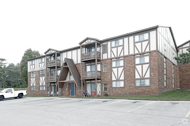

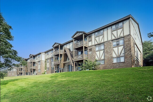

Property Detail
6935 Tuson Blvd
08-32-353-008
T4N, R9E SEC 32 THAT PART OF W 1/2 OF SW 1/4 LYING SLY OF CEN OF ANDERSONVILLE RD & NLY OF GTWRR, EXC BEG AT PT DIST N 89-29-45 E 526.87 FT FROM SW SEC COR, TH N 55-04-00 W 427 FT TO SHORE LINE OF LESTER LAKE, TH NELY & SLY ALG SD LINE TO S SEC LINE,
Apartment
Oakland
R2
Michigan
AE The base floodplain where base flood elevations are provided. AE Zones are now used on new format FIRMs instead of A1-A30 Zones.
29.33 AC
2025
Outlying Oakland County
2025
Detroit
127300
Detroit-Warren-Dearborn, MI
111,760 SF
NEARBY LISTINGS FOR SALE OR LEASE
-
-
View all Clarkston listings for sale on LoopNet.com
DEMOGRAPHICS near 6935 Tuson Blvd
1 mile
3 mile
5 mile
2025 Total Population
5,099
35,466
91,374
2030 Population
5,157
36,162
93,147
Pop Growth 2025-2030
+ 1.14%
+ 1.96%
+ 1.94%
Average Age
44
43
43
2025 Total Households
2,424
14,613
37,479
HH Growth 2025-2030
+ 1.16%
+ 1.96%
+ 1.94%
Median Household Inc
$72,962
$91,255
$90,704
Avg Household Size
2.10
2.40
2.40
2025 Avg HH Vehicles
2.00
2.00
2.00
Median Home Value
$271,619
$289,652
$299,334
Median Year Built
1972
1972
1976
Nearby Places
Map Layers
Map Styles
 Street
 Aerial
Layers
 Traffic
 Biking
Places
Listings with unknown addresses are not visible on the map
- Restaurants
- Banks
- Shops
- Fitness
- Groceries
PUBLIC TRANSPORTATION
COMMUTER RAIL
Pontiac Amtrak Station (Wolverine - Amtrak)
Drive
Walk
Distance
Pontiac Amtrak Station (Wolverine - Amtrak)
18 min
9.1 mi
AIRPORT
Bishop International
Drive
Walk
Distance
Bishop International
46 min
29.7 mi
Freight Ports
Port of Toledo
Drive
Walk
Distance
Port of Toledo
108 min
84.5 mi
Nearby Properties
Address
Land Use
TOTAL SIZE
Lot Size
Zoning
Address
Land Use
TOTAL SIZE
Lot Size
Zoning
232,743 SF
40 AC
BI
Address
Land Use
TOTAL SIZE
Lot Size
Zoning
1,075,040 SF
90.26 AC
II
Address
Land Use
TOTAL SIZE
Lot Size
Zoning
388,304 SF
69.09 AC
R2
Address
Land Use
TOTAL SIZE
Lot Size
Zoning
138,009 SF
8.03 AC
PUD
Address
Land Use
TOTAL SIZE
Lot Size
Zoning
178,417 SF
39.45 AC
Address
Land Use
TOTAL SIZE
Lot Size
Zoning
208,006 SF
1.24 AC
R2
Address
Land Use
TOTAL SIZE
Lot Size
Zoning
415,169 SF
27.93 AC
II
Address
Land Use
TOTAL SIZE
Lot Size
Zoning
68,725 SF
4.96 AC
PUD
Address
Land Use
TOTAL SIZE
Lot Size
Zoning
21,719 SF
26.34 AC
R2
Address
Land Use
TOTAL SIZE
Lot Size
Zoning
249,200 SF
48.39 AC
R2
Address
Land Use
TOTAL SIZE
Lot Size
Zoning
327,288 SF
19.85 AC
R2
Address
Land Use
TOTAL SIZE
Lot Size
Zoning
78,261 SF
7.80 AC
PUD
Address
Land Use
TOTAL SIZE
Lot Size
Zoning
7.18 AC
PUD
Address
Land Use
TOTAL SIZE
Lot Size
Zoning
128,290 SF
9.26 AC
BI
Address
Land Use
TOTAL SIZE
Lot Size
Zoning
44.10 AC
PUD
Address
Land Use
TOTAL SIZE
Lot Size
Zoning
87,130 SF
9.01 AC
C-3
Address
Land Use
TOTAL SIZE
Lot Size
Zoning
107,005 SF
8.12 AC
BI
Address
Land Use
TOTAL SIZE
Lot Size
Zoning
327,288 SF
29.09 AC
REC
Address
Land Use
TOTAL SIZE
Lot Size
Zoning
19,504 SF
3.16 AC
ML
Address
Land Use
TOTAL SIZE
Lot Size
Zoning
151,736 SF
26.03 AC
C-2
Address
Land Use
TOTAL SIZE
Lot Size
Zoning
48,645 SF
6.68 AC
PUD
Address
Land Use
TOTAL SIZE
Lot Size
Zoning
49,169 SF
5.02 AC
PUD
Address
Land Use
TOTAL SIZE
Lot Size
Zoning
117,980 SF
11.33 AC
IOP
Address
Land Use
TOTAL SIZE
Lot Size
Zoning
86,818 SF
7.74 AC
AI
Address
Land Use
TOTAL SIZE
Lot Size
Zoning
32,059 SF
BLL
Address
Land Use
TOTAL SIZE
Lot Size
Zoning
31,068 SF
3 AC
PUD
Address
Land Use
TOTAL SIZE
Lot Size
Zoning
143,550 SF
11.92 AC
R2
Address
Land Use
TOTAL SIZE
Lot Size
Zoning
739 SF
5.36 AC
R1A
Address
Land Use
TOTAL SIZE
Lot Size
Zoning
62,944 SF
6.65 AC
C-2
The World's #1 Commercial Real Estate Marketplace
Connect with us
© 2026 CoStar Group
The information above has been obtained from sources believed reliable. While we do not doubt its accuracy we have not verified it and make no guarantee, warranty or representation about it. It is your responsibility to independently confirm its accuracy and completeness. Any projections, opinions, assumptions, or estimates used are for example only and do not represent the current or future performance of the property. The value of this transaction to you depends on tax and other factors which should be evaluated by your tax, financial, and legal advisors. You and your advisors should conduct a careful, independent investigation of the property to determine to your satisfaction the suitability of the property for your needs.