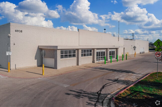
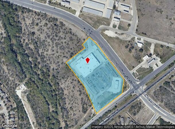
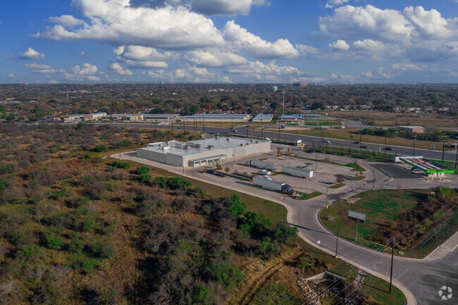
Property Record
6938 Walzem Rd, San Antonio, TX 78239
NEARBY LISTINGS FOR SALE OR LEASE
Property Detail
6938 Walzem Rd
San Antonio-New Braunfels, TX
Ncb 15894 (Twister 4661 Replat)
15894-018-0080
NCB 15894 (TWISTER 4661 REPLAT), BLOCK 18 LOT 8 2017-CREATED PER PLAT 9709/187-196 FILED 12-23-2016
Supermarket
Bexar
AE
Texas
48029C0430G
8
2024
7.15 AC
2025
Northeast
121402
San Antonio
71,754 SF
DEMOGRAPHICS near 6938 Walzem Rd
1 Mile
3 Mile
5 Mile
2024 Total Population
12,540
114,280
278,739
2029 Population
13,243
121,484
296,513
Pop Growth 2024-2029
+ 5.61%
+ 6.30%
+ 6.38%
Average Age
38
37
37
2024 Total Households
4,617
41,309
102,152
HH Growth 2024-2029
+ 5.85%
+ 6.40%
+ 6.48%
Median Household Inc
$56,425
$56,110
$60,080
Avg Household Size
2.70
2.70
2.60
2024 Avg HH Vehicles
2.00
2.00
2.00
Median Home Value
$209,814
$168,650
$181,790
Median Year Built
1983
1984
1985
Nearby Places
Map Layers
Map Styles
 Street
 Aerial
- Restaurants
- Banks
- Shops
- Fitness
- Groceries
PUBLIC TRANSPORTATION
AIRPORT
San Antonio International
DRIVE
WALK
Distance
San Antonio International
15 min
8.9 mi
Freight Ports
Calhoun Port
DRIVE
WALK
Distance
Calhoun Port
177 min
144.0 mi
SALE & LEASE HISTORY
LISTING DATE
SALE/LEASE

Oct 17, 2018
For Lease
Jul 22, 2022
For Lease
Nearby Properties
Address
Land Use
TOTAL SIZE
Lot Size
Zoning
Address
Land Use
TOTAL SIZE
Lot Size
Zoning
727,299 SF
47.68 AC
Address
Land Use
TOTAL SIZE
Lot Size
Zoning
347,943 SF
10.07 AC
Address
Land Use
TOTAL SIZE
Lot Size
Zoning
278,406 SF
13.39 AC
Address
Land Use
TOTAL SIZE
Lot Size
Zoning
116,536 SF
13.84 AC
Address
Land Use
TOTAL SIZE
Lot Size
Zoning
110,605 SF
19.95 AC
Address
Land Use
TOTAL SIZE
Lot Size
Zoning
277,887 SF
14.14 AC
Address
Land Use
TOTAL SIZE
Lot Size
Zoning
249,633 SF
7.04 AC
Address
Land Use
TOTAL SIZE
Lot Size
Zoning
598,070 SF
46.05 AC
Address
Land Use
TOTAL SIZE
Lot Size
Zoning
328,605 SF
25.69 AC
Address
Land Use
TOTAL SIZE
Lot Size
Zoning
457,302 SF
34.40 AC
Address
Land Use
TOTAL SIZE
Lot Size
Zoning
230,659 SF
15.48 AC
Address
Land Use
TOTAL SIZE
Lot Size
Zoning
74.65 AC
Address
Land Use
TOTAL SIZE
Lot Size
Zoning
273,516 SF
17.50 AC
Address
Land Use
TOTAL SIZE
Lot Size
Zoning
198,868 SF
15.15 AC
Address
Land Use
TOTAL SIZE
Lot Size
Zoning
337,468 SF
21.84 AC
Address
Land Use
TOTAL SIZE
Lot Size
Zoning
222,865 SF
17.75 AC
Address
Land Use
TOTAL SIZE
Lot Size
Zoning
431,326 SF
42.70 AC
Address
Land Use
TOTAL SIZE
Lot Size
Zoning
190,134 SF
10.54 AC
Address
Land Use
TOTAL SIZE
Lot Size
Zoning
257,263 SF
10.07 AC
Address
Land Use
TOTAL SIZE
Lot Size
Zoning
391,863 SF
24.43 AC
Address
Land Use
TOTAL SIZE
Lot Size
Zoning
15.42 AC
Address
Land Use
TOTAL SIZE
Lot Size
Zoning
144,814 SF
8.18 AC
Address
Land Use
TOTAL SIZE
Lot Size
Zoning
176,907 SF
12.73 AC
Address
Land Use
TOTAL SIZE
Lot Size
Zoning
192,677 SF
16.14 AC
Address
Land Use
TOTAL SIZE
Lot Size
Zoning
200,595 SF
16.27 AC
Address
Land Use
TOTAL SIZE
Lot Size
Zoning
196,090 SF
12.67 AC
Address
Land Use
TOTAL SIZE
Lot Size
Zoning
618,000 SF
23.87 AC
Address
Land Use
TOTAL SIZE
Lot Size
Zoning
184,637 SF
14.58 AC
Address
Land Use
TOTAL SIZE
Lot Size
Zoning
178,262 SF
33.28 AC
Address
Land Use
TOTAL SIZE
Lot Size
Zoning
291,300 SF
17.90 AC
The World's #1 Commercial Real Estate Marketplace
Connect with us
© 2026 CoStar Group
The information above has been obtained from sources believed reliable. While we do not doubt its accuracy we have not verified it and make no guarantee, warranty or representation about it. It is your responsibility to independently confirm its accuracy and completeness. Any projections, opinions, assumptions, or estimates used are for example only and do not represent the current or future performance of the property. The value of this transaction to you depends on tax and other factors which should be evaluated by your tax, financial, and legal advisors. You and your advisors should conduct a careful, independent investigation of the property to determine to your satisfaction the suitability of the property for your needs.