Property Record
694 Riverside Dr, Mount Airy, NC 27030

NEARBY LISTINGS FOR SALE OR LEASE
Property Detail
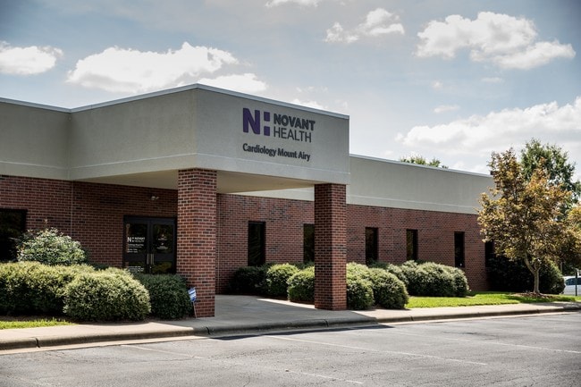
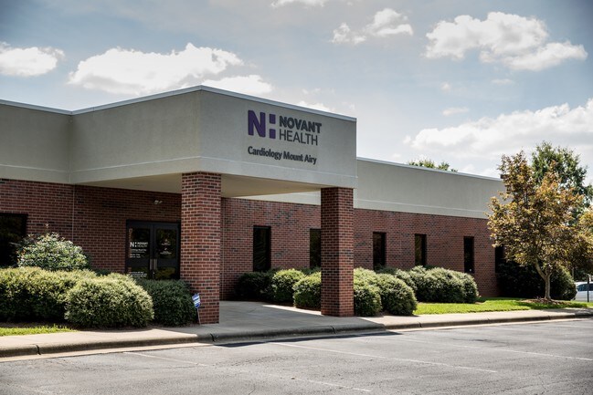
694 Riverside Dr
5031-03-11-6380
Riverside Dr
Medicalbuilding
TRACT 4 PB 18 PG 36
X
Surry
3711503100K
North Carolina
2025
1.26 AC
2025
Hickory/Morganton
930301
Other Market Areas
7,200 SF
Mount Airy, NC
DEMOGRAPHICS near 694 Riverside Dr
1 Mile
3 Mile
5 Mile
2024 Total Population
2,910
17,968
26,446
2029 Population
2,943
18,223
26,698
Pop Growth 2024-2029
+ 1.13%
+ 1.42%
+ 0.95%
Average Age
44
44
44
2024 Total Households
1,285
7,915
11,489
HH Growth 2024-2029
+ 1.01%
+ 1.42%
+ 0.96%
Median Household Inc
$74,458
$45,498
$46,743
Avg Household Size
2.20
2.20
2.20
2024 Avg HH Vehicles
2.00
2.00
2.00
Median Home Value
$184,413
$151,255
$149,982
Median Year Built
1969
1972
1975
Nearby Places
Map Layers
Map Styles
 Street
 Aerial
- Restaurants
- Banks
- Shops
- Fitness
- Groceries
SALE & LEASE HISTORY
LISTING DATE
SALE/LEASE

Sep 28, 2016
For Sale
Jan 20, 2017
For Sale
Jan 20, 2017
For Sale
Nearby Properties
Address
Land Use
TOTAL SIZE
Lot Size
Zoning
Address
Land Use
TOTAL SIZE
Lot Size
Zoning
240,171 SF
12 AC
B5
Address
Land Use
TOTAL SIZE
Lot Size
Zoning
200,663 SF
10.49 AC
R8
Address
Land Use
TOTAL SIZE
Lot Size
Zoning
86,738 SF
29.44 AC
R6
Address
Land Use
TOTAL SIZE
Lot Size
Zoning
93,565 SF
23.80 AC
R8
Address
Land Use
TOTAL SIZE
Lot Size
Zoning
1,428 SF
45.45 AC
M1
Address
Land Use
TOTAL SIZE
Lot Size
Zoning
12,088 SF
37.77 AC
RL
Address
Land Use
TOTAL SIZE
Lot Size
Zoning
112,521 SF
10.33 AC
B4
Address
Land Use
TOTAL SIZE
Lot Size
Zoning
10,592 SF
18.17 AC
CU-B5
Address
Land Use
TOTAL SIZE
Lot Size
Zoning
39,024 SF
3.04 AC
B2
Address
Land Use
TOTAL SIZE
Lot Size
Zoning
79,958 SF
20.05 AC
R8
Address
Land Use
TOTAL SIZE
Lot Size
Zoning
9,180 SF
214 AC
MI
Address
Land Use
TOTAL SIZE
Lot Size
Zoning
60,016 SF
10.16 AC
R8
Address
Land Use
TOTAL SIZE
Lot Size
Zoning
108,476 SF
14.17 AC
B4
Address
Land Use
TOTAL SIZE
Lot Size
Zoning
39,656 SF
11.65 AC
B2
Address
Land Use
TOTAL SIZE
Lot Size
Zoning
162,322 SF
35 AC
M1
Address
Land Use
TOTAL SIZE
Lot Size
Zoning
60,252 SF
8.34 AC
B4
Address
Land Use
TOTAL SIZE
Lot Size
Zoning
24,213 SF
4.08 AC
B5
Address
Land Use
TOTAL SIZE
Lot Size
Zoning
51,045 SF
2.60 AC
R6
Address
Land Use
TOTAL SIZE
Lot Size
Zoning
32,734 SF
5.35 AC
B5
Address
Land Use
TOTAL SIZE
Lot Size
Zoning
26,394 SF
3.62 AC
M1
Address
Land Use
TOTAL SIZE
Lot Size
Zoning
36,664 SF
5.36 AC
B5
Address
Land Use
TOTAL SIZE
Lot Size
Zoning
171,232 SF
22.65 AC
M1
Address
Land Use
TOTAL SIZE
Lot Size
Zoning
49,606 SF
0.59 AC
B2
Address
Land Use
TOTAL SIZE
Lot Size
Zoning
21,316 SF
19 AC
RG
Address
Land Use
TOTAL SIZE
Lot Size
Zoning
22,492 SF
3.08 AC
B2
Address
Land Use
TOTAL SIZE
Lot Size
Zoning
30,234 SF
2.60 AC
M1
Address
Land Use
TOTAL SIZE
Lot Size
Zoning
54,310 SF
B4
Address
Land Use
TOTAL SIZE
Lot Size
Zoning
57,205 SF
6.03 AC
B2
Address
Land Use
TOTAL SIZE
Lot Size
Zoning
41,250 SF
4.78 AC
B2
Address
Land Use
TOTAL SIZE
Lot Size
Zoning
18,666 SF
2 AC
B4
The World's #1 Commercial Real Estate Marketplace
Connect with us
© 2025 CoStar Group
The information above has been obtained from sources believed reliable. While we do not doubt its accuracy we have not verified it and make no guarantee, warranty or representation about it. It is your responsibility to independently confirm its accuracy and completeness. Any projections, opinions, assumptions, or estimates used are for example only and do not represent the current or future performance of the property. The value of this transaction to you depends on tax and other factors which should be evaluated by your tax, financial, and legal advisors. You and your advisors should conduct a careful, independent investigation of the property to determine to your satisfaction the suitability of the property for your needs.