Property Record
6942 S Howell Ave, Oak Creek, WI 53154

NEARBY LISTINGS FOR SALE OR LEASE
Property Detail
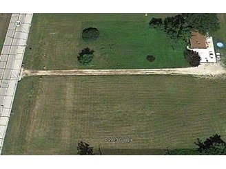
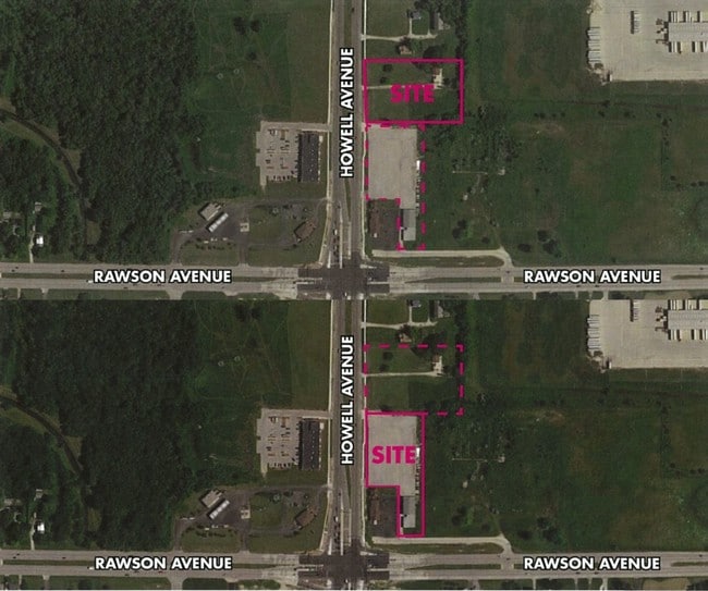
6942 S Howell Ave
Milwaukee-Waukesha, WI
Certified Surv Map 500
733-9004-000
CERTIFIED SURVEY MAP NO. 500 LOT 4 SW 1/4 SEC. 4-5-22
Commercialnec
Milwaukee
X
Wisconsin
55079C0166E
4
2024
2.26 AC
2024
Milwaukee SE
160102
Milwaukee/Madison
DEMOGRAPHICS near 6942 S Howell Ave
1 Mile
3 Mile
5 Mile
2024 Total Population
1,582
63,737
173,627
2029 Population
1,541
62,006
168,762
Pop Growth 2024-2029
(2.59%)
(2.72%)
(2.80%)
Average Age
41
41
41
2024 Total Households
631
26,964
73,172
HH Growth 2024-2029
(2.69%)
(2.75%)
(2.85%)
Median Household Inc
$85,261
$70,621
$69,082
Avg Household Size
2.50
2.30
2.30
2024 Avg HH Vehicles
2.00
2.00
2.00
Median Home Value
$241,455
$225,094
$225,960
Median Year Built
1973
1972
1965
Nearby Places
Map Layers
Map Styles
 Street
 Aerial
- Restaurants
- Banks
- Shops
- Fitness
- Groceries
PUBLIC TRANSPORTATION
COMMUTER RAIL
General Mitchell Intl. Airport Amtrak Station (Hiawatha Service - Amtrak)
DRIVE
WALK
Distance
General Mitchell Intl. Airport Amtrak Station (Hiawatha Service - Amtrak)
6 min
2.5 mi
AIRPORT
General Mitchell International
DRIVE
WALK
Distance
General Mitchell International
6 min
2.7 mi
Freight Ports
Port Milwaukee
DRIVE
WALK
Distance
Port Milwaukee
14 min
6.1 mi
SALE & LEASE HISTORY
LISTING DATE
SALE/LEASE

May 09, 2017
For Sale
May 09, 2017
For Sale
Jul 20, 2017
For Sale
Feb 17, 2020
For Sale
Feb 11, 2025
For Sale
Nearby Properties
Address
Land Use
TOTAL SIZE
Lot Size
Zoning
Address
Land Use
TOTAL SIZE
Lot Size
Zoning
Address
Land Use
TOTAL SIZE
Lot Size
Zoning
33.80 AC
Address
Land Use
TOTAL SIZE
Lot Size
Zoning
28.76 AC
Address
Land Use
TOTAL SIZE
Lot Size
Zoning
3.15 AC
Address
Land Use
TOTAL SIZE
Lot Size
Zoning
6.90 AC
Address
Land Use
TOTAL SIZE
Lot Size
Zoning
Address
Land Use
TOTAL SIZE
Lot Size
Zoning
16.06 AC
Address
Land Use
TOTAL SIZE
Lot Size
Zoning
3.45 AC
Address
Land Use
TOTAL SIZE
Lot Size
Zoning
2.53 AC
Address
Land Use
TOTAL SIZE
Lot Size
Zoning
27.30 AC
RESIDENTIA
Address
Land Use
TOTAL SIZE
Lot Size
Zoning
63,273 SF
5.42 AC
Address
Land Use
TOTAL SIZE
Lot Size
Zoning
8.79 AC
RESIDENTIA
Address
Land Use
TOTAL SIZE
Lot Size
Zoning
18.39 AC
RESIDENTIA
Address
Land Use
TOTAL SIZE
Lot Size
Zoning
26.21 AC
Address
Land Use
TOTAL SIZE
Lot Size
Zoning
21.72 AC
RESIDENTIA
Address
Land Use
TOTAL SIZE
Lot Size
Zoning
9.24 AC
RESIDENTIA
Address
Land Use
TOTAL SIZE
Lot Size
Zoning
16.48 AC
Address
Land Use
TOTAL SIZE
Lot Size
Zoning
13.84 AC
Address
Land Use
TOTAL SIZE
Lot Size
Zoning
7.36 AC
RESIDENTIA
Address
Land Use
TOTAL SIZE
Lot Size
Zoning
360,000 SF
14.60 AC
IL1
Address
Land Use
TOTAL SIZE
Lot Size
Zoning
15.92 AC
Address
Land Use
TOTAL SIZE
Lot Size
Zoning
14.03 AC
RESIDENTIA
Address
Land Use
TOTAL SIZE
Lot Size
Zoning
378,000 SF
19.24 AC
M-1PUD
Address
Land Use
TOTAL SIZE
Lot Size
Zoning
9.55 AC
RESIDENTIA
Address
Land Use
TOTAL SIZE
Lot Size
Zoning
Address
Land Use
TOTAL SIZE
Lot Size
Zoning
153,300 SF
7.39 AC
M-1PUD
Address
Land Use
TOTAL SIZE
Lot Size
Zoning
85,264 SF
3.67 AC
PD
Address
Land Use
TOTAL SIZE
Lot Size
Zoning
2.39 AC
Address
Land Use
TOTAL SIZE
Lot Size
Zoning
Address
Land Use
TOTAL SIZE
Lot Size
Zoning
The World's #1 Commercial Real Estate Marketplace
Connect with us
© 2026 CoStar Group
The information above has been obtained from sources believed reliable. While we do not doubt its accuracy we have not verified it and make no guarantee, warranty or representation about it. It is your responsibility to independently confirm its accuracy and completeness. Any projections, opinions, assumptions, or estimates used are for example only and do not represent the current or future performance of the property. The value of this transaction to you depends on tax and other factors which should be evaluated by your tax, financial, and legal advisors. You and your advisors should conduct a careful, independent investigation of the property to determine to your satisfaction the suitability of the property for your needs.