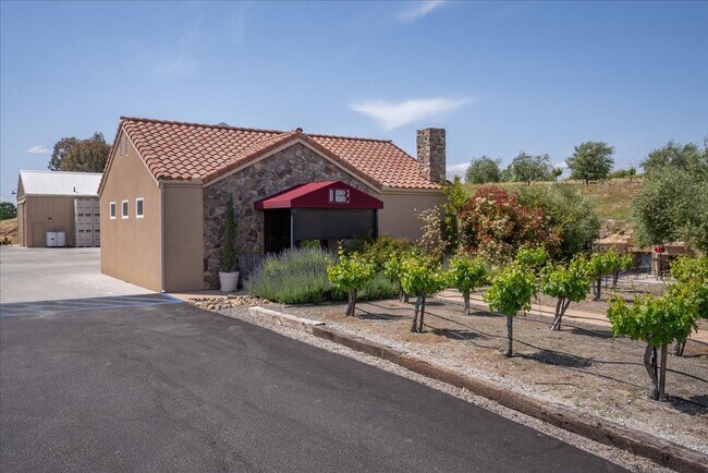
Property Record
6944 Union Rd, Paso Robles, CA 93446
NEARBY LISTINGS FOR SALE OR LEASE
Property Detail
6944 Union Rd
015-053-016
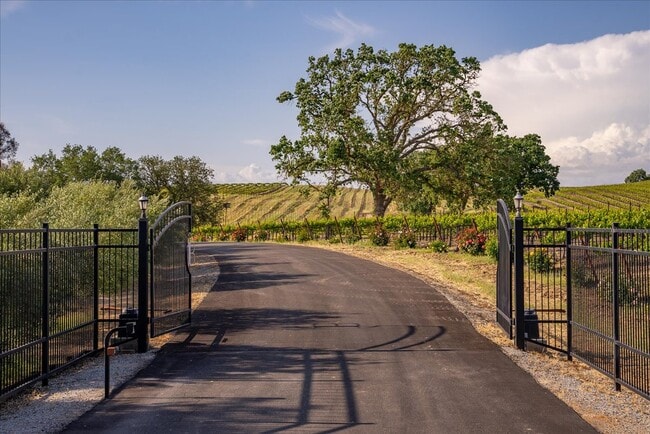
AL 79-29 PAR C
Sfr
San Luis Obispo
A
California
06079C0425G
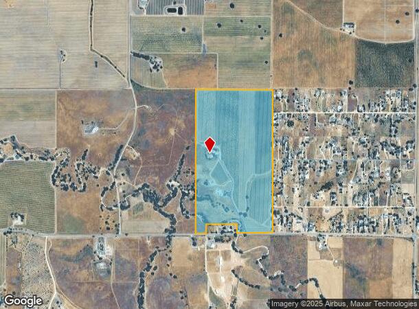
84.85 AC
2024
North 101 Corridor
2025
San Luis Obispo/Paso Robles
010302
San Luis Obispo-Paso Robles, CA
1,947 SF
DEMOGRAPHICS near 6944 Union Rd
1 mile
3 mile
5 mile
2024 Total Population
3,759
32,116
36,898
2029 Population
3,742
31,872
36,544
Pop Growth 2024-2029
(0.45%)
(0.76%)
(0.96%)
Average Age
43
40
40
2024 Total Households
1,362
11,789
13,564
HH Growth 2024-2029
(0.66%)
(0.92%)
(1.12%)
Median Household Inc
$76,894
$76,240
$80,580
Avg Household Size
2.70
2.70
2.70
2024 Avg HH Vehicles
2.00
2.00
2.00
Median Home Value
$673,913
$612,622
$624,564
Median Year Built
1997
1986
1987
Nearby Places
Map Layers
Map Styles
 Street
 Aerial
Transit
 Traffic
 Biking
Places
Listings with unknown addresses are not visible on the map
- Restaurants
- Banks
- Shops
- Fitness
- Groceries
PUBLIC TRANSPORTATION
COMMUTER RAIL
Paso Robles Amtrak Station (Coast Starlight - Amtrak)
Drive
Walk
Distance
Paso Robles Amtrak Station (Coast Starlight - Amtrak)
17 min
8.5 mi
AIRPORT
San Luis County Regional
Drive
Walk
Distance
San Luis County Regional
60 min
42.7 mi
Freight Ports
The Port of Hueneme
Drive
Walk
Distance
The Port of Hueneme
217 min
169.8 mi
SALE & LEASE HISTORY
LISTING DATE
SALE/LEASE

May 22, 2023
For Sale
Nearby Properties
Address
Land Use
TOTAL SIZE
Lot Size
Zoning
Address
Land Use
TOTAL SIZE
Lot Size
Zoning
160 AC
AG
Address
Land Use
TOTAL SIZE
Lot Size
Zoning
24.74 AC
AG
Address
Land Use
TOTAL SIZE
Lot Size
Zoning
7,274 SF
265.60 AC
AG
Address
Land Use
TOTAL SIZE
Lot Size
Zoning
1,386 SF
315 AC
AG
Address
Land Use
TOTAL SIZE
Lot Size
Zoning
1,584 SF
255.80 AC
AG
Address
Land Use
TOTAL SIZE
Lot Size
Zoning
2,145 SF
40.72 AC
AG
Address
Land Use
TOTAL SIZE
Lot Size
Zoning
6,025 SF
224.27 AC
POS
Address
Land Use
TOTAL SIZE
Lot Size
Zoning
201.46 AC
Address
Land Use
TOTAL SIZE
Lot Size
Zoning
2,510 SF
149 AC
AG
Address
Land Use
TOTAL SIZE
Lot Size
Zoning
14,228 SF
382 AC
AG
Address
Land Use
TOTAL SIZE
Lot Size
Zoning
159 AC
AG
Address
Land Use
TOTAL SIZE
Lot Size
Zoning
40.57 AC
AG
Address
Land Use
TOTAL SIZE
Lot Size
Zoning
82.10 AC
AG
Address
Land Use
TOTAL SIZE
Lot Size
Zoning
Address
Land Use
TOTAL SIZE
Lot Size
Zoning
4,853 SF
93 AC
AG
Address
Land Use
TOTAL SIZE
Lot Size
Zoning
3.73 AC
AP
Address
Land Use
TOTAL SIZE
Lot Size
Zoning
6,906 SF
130.40 AC
AG
Address
Land Use
TOTAL SIZE
Lot Size
Zoning
137.33 AC
AG
Address
Land Use
TOTAL SIZE
Lot Size
Zoning
2,405 SF
480 AC
AG
Address
Land Use
TOTAL SIZE
Lot Size
Zoning
3,224 SF
79.72 AC
AG
Address
Land Use
TOTAL SIZE
Lot Size
Zoning
1,571 SF
80 AC
AG
Address
Land Use
TOTAL SIZE
Lot Size
Zoning
7,191 SF
160.76 AC
AG
Address
Land Use
TOTAL SIZE
Lot Size
Zoning
Address
Land Use
TOTAL SIZE
Lot Size
Zoning
2,538 SF
156 AC
AG
Address
Land Use
TOTAL SIZE
Lot Size
Zoning
1,416 SF
83 AC
AG
Address
Land Use
TOTAL SIZE
Lot Size
Zoning
7,591 SF
36.86 AC
AG
Address
Land Use
TOTAL SIZE
Lot Size
Zoning
149 AC
AG
Address
Land Use
TOTAL SIZE
Lot Size
Zoning
97.50 AC
AG
Address
Land Use
TOTAL SIZE
Lot Size
Zoning
2,335 SF
38.28 AC
AG
Address
Land Use
TOTAL SIZE
Lot Size
Zoning
77.90 AC
AG
The World's #1 Commercial Real Estate Marketplace
Connect with us
© 2026 CoStar Group
The information above has been obtained from sources believed reliable. While we do not doubt its accuracy we have not verified it and make no guarantee, warranty or representation about it. It is your responsibility to independently confirm its accuracy and completeness. Any projections, opinions, assumptions, or estimates used are for example only and do not represent the current or future performance of the property. The value of this transaction to you depends on tax and other factors which should be evaluated by your tax, financial, and legal advisors. You and your advisors should conduct a careful, independent investigation of the property to determine to your satisfaction the suitability of the property for your needs.