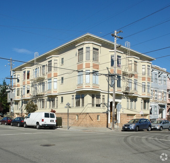
Property Record
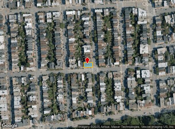
695 3Rd Ave, San Francisco, CA 94118
NEARBY LISTINGS FOR SALE OR LEASE
Property Detail
695 3Rd Ave
San Francisco
Outside Land Bl 378
San Francisco-Redwood City-South San Francisco, CA
MAP D4 5
1641-023
San Francisco
Apartment
California
2024
23
2025
0.11 AC
045100
Mission Bay
12,390 SF
DEMOGRAPHICS near 695 3Rd Ave
1 Mile
3 Mile
5 Mile
2024 Total Population
58,763
385,869
637,711
2029 Population
55,567
360,049
590,994
Pop Growth 2024-2029
(5.44%)
(6.69%)
(7.33%)
Average Age
40
42
42
2024 Total Households
29,313
188,807
282,683
HH Growth 2024-2029
(6.06%)
(7.23%)
(7.70%)
Median Household Inc
$156,106
$124,528
$129,107
Avg Household Size
1.80
1.90
2.10
2024 Avg HH Vehicles
1.00
1.00
1.00
Median Home Value
$1,090,103
$1,096,320
$1,097,668
Median Year Built
2004
1952
1949
Nearby Places
Map Layers
Map Styles
 Street
 Aerial
- Restaurants
- Banks
- Shops
- Fitness
- Groceries
PUBLIC TRANSPORTATION
TRANSIT/SUBWAY
UCSF (N Judah - San Francisco Municipal Railway (MUNI Metro))
DRIVE
WALK
Distance
UCSF (N Judah - San Francisco Municipal Railway (MUNI Metro))
6 min
11 min
0.6 mi
Irving and Arguello (N Judah - San Francisco Municipal Railway (MUNI Metro))
DRIVE
WALK
Distance
Irving and Arguello (N Judah - San Francisco Municipal Railway (MUNI Metro))
7 min
19 min
1.0 mi
Carl Street and Hillway Avenue (N Judah - San Francisco Municipal Railway (MUNI Metro))
DRIVE
WALK
Distance
Carl Street and Hillway Avenue (N Judah - San Francisco Municipal Railway (MUNI Metro))
6 min
19 min
1.0 mi
Carl and Hillway (N Judah - San Francisco Municipal Railway (MUNI Metro))
DRIVE
WALK
Distance
Carl and Hillway (N Judah - San Francisco Municipal Railway (MUNI Metro))
6 min
19 min
1.0 mi
COMMUTER RAIL
San Francisco 4th & King (Caltrain - Caltrain (Caltrain))
DRIVE
WALK
Distance
San Francisco 4th & King (Caltrain - Caltrain (Caltrain))
14 min
4.9 mi
22nd Street (Caltrain - Caltrain (Caltrain))
DRIVE
WALK
Distance
22nd Street (Caltrain - Caltrain (Caltrain))
18 min
6.3 mi
AIRPORT
San Francisco International
DRIVE
WALK
Distance
San Francisco International
26 min
15.9 mi
Metro Oakland International
DRIVE
WALK
Distance
Metro Oakland International
36 min
23.1 mi
Freight Ports
Port of San Francisco
DRIVE
WALK
Distance
Port of San Francisco
1 min
3.9 mi
SALE & LEASE HISTORY
LISTING DATE
SALE/LEASE

Oct 05, 2017
For Lease
Nearby Properties
Address
Land Use
TOTAL SIZE
Lot Size
Zoning
Address
Land Use
TOTAL SIZE
Lot Size
Zoning
1,015,000 SF
2.43 AC
RC4
Address
Land Use
TOTAL SIZE
Lot Size
Zoning
248,303 SF
4.35 AC
Address
Land Use
TOTAL SIZE
Lot Size
Zoning
508,714 SF
1.29 AC
C3R
Address
Land Use
TOTAL SIZE
Lot Size
Zoning
696,431 SF
0.97 AC
C3G
Address
Land Use
TOTAL SIZE
Lot Size
Zoning
1.52 AC
C3G
Address
Land Use
TOTAL SIZE
Lot Size
Zoning
1,424,230 SF
2.60 AC
C3G
Address
Land Use
TOTAL SIZE
Lot Size
Zoning
393,918 SF
3.36 AC
WMUG
Address
Land Use
TOTAL SIZE
Lot Size
Zoning
24.37 AC
Address
Land Use
TOTAL SIZE
Lot Size
Zoning
2.93 AC
Address
Land Use
TOTAL SIZE
Lot Size
Zoning
342,727 SF
1.36 AC
C3G
Address
Land Use
TOTAL SIZE
Lot Size
Zoning
291,522 SF
6.66 AC
CM
Address
Land Use
TOTAL SIZE
Lot Size
Zoning
718 SF
18.55 AC
RH2
Address
Land Use
TOTAL SIZE
Lot Size
Zoning
345,000 SF
1.74 AC
WMUG
Address
Land Use
TOTAL SIZE
Lot Size
Zoning
246,069 SF
0.69 AC
Address
Land Use
TOTAL SIZE
Lot Size
Zoning
89,551 SF
0.73 AC
RC4
Address
Land Use
TOTAL SIZE
Lot Size
Zoning
332,221 SF
1.17 AC
Address
Land Use
TOTAL SIZE
Lot Size
Zoning
450,000 SF
1.07 AC
C3G
Address
Land Use
TOTAL SIZE
Lot Size
Zoning
337,664 SF
0.36 AC
C3G
Address
Land Use
TOTAL SIZE
Lot Size
Zoning
368,488 SF
1.06 AC
C3R
Address
Land Use
TOTAL SIZE
Lot Size
Zoning
213,553 SF
0.46 AC
C3G
Address
Land Use
TOTAL SIZE
Lot Size
Zoning
409,895 SF
7.20 AC
RH3
Address
Land Use
TOTAL SIZE
Lot Size
Zoning
741,667 SF
1.96 AC
C3G
Address
Land Use
TOTAL SIZE
Lot Size
Zoning
241,907 SF
0.82 AC
C3G
Address
Land Use
TOTAL SIZE
Lot Size
Zoning
524,271 SF
1.06 AC
RC4
Address
Land Use
TOTAL SIZE
Lot Size
Zoning
2.40 AC
NC3
Address
Land Use
TOTAL SIZE
Lot Size
Zoning
297,170 SF
0.43 AC
C3G
Address
Land Use
TOTAL SIZE
Lot Size
Zoning
1,320,000 SF
3.01 AC
C3G
Address
Land Use
TOTAL SIZE
Lot Size
Zoning
250,843 SF
6.62 AC
NC3
Address
Land Use
TOTAL SIZE
Lot Size
Zoning
151,084 SF
1.35 AC
Address
Land Use
TOTAL SIZE
Lot Size
Zoning
231,687 SF
8.64 AC
The World's #1 Commercial Real Estate Marketplace
Connect with us
© 2025 CoStar Group
The information above has been obtained from sources believed reliable. While we do not doubt its accuracy we have not verified it and make no guarantee, warranty or representation about it. It is your responsibility to independently confirm its accuracy and completeness. Any projections, opinions, assumptions, or estimates used are for example only and do not represent the current or future performance of the property. The value of this transaction to you depends on tax and other factors which should be evaluated by your tax, financial, and legal advisors. You and your advisors should conduct a careful, independent investigation of the property to determine to your satisfaction the suitability of the property for your needs.