Property Record
734 Deer Leap Dr, Bethany Beach, DE 19930


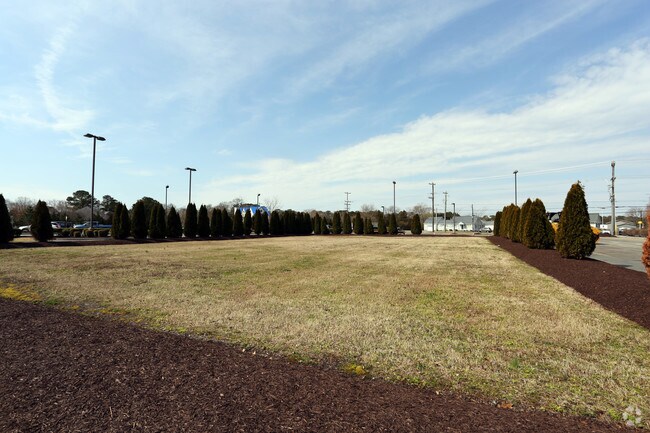
Property Detail
734 Deer Leap Dr
134-13.00-88.00
THE SALT POND COMMON AREA
Commercialnec
SUSSEX
MR
Delaware
AE The base floodplain where base flood elevations are provided. AE Zones are now used on new format FIRMs instead of A1-A30 Zones.
146.52 AC
0
Sussex County
2025
Philadelphia
0512021020
Seaford, DE
2,288 SF
NEARBY LISTINGS FOR SALE OR LEASE
DEMOGRAPHICS near 734 Deer Leap Dr
1 mile
3 mile
5 mile
2025 Total Population
4,030
27,177
37,445
2030 Population
4,771
32,054
43,787
Pop Growth 2025-2030
+ 18.39%
+ 17.95%
+ 16.94%
Average Age
57
57
56
2025 Total Households
2,006
13,115
17,848
HH Growth 2025-2030
+ 18.25%
+ 17.74%
+ 16.79%
Median Household Inc
$93,487
$91,298
$90,403
Avg Household Size
1.90
2.00
2.00
2025 Avg HH Vehicles
2.00
2.00
2.00
Median Home Value
$615,528
$588,194
$544,934
Median Year Built
2002
2002
2003
Nearby Places
Map Layers
Map Styles
 Street
 Aerial
Transit
 Traffic
 Biking
Places
Listings with unknown addresses are not visible on the map
- Restaurants
- Banks
- Shops
- Fitness
- Groceries
PUBLIC TRANSPORTATION
AIRPORT
Salisbury-Ocean City Wicomico Regional
Drive
Walk
Distance
Salisbury-Ocean City Wicomico Regional
62 min
35.5 mi
Freight Ports
Port of Wilmington, RI
Drive
Walk
Distance
Port of Wilmington, RI
139 min
104.1 mi
SALE & LEASE HISTORY
LISTING DATE
SALE/LEASE

Sep 25, 2016
For Lease
Sep 23, 2016
For Sale
Nearby Properties
Address
Land Use
TOTAL SIZE
Lot Size
Zoning
Address
Land Use
TOTAL SIZE
Lot Size
Zoning
1,064 SF
101.02 AC
MR
Address
Land Use
TOTAL SIZE
Lot Size
Zoning
Address
Land Use
TOTAL SIZE
Lot Size
Zoning
840 SF
162.56 AC
TN
Address
Land Use
TOTAL SIZE
Lot Size
Zoning
15.52 AC
TN
Address
Land Use
TOTAL SIZE
Lot Size
Zoning
1.05 AC
TN
Address
Land Use
TOTAL SIZE
Lot Size
Zoning
11.28 AC
MR
Address
Land Use
TOTAL SIZE
Lot Size
Zoning
3.46 AC
AR-1
Address
Land Use
TOTAL SIZE
Lot Size
Zoning
504 SF
78.36 AC
MR
Address
Land Use
TOTAL SIZE
Lot Size
Zoning
38.88 AC
AR-1
Address
Land Use
TOTAL SIZE
Lot Size
Zoning
0.78 AC
TN
Address
Land Use
TOTAL SIZE
Lot Size
Zoning
Address
Land Use
TOTAL SIZE
Lot Size
Zoning
2.53 AC
C-1
Address
Land Use
TOTAL SIZE
Lot Size
Zoning
2 AC
HR-1
Address
Land Use
TOTAL SIZE
Lot Size
Zoning
15.24 AC
Address
Land Use
TOTAL SIZE
Lot Size
Zoning
1,956 SF
0.19 AC
AR-1
Address
Land Use
TOTAL SIZE
Lot Size
Zoning
2.07 AC
GR
Address
Land Use
TOTAL SIZE
Lot Size
Zoning
2,238 SF
0.17 AC
Address
Land Use
TOTAL SIZE
Lot Size
Zoning
2,238 SF
0.17 AC
Address
Land Use
TOTAL SIZE
Lot Size
Zoning
2,792 SF
0.17 AC
Address
Land Use
TOTAL SIZE
Lot Size
Zoning
2,792 SF
0.17 AC
Address
Land Use
TOTAL SIZE
Lot Size
Zoning
2,792 SF
0.17 AC
Address
Land Use
TOTAL SIZE
Lot Size
Zoning
2,792 SF
0.17 AC
Address
Land Use
TOTAL SIZE
Lot Size
Zoning
2,792 SF
0.17 AC
Address
Land Use
TOTAL SIZE
Lot Size
Zoning
10.15 AC
TN
Address
Land Use
TOTAL SIZE
Lot Size
Zoning
2,700 SF
0.06 AC
Address
Land Use
TOTAL SIZE
Lot Size
Zoning
0.39 AC
TN
Address
Land Use
TOTAL SIZE
Lot Size
Zoning
1,918 SF
0.17 AC
Address
Land Use
TOTAL SIZE
Lot Size
Zoning
1,918 SF
0.17 AC
Address
Land Use
TOTAL SIZE
Lot Size
Zoning
2,240 SF
0.17 AC
Address
Land Use
TOTAL SIZE
Lot Size
Zoning
1,662 SF
0.19 AC
AR-1
The World's #1 Commercial Real Estate Marketplace
Connect with us
© 2026 CoStar Group
The information above has been obtained from sources believed reliable. While we do not doubt its accuracy we have not verified it and make no guarantee, warranty or representation about it. It is your responsibility to independently confirm its accuracy and completeness. Any projections, opinions, assumptions, or estimates used are for example only and do not represent the current or future performance of the property. The value of this transaction to you depends on tax and other factors which should be evaluated by your tax, financial, and legal advisors. You and your advisors should conduct a careful, independent investigation of the property to determine to your satisfaction the suitability of the property for your needs.