Property Record
695 Chaney Dr, Collierville, TN 38017

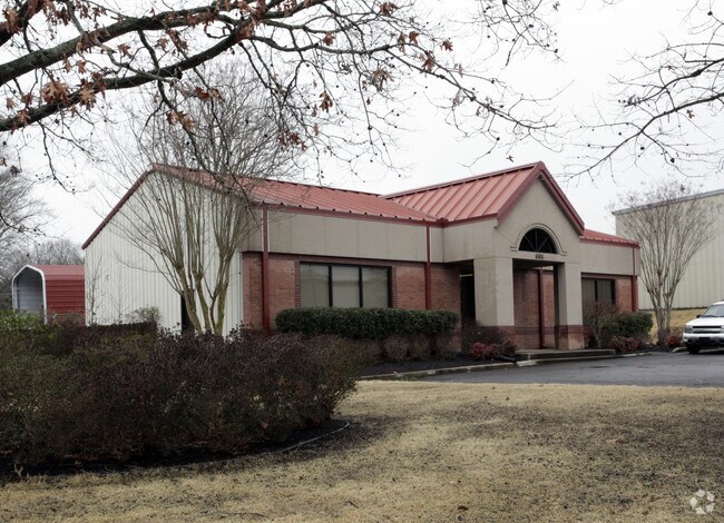
Property Detail
695 Chaney Dr
Memphis, TN-MS-AR
SHELBY
C0-258U-B0-0017
Tennessee
Officebuilding
0.84 AC
GC
385 Corridor
B and X Area of moderate flood hazard, usually the area between the limits of the 100-year and 500-year floods.
Memphis
2,275 SF
NEARBY LISTINGS FOR SALE OR LEASE
DEMOGRAPHICS near 695 Chaney Dr
1 mile
3 mile
5 mile
2025 Total Population
1,487
26,862
49,873
2030 Population
1,469
26,438
49,130
Pop Growth 2025-2030
(1.21%)
(1.58%)
(1.49%)
Average Age
41
40
40
2025 Total Households
553
9,777
17,882
HH Growth 2025-2030
(1.45%)
(1.65%)
(1.50%)
Median Household Inc
$71,361
$121,540
$129,288
Avg Household Size
2.60
2.70
2.80
2025 Avg HH Vehicles
2.00
2.00
2.00
Median Home Value
$488,371
$453,455
$470,562
Median Year Built
1969
1994
1996
Nearby Places
Map Layers
Map Styles
 Street
 Aerial
Transit
 Traffic
 Biking
Places
Listings with unknown addresses are not visible on the map
- Restaurants
- Banks
- Shops
- Fitness
- Groceries
PUBLIC TRANSPORTATION
AIRPORT
Memphis International
Drive
Walk
Distance
Memphis International
35 min
20.6 mi
Nearby Properties
Address
Land Use
TOTAL SIZE
Lot Size
Zoning
Address
Land Use
TOTAL SIZE
Lot Size
Zoning
88,989 SF
6.91 AC
PD
Address
Land Use
TOTAL SIZE
Lot Size
Zoning
241,626 SF
19.59 AC
Address
Land Use
TOTAL SIZE
Lot Size
Zoning
115,753 SF
21.54 AC
R-1
Address
Land Use
TOTAL SIZE
Lot Size
Zoning
40,257 SF
24.68 AC
R-1
Address
Land Use
TOTAL SIZE
Lot Size
Zoning
98,107 SF
10.09 AC
RI
Address
Land Use
TOTAL SIZE
Lot Size
Zoning
167,121 SF
13.56 AC
AG
Address
Land Use
TOTAL SIZE
Lot Size
Zoning
28,280 SF
3.47 AC
R-1
Address
Land Use
TOTAL SIZE
Lot Size
Zoning
67,592 SF
18.31 AC
PD
Address
Land Use
TOTAL SIZE
Lot Size
Zoning
963,300 SF
52.78 AC
B3
Address
Land Use
TOTAL SIZE
Lot Size
Zoning
223,103 SF
19.25 AC
SCC
Address
Land Use
TOTAL SIZE
Lot Size
Zoning
17,812 SF
25 AC
R-3
Address
Land Use
TOTAL SIZE
Lot Size
Zoning
16,655 SF
5.69 AC
SCC
Address
Land Use
TOTAL SIZE
Lot Size
Zoning
68,175 SF
20.58 AC
R-1
Address
Land Use
TOTAL SIZE
Lot Size
Zoning
916,949 SF
100.43 AC
GI
Address
Land Use
TOTAL SIZE
Lot Size
Zoning
108,234 SF
13.48 AC
SCC
Address
Land Use
TOTAL SIZE
Lot Size
Zoning
75,975 SF
13.09 AC
SCC
Address
Land Use
TOTAL SIZE
Lot Size
Zoning
73,377 SF
6.56 AC
PD
Address
Land Use
TOTAL SIZE
Lot Size
Zoning
256,456 SF
51.05 AC
M2
Address
Land Use
TOTAL SIZE
Lot Size
Zoning
147,342 SF
4.93 AC
R-1
Address
Land Use
TOTAL SIZE
Lot Size
Zoning
197,121 SF
22.07 AC
SCC
Address
Land Use
TOTAL SIZE
Lot Size
Zoning
54,424 SF
6.28 AC
R-1
Address
Land Use
TOTAL SIZE
Lot Size
Zoning
36,800 SF
18.50 AC
Address
Land Use
TOTAL SIZE
Lot Size
Zoning
155.29 AC
CA
Address
Land Use
TOTAL SIZE
Lot Size
Zoning
62,710 SF
11.97 AC
SCC
Address
Land Use
TOTAL SIZE
Lot Size
Zoning
29,260 SF
6.55 AC
R-1
Address
Land Use
TOTAL SIZE
Lot Size
Zoning
111,730 SF
11.30 AC
RI
Address
Land Use
TOTAL SIZE
Lot Size
Zoning
85,290 SF
11.58 AC
SCC
Address
Land Use
TOTAL SIZE
Lot Size
Zoning
49,377 SF
17.50 AC
Address
Land Use
TOTAL SIZE
Lot Size
Zoning
39,856 SF
2.26 AC
R-1
Address
Land Use
TOTAL SIZE
Lot Size
Zoning
125,993 SF
9.08 AC
RI
The World's #1 Commercial Real Estate Marketplace
Connect with us
© 2026 CoStar Group
The information above has been obtained from sources believed reliable. While we do not doubt its accuracy we have not verified it and make no guarantee, warranty or representation about it. It is your responsibility to independently confirm its accuracy and completeness. Any projections, opinions, assumptions, or estimates used are for example only and do not represent the current or future performance of the property. The value of this transaction to you depends on tax and other factors which should be evaluated by your tax, financial, and legal advisors. You and your advisors should conduct a careful, independent investigation of the property to determine to your satisfaction the suitability of the property for your needs.