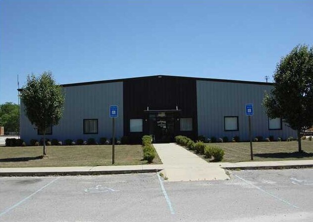
Property Record
695 Mccollum Ln, Albany, GA 31705

NEARBY LISTINGS FOR SALE OR LEASE
-
-
-
No Photo
-
-
-
-
-
View all Albany listings for sale on LoopNet.com
Property Detail
695 Mccollum Ln
Albany, GA
Mccollum Dr
00136-00001-17C
SPLIT FROM 136/1/17 FOR TAX YR
Distributionwarehouseregional
Dougherty
X
Georgia
13321C0175D
123&156
2025
13.56 AC
2024
Albany/Southwest
011200
Other Market Areas
13,680 SF
DEMOGRAPHICS near 695 Mccollum Ln
1 Mile
3 Mile
5 Mile
2024 Total Population
721
12,695
30,021
2029 Population
703
12,438
29,542
Pop Growth 2024-2029
(2.50%)
(2.02%)
(1.60%)
Average Age
41
37
37
2024 Total Households
290
4,975
11,447
HH Growth 2024-2029
(2.76%)
(2.05%)
(1.67%)
Median Household Inc
$45,116
$27,756
$35,622
Avg Household Size
2.50
2.40
2.40
2024 Avg HH Vehicles
2.00
1.00
2.00
Median Home Value
$88,613
$77,459
$99,226
Median Year Built
1977
1975
1978
Nearby Places
Map Layers
Map Styles
 Street
 Aerial
- Restaurants
- Banks
- Shops
- Fitness
- Groceries
PUBLIC TRANSPORTATION
AIRPORT
Southwest Georgia Regional
DRIVE
WALK
Distance
Southwest Georgia Regional
21 min
10.7 mi
Nearby Properties
Address
Land Use
TOTAL SIZE
Lot Size
Zoning
Address
Land Use
TOTAL SIZE
Lot Size
Zoning
243,722 SF
226.11 AC
M2
Address
Land Use
TOTAL SIZE
Lot Size
Zoning
58.86 AC
C3
Address
Land Use
TOTAL SIZE
Lot Size
Zoning
3,664 SF
1,672.02 AC
C1
Address
Land Use
TOTAL SIZE
Lot Size
Zoning
50,000 SF
50.37 AC
C3
Address
Land Use
TOTAL SIZE
Lot Size
Zoning
653,525 SF
324.66 AC
M2
Address
Land Use
TOTAL SIZE
Lot Size
Zoning
382,331 SF
30.50 AC
M1
Address
Land Use
TOTAL SIZE
Lot Size
Zoning
155,970 SF
20.89 AC
C3
Address
Land Use
TOTAL SIZE
Lot Size
Zoning
23,040 SF
10.59 AC
R6
Address
Land Use
TOTAL SIZE
Lot Size
Zoning
13,958 SF
15 AC
M1
Address
Land Use
TOTAL SIZE
Lot Size
Zoning
5,560 SF
12.88 AC
R6
Address
Land Use
TOTAL SIZE
Lot Size
Zoning
52,844 SF
18.09 AC
R6
Address
Land Use
TOTAL SIZE
Lot Size
Zoning
34,560 SF
7.46 AC
R6
Address
Land Use
TOTAL SIZE
Lot Size
Zoning
12,544 SF
10.72 AC
R6
Address
Land Use
TOTAL SIZE
Lot Size
Zoning
2,726 SF
6.29 AC
R6
Address
Land Use
TOTAL SIZE
Lot Size
Zoning
36,000 SF
5.07 AC
C3
Address
Land Use
TOTAL SIZE
Lot Size
Zoning
87,364 SF
11.38 AC
R1A
Address
Land Use
TOTAL SIZE
Lot Size
Zoning
15,124 SF
2.42 AC
C2
Address
Land Use
TOTAL SIZE
Lot Size
Zoning
53,504 SF
3.62 AC
C3
Address
Land Use
TOTAL SIZE
Lot Size
Zoning
9,616 SF
5.49 AC
C3
Address
Land Use
TOTAL SIZE
Lot Size
Zoning
16,006 SF
5.09 AC
C3
Address
Land Use
TOTAL SIZE
Lot Size
Zoning
14,708 SF
3.54 AC
C3
Address
Land Use
TOTAL SIZE
Lot Size
Zoning
10,772 SF
13.75 AC
M1
Address
Land Use
TOTAL SIZE
Lot Size
Zoning
18,851 SF
2.97 AC
C3
Address
Land Use
TOTAL SIZE
Lot Size
Zoning
36,352 SF
14.86 AC
C3
Address
Land Use
TOTAL SIZE
Lot Size
Zoning
4,845 SF
9.11 AC
C7
Address
Land Use
TOTAL SIZE
Lot Size
Zoning
304.98 AC
Address
Land Use
TOTAL SIZE
Lot Size
Zoning
6,415 SF
18.43 AC
AG
Address
Land Use
TOTAL SIZE
Lot Size
Zoning
20,496 SF
2.08 AC
C3
Address
Land Use
TOTAL SIZE
Lot Size
Zoning
66,062 SF
6.49 AC
R6
Address
Land Use
TOTAL SIZE
Lot Size
Zoning
47,965 SF
9.67 AC
C1
The World's #1 Commercial Real Estate Marketplace
Connect with us
© 2026 CoStar Group
The information above has been obtained from sources believed reliable. While we do not doubt its accuracy we have not verified it and make no guarantee, warranty or representation about it. It is your responsibility to independently confirm its accuracy and completeness. Any projections, opinions, assumptions, or estimates used are for example only and do not represent the current or future performance of the property. The value of this transaction to you depends on tax and other factors which should be evaluated by your tax, financial, and legal advisors. You and your advisors should conduct a careful, independent investigation of the property to determine to your satisfaction the suitability of the property for your needs.