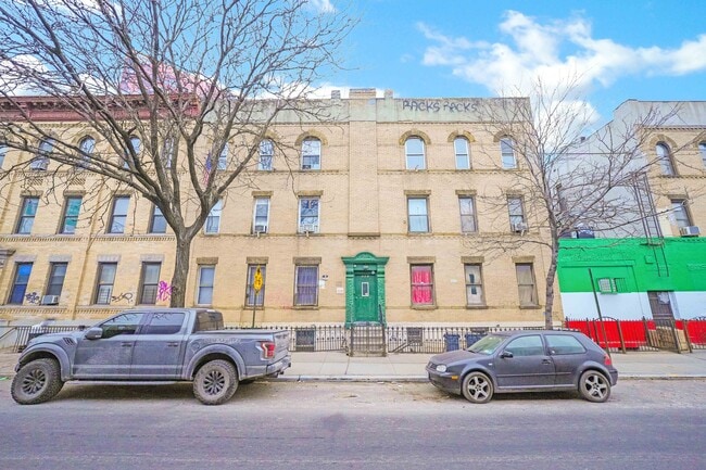
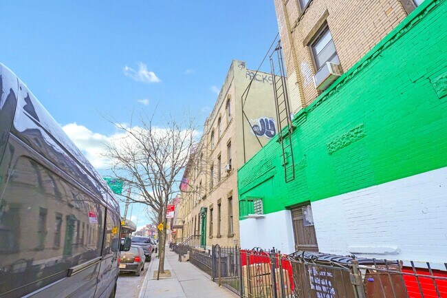
Property Record
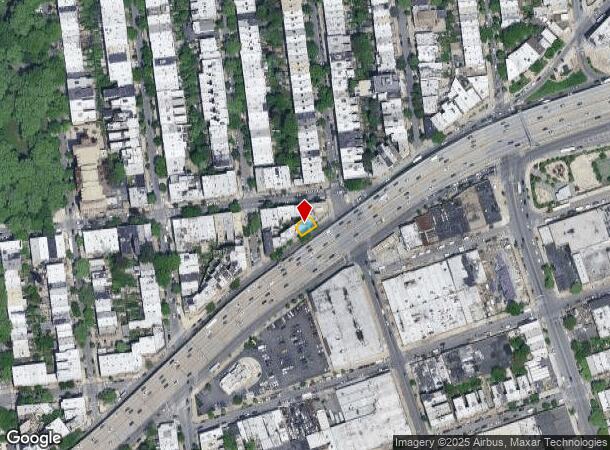
695 Meeker Ave, Brooklyn, NY 11222

NEARBY LISTINGS FOR SALE OR LEASE
Property Detail
695 Meeker Ave
02707-0009
Kings
Multifamilydwelling
New York
X
9
3604970202F
0.04 AC
2024
Greenpoint
2025
Long Island (New York)
059300
New York-Jersey City-White Plains, NY-NJ
4,536 SF
DEMOGRAPHICS near 695 Meeker Ave
1 mile
3 mile
5 mile
2024 Total Population
63,214
1,220,002
3,255,385
2029 Population
59,978
1,148,146
3,050,242
Pop Growth 2024-2029
(5.12%)
(5.89%)
(6.30%)
Average Age
37
38
39
2024 Total Households
30,168
522,821
1,389,478
HH Growth 2024-2029
(5.61%)
(6.25%)
(6.58%)
Median Household Inc
$111,731
$83,889
$86,897
Avg Household Size
2.10
2.20
2.20
2024 Avg HH Vehicles
.00
.00
.00
Median Home Value
$1,043,782
$872,554
$882,268
Median Year Built
1948
1952
1951
Nearby Places
Map Layers
Map Styles
 Street
 Aerial
Transit
 Traffic
 Biking
Places
Listings with unknown addresses are not visible on the map
- Restaurants
- Banks
- Shops
- Fitness
- Groceries
PUBLIC TRANSPORTATION
TRANSIT/SUBWAY
Nassau Avenue (G - New York MTA Subway (The Subway))
Drive
Walk
Distance
Nassau Avenue (G - New York MTA Subway (The Subway))
3 min
14 min
0.7 mi
Graham Avenue (L - New York MTA Subway (The Subway))
Drive
Walk
Distance
Graham Avenue (L - New York MTA Subway (The Subway))
3 min
15 min
0.8 mi
Grand Street (L Line) (L - New York MTA Subway (The Subway))
Drive
Walk
Distance
Grand Street (L Line) (L - New York MTA Subway (The Subway))
3 min
17 min
0.9 mi
Lorimer Street (L Line) (L - New York MTA Subway (The Subway))
Drive
Walk
Distance
Lorimer Street (L Line) (L - New York MTA Subway (The Subway))
3 min
18 min
0.9 mi
COMMUTER RAIL
Hunterspoint Avenue Station (Hempstead Branch - Long Island Rail Road, Oyster Bay Branch - Long Island Rail Road)
Drive
Walk
Distance
Hunterspoint Avenue Station (Hempstead Branch - Long Island Rail Road, Oyster Bay Branch - Long Island Rail Road)
7 min
2.0 mi
Long Island City Station (Hempstead Branch - Long Island Rail Road)
Drive
Walk
Distance
Long Island City Station (Hempstead Branch - Long Island Rail Road)
8 min
2.4 mi
AIRPORT
LaGuardia
Drive
Walk
Distance
LaGuardia
13 min
6.2 mi
John F Kennedy International
Drive
Walk
Distance
John F Kennedy International
22 min
14.4 mi
Newark Liberty International
Drive
Walk
Distance
Newark Liberty International
28 min
15.8 mi
Freight Ports
NY - Red Hook Container Terminal
Drive
Walk
Distance
NY - Red Hook Container Terminal
11 min
5.6 mi
SALE & LEASE HISTORY
LISTING DATE
SALE/LEASE

Jan 08, 2024
For Sale
Feb 22, 2022
For Sale
Aug 28, 2017
For Sale
Nearby Properties
Address
Land Use
TOTAL SIZE
Lot Size
Zoning
Address
Land Use
TOTAL SIZE
Lot Size
Zoning
97.14 AC
R7-2
Address
Land Use
TOTAL SIZE
Lot Size
Zoning
1.22 AC
R7-2
Address
Land Use
TOTAL SIZE
Lot Size
Zoning
0.92 AC
R7-2
Address
Land Use
TOTAL SIZE
Lot Size
Zoning
97.14 AC
R7-2
Address
Land Use
TOTAL SIZE
Lot Size
Zoning
8,462,176 SF
61.41 AC
R7-2
Address
Land Use
TOTAL SIZE
Lot Size
Zoning
4,380,201 SF
97.06 AC
R7-2
Address
Land Use
TOTAL SIZE
Lot Size
Zoning
1,678,135 SF
1.01 AC
C5-3
Address
Land Use
TOTAL SIZE
Lot Size
Zoning
2,812,739 SF
2.10 AC
C5-3
Address
Land Use
TOTAL SIZE
Lot Size
Zoning
1,586,876 SF
1.87 AC
C5-3
Address
Land Use
TOTAL SIZE
Lot Size
Zoning
2,344,406 SF
1.84 AC
C5-3
Address
Land Use
TOTAL SIZE
Lot Size
Zoning
2,400,000 SF
15.14 AC
C5-2
Address
Land Use
TOTAL SIZE
Lot Size
Zoning
2,124,441 SF
17.29 AC
R8
Address
Land Use
TOTAL SIZE
Lot Size
Zoning
1,160,500 SF
1.62 AC
C6-6
Address
Land Use
TOTAL SIZE
Lot Size
Zoning
2,230,742 SF
6.33 AC
R9
Address
Land Use
TOTAL SIZE
Lot Size
Zoning
1,015,287 SF
1 AC
C5-3
Address
Land Use
TOTAL SIZE
Lot Size
Zoning
1,233,394 SF
1.78 AC
C5-3
Address
Land Use
TOTAL SIZE
Lot Size
Zoning
1,134,017 SF
1.05 AC
C5-3
Address
Land Use
TOTAL SIZE
Lot Size
Zoning
822,014 SF
1.38 AC
C52.5
Address
Land Use
TOTAL SIZE
Lot Size
Zoning
1,104,505 SF
2.32 AC
C4-7
Address
Land Use
TOTAL SIZE
Lot Size
Zoning
916,553 SF
1.39 AC
C5-3
Address
Land Use
TOTAL SIZE
Lot Size
Zoning
1,033,031 SF
1.87 AC
C52.5
Address
Land Use
TOTAL SIZE
Lot Size
Zoning
940,000 SF
1.44 AC
C6-2
Address
Land Use
TOTAL SIZE
Lot Size
Zoning
988,829 SF
1.44 AC
R10
Address
Land Use
TOTAL SIZE
Lot Size
Zoning
988,829 SF
1.44 AC
R10
Address
Land Use
TOTAL SIZE
Lot Size
Zoning
988,829 SF
1.44 AC
R10
Address
Land Use
TOTAL SIZE
Lot Size
Zoning
988,829 SF
1.44 AC
R10
Address
Land Use
TOTAL SIZE
Lot Size
Zoning
988,829 SF
1.44 AC
R10
Address
Land Use
TOTAL SIZE
Lot Size
Zoning
988,829 SF
1.44 AC
R10
Address
Land Use
TOTAL SIZE
Lot Size
Zoning
988,829 SF
1.44 AC
R10
Address
Land Use
TOTAL SIZE
Lot Size
Zoning
988,829 SF
1.44 AC
R10
The World's #1 Commercial Real Estate Marketplace
Connect with us
© 2026 CoStar Group
The information above has been obtained from sources believed reliable. While we do not doubt its accuracy we have not verified it and make no guarantee, warranty or representation about it. It is your responsibility to independently confirm its accuracy and completeness. Any projections, opinions, assumptions, or estimates used are for example only and do not represent the current or future performance of the property. The value of this transaction to you depends on tax and other factors which should be evaluated by your tax, financial, and legal advisors. You and your advisors should conduct a careful, independent investigation of the property to determine to your satisfaction the suitability of the property for your needs.