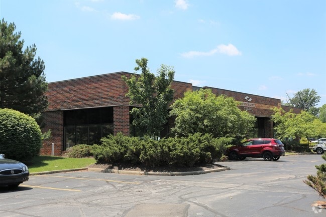
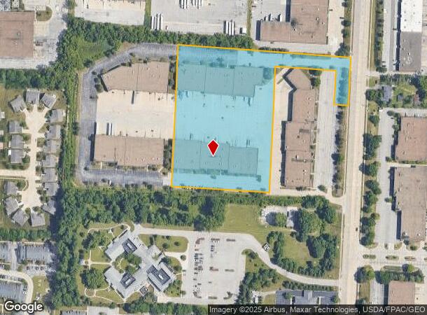
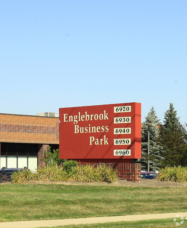
Property Record
6930 Engle Rd, Cleveland, OH 44130
Current Lease Availabilities
NEARBY LISTINGS FOR SALE OR LEASE
Property Detail
6930 Engle Rd
Cleveland
Englewood Plaza South
Cleveland-Elyria, OH
2 3 LOT2
371-14-004
Cuyahoga
Multitenantindustrial
Ohio
2024
2
2024
6.23 AC
173104
Airport
77,694 SF
DEMOGRAPHICS near 6930 Engle Rd
1 Mile
3 Mile
5 Mile
2024 Total Population
5,169
59,837
186,968
2029 Population
4,998
58,077
181,948
Pop Growth 2024-2029
(3.31%)
(2.94%)
(2.68%)
Average Age
47
43
43
2024 Total Households
2,400
25,621
81,988
HH Growth 2024-2029
(3.58%)
(3.17%)
(2.89%)
Median Household Inc
$68,487
$65,703
$64,525
Avg Household Size
2.00
2.20
2.20
2024 Avg HH Vehicles
2.00
2.00
2.00
Median Home Value
$161,449
$166,170
$167,902
Median Year Built
1972
1963
1963
Nearby Places
Map Layers
Map Styles
 Street
 Aerial
- Restaurants
- Banks
- Shops
- Fitness
- Groceries
PUBLIC TRANSPORTATION
AIRPORT
Cleveland-Hopkins International
DRIVE
WALK
Distance
Cleveland-Hopkins International
13 min
5.3 mi
Akron-Canton Regional
DRIVE
WALK
Distance
Akron-Canton Regional
62 min
48.7 mi
Nearby Properties
Address
Land Use
TOTAL SIZE
Lot Size
Zoning
Address
Land Use
TOTAL SIZE
Lot Size
Zoning
748.88 AC
GI
Address
Land Use
TOTAL SIZE
Lot Size
Zoning
1,490,538 SF
19.29 AC
PF
Address
Land Use
TOTAL SIZE
Lot Size
Zoning
754.68 AC
GI
Address
Land Use
TOTAL SIZE
Lot Size
Zoning
526.33 AC
GI
Address
Land Use
TOTAL SIZE
Lot Size
Zoning
237,144 SF
2.12 AC
PG
Address
Land Use
TOTAL SIZE
Lot Size
Zoning
668,882 SF
41.27 AC
SC
Address
Land Use
TOTAL SIZE
Lot Size
Zoning
1,514 SF
23.65 AC
RSF-B
Address
Land Use
TOTAL SIZE
Lot Size
Zoning
208.22 AC
U5-A
Address
Land Use
TOTAL SIZE
Lot Size
Zoning
657,013 SF
48.88 AC
SI
Address
Land Use
TOTAL SIZE
Lot Size
Zoning
289,215 SF
20.56 AC
RSF-B
Address
Land Use
TOTAL SIZE
Lot Size
Zoning
Address
Land Use
TOTAL SIZE
Lot Size
Zoning
Address
Land Use
TOTAL SIZE
Lot Size
Zoning
768,485 SF
14.53 AC
R1-A
Address
Land Use
TOTAL SIZE
Lot Size
Zoning
88.28 AC
U5-A
Address
Land Use
TOTAL SIZE
Lot Size
Zoning
244,717 SF
23.97 AC
RMF-1
Address
Land Use
TOTAL SIZE
Lot Size
Zoning
505,418 SF
33.99 AC
SC
Address
Land Use
TOTAL SIZE
Lot Size
Zoning
299,114 SF
23.65 AC
RSF-B
Address
Land Use
TOTAL SIZE
Lot Size
Zoning
126,000 SF
3.02 AC
PG
Address
Land Use
TOTAL SIZE
Lot Size
Zoning
309,231 SF
34.28 AC
Address
Land Use
TOTAL SIZE
Lot Size
Zoning
1,391,445 SF
136.05 AC
GI
Address
Land Use
TOTAL SIZE
Lot Size
Zoning
3.53 AC
SI
Address
Land Use
TOTAL SIZE
Lot Size
Zoning
364,000 SF
33.27 AC
U5-A
Address
Land Use
TOTAL SIZE
Lot Size
Zoning
174.94 AC
U5-A
Address
Land Use
TOTAL SIZE
Lot Size
Zoning
300,120 SF
20.18 AC
GI
Address
Land Use
TOTAL SIZE
Lot Size
Zoning
263,867 SF
59.28 AC
PF
Address
Land Use
TOTAL SIZE
Lot Size
Zoning
103.89 AC
U5-A
Address
Land Use
TOTAL SIZE
Lot Size
Zoning
426.60 AC
PF
Address
Land Use
TOTAL SIZE
Lot Size
Zoning
166,104 SF
4.70 AC
CC
Address
Land Use
TOTAL SIZE
Lot Size
Zoning
24.55 AC
GI
Address
Land Use
TOTAL SIZE
Lot Size
Zoning
107,427 SF
30 AC
SF-A
The World's #1 Commercial Real Estate Marketplace
Connect with us
© 2026 CoStar Group
The information above has been obtained from sources believed reliable. While we do not doubt its accuracy we have not verified it and make no guarantee, warranty or representation about it. It is your responsibility to independently confirm its accuracy and completeness. Any projections, opinions, assumptions, or estimates used are for example only and do not represent the current or future performance of the property. The value of this transaction to you depends on tax and other factors which should be evaluated by your tax, financial, and legal advisors. You and your advisors should conduct a careful, independent investigation of the property to determine to your satisfaction the suitability of the property for your needs.