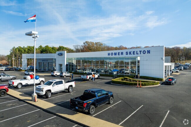
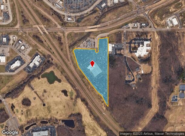
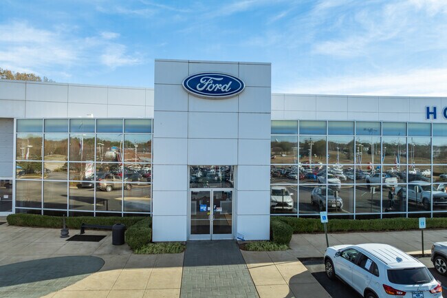
Property Record
6950 Hannah Cv, Olive Branch, MS 38654
NEARBY LISTINGS FOR SALE OR LEASE
Property Detail
6950 Hannah Cv
Memphis, TN-MS-AR
Parkside Center Comm S/D
1069322500000200
PARKSIDE CENTER COMM S/D FIRST REV LOT 2
Communitycenter
DeSoto
AE
Mississippi
28033C0103H
2
2025
12.39 AC
2025
Olive Branch
070821
Memphis
32,285 SF
DEMOGRAPHICS near 6950 Hannah Cv
1 Mile
3 Mile
5 Mile
2024 Total Population
3,888
36,642
84,062
2029 Population
4,254
39,590
87,880
Pop Growth 2024-2029
+ 9.41%
+ 8.05%
+ 4.54%
Average Age
42
39
38
2024 Total Households
1,551
13,505
29,862
HH Growth 2024-2029
+ 9.48%
+ 8.06%
+ 4.60%
Median Household Inc
$77,584
$77,406
$78,167
Avg Household Size
2.40
2.70
2.80
2024 Avg HH Vehicles
2.00
2.00
2.00
Median Home Value
$252,928
$228,357
$230,877
Median Year Built
1997
1997
1995
Nearby Places
Map Layers
Map Styles
 Street
 Aerial
- Restaurants
- Banks
- Shops
- Fitness
- Groceries
PUBLIC TRANSPORTATION
AIRPORT
Memphis International
DRIVE
WALK
Distance
Memphis International
19 min
12.5 mi
Freight Ports
Port of Shreveport
DRIVE
WALK
Distance
Port of Shreveport
423 min
386.2 mi
Nearby Properties
Address
Land Use
TOTAL SIZE
Lot Size
Zoning
Address
Land Use
TOTAL SIZE
Lot Size
Zoning
1,059,729 SF
74.33 AC
M-2
Address
Land Use
TOTAL SIZE
Lot Size
Zoning
434,122 SF
23.97 AC
R-6
Address
Land Use
TOTAL SIZE
Lot Size
Zoning
158,366 SF
24.31 AC
R-6
Address
Land Use
TOTAL SIZE
Lot Size
Zoning
326,743 SF
22.91 AC
R-8
Address
Land Use
TOTAL SIZE
Lot Size
Zoning
345,770 SF
18.13 AC
EMP
Address
Land Use
TOTAL SIZE
Lot Size
Zoning
864,054 SF
72.19 AC
M-1
Address
Land Use
TOTAL SIZE
Lot Size
Zoning
307,100 SF
18.95 AC
CA
Address
Land Use
TOTAL SIZE
Lot Size
Zoning
309,885 SF
17.49 AC
R-8
Address
Land Use
TOTAL SIZE
Lot Size
Zoning
860,464 SF
54.55 AC
M-1
Address
Land Use
TOTAL SIZE
Lot Size
Zoning
693,680 SF
47.15 AC
M-1
Address
Land Use
TOTAL SIZE
Lot Size
Zoning
814,054 SF
51.14 AC
M-1
Address
Land Use
TOTAL SIZE
Lot Size
Zoning
217,172 SF
12.32 AC
R-6
Address
Land Use
TOTAL SIZE
Lot Size
Zoning
210,161 SF
14.86 AC
R-6
Address
Land Use
TOTAL SIZE
Lot Size
Zoning
210,354 SF
17.31 AC
R-8
Address
Land Use
TOTAL SIZE
Lot Size
Zoning
390,874 SF
122.03 AC
M-1
Address
Land Use
TOTAL SIZE
Lot Size
Zoning
445,114 SF
32.34 AC
M-1
Address
Land Use
TOTAL SIZE
Lot Size
Zoning
27,669 SF
34.27 AC
R-4
Address
Land Use
TOTAL SIZE
Lot Size
Zoning
480,000 SF
23.80 AC
M-2
Address
Land Use
TOTAL SIZE
Lot Size
Zoning
10,155 SF
26.43 AC
R-4
Address
Land Use
TOTAL SIZE
Lot Size
Zoning
368,608 SF
21.85 AC
M-1
Address
Land Use
TOTAL SIZE
Lot Size
Zoning
130,091 SF
9.39 AC
R-6
Address
Land Use
TOTAL SIZE
Lot Size
Zoning
13,554 SF
15.32 AC
PUD
Address
Land Use
TOTAL SIZE
Lot Size
Zoning
287,500 SF
20 AC
M-2
Address
Land Use
TOTAL SIZE
Lot Size
Zoning
329,096 SF
21.64 AC
M-1
Address
Land Use
TOTAL SIZE
Lot Size
Zoning
250,364 SF
13.72 AC
M-1
Address
Land Use
TOTAL SIZE
Lot Size
Zoning
9,682 SF
14 AC
PUD
Address
Land Use
TOTAL SIZE
Lot Size
Zoning
320,000 SF
16.20 AC
M-2
Address
Land Use
TOTAL SIZE
Lot Size
Zoning
11,097 SF
13.39 AC
PUD
Address
Land Use
TOTAL SIZE
Lot Size
Zoning
217,448 SF
19.07 AC
M-1
Address
Land Use
TOTAL SIZE
Lot Size
Zoning
218,400 SF
14.52 AC
M-1
The World's #1 Commercial Real Estate Marketplace
Connect with us
© 2026 CoStar Group
The information above has been obtained from sources believed reliable. While we do not doubt its accuracy we have not verified it and make no guarantee, warranty or representation about it. It is your responsibility to independently confirm its accuracy and completeness. Any projections, opinions, assumptions, or estimates used are for example only and do not represent the current or future performance of the property. The value of this transaction to you depends on tax and other factors which should be evaluated by your tax, financial, and legal advisors. You and your advisors should conduct a careful, independent investigation of the property to determine to your satisfaction the suitability of the property for your needs.