Property Record
6951 5Th St, Northport, AL 35476


NEARBY LISTINGS FOR SALE OR LEASE
Property Detail
6951 5Th St
31-04-18-2-002-002.000
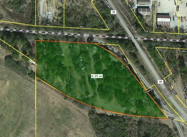
BEG NW COR SEC 18; TH S 505(S) TO POB; TH E ALG S RR ROW 390 (S); SE 745(S); NWLY 968(S); N 250(S) TO POB IN NW1/4-NW1/4 S18 T21S R10W
Autorepair
Tuscaloosa
AE
Alabama
01125C0482G
6.30 AC
2025
Tuscaloosa
2024
Birmingham
010302
Tuscaloosa, AL
6,000 SF
DEMOGRAPHICS near 6951 5Th St
1 Mile
3 Mile
5 Mile
2024 Total Population
1,763
14,370
63,225
2029 Population
1,984
16,108
71,810
Pop Growth 2024-2029
+ 12.54%
+ 12.09%
+ 13.58%
Average Age
39
41
37
2024 Total Households
671
5,392
25,207
HH Growth 2024-2029
+ 12.82%
+ 12.11%
+ 14.16%
Median Household Inc
$58,333
$65,680
$46,935
Avg Household Size
2.50
2.40
2.20
2024 Avg HH Vehicles
2.00
2.00
2.00
Median Home Value
$181,521
$192,811
$196,706
Median Year Built
1991
1988
1986
Nearby Places
Map Layers
Map Styles
 Street
 Aerial
- Restaurants
- Banks
- Shops
- Fitness
- Groceries
PUBLIC TRANSPORTATION
COMMUTER RAIL
DRIVE
WALK
Distance
12 min
6.5 mi
SALE & LEASE HISTORY
LISTING DATE
SALE/LEASE

Aug 24, 2017
For Sale
Nearby Properties
Address
Land Use
TOTAL SIZE
Lot Size
Zoning
Address
Land Use
TOTAL SIZE
Lot Size
Zoning
24,360 SF
142 AC
Address
Land Use
TOTAL SIZE
Lot Size
Zoning
174,000 SF
28.67 AC
R1
Address
Land Use
TOTAL SIZE
Lot Size
Zoning
361,935 SF
133.67 AC
MH
Address
Land Use
TOTAL SIZE
Lot Size
Zoning
301,560 SF
15 AC
ML
Address
Land Use
TOTAL SIZE
Lot Size
Zoning
10,440 SF
12 AC
Address
Land Use
TOTAL SIZE
Lot Size
Zoning
32,640 SF
9.80 AC
C6
Address
Land Use
TOTAL SIZE
Lot Size
Zoning
143,038 SF
36 AC
O-I
Address
Land Use
TOTAL SIZE
Lot Size
Zoning
50,652 SF
19.03 AC
ML
Address
Land Use
TOTAL SIZE
Lot Size
Zoning
208,996 SF
25 AC
C-6
Address
Land Use
TOTAL SIZE
Lot Size
Zoning
140,412 SF
14.35 AC
C6
Address
Land Use
TOTAL SIZE
Lot Size
Zoning
213,549 SF
8.80 AC
ML
Address
Land Use
TOTAL SIZE
Lot Size
Zoning
211,838 SF
11.71 AC
ML
Address
Land Use
TOTAL SIZE
Lot Size
Zoning
176,846 SF
21.27 AC
ML
Address
Land Use
TOTAL SIZE
Lot Size
Zoning
108,000 SF
11.87 AC
Address
Land Use
TOTAL SIZE
Lot Size
Zoning
16,920 SF
6.84 AC
AG
Address
Land Use
TOTAL SIZE
Lot Size
Zoning
8,160 SF
3.18 AC
MFH
Address
Land Use
TOTAL SIZE
Lot Size
Zoning
89,820 SF
5.33 AC
MH
Address
Land Use
TOTAL SIZE
Lot Size
Zoning
8,152 SF
18 AC
ML
Address
Land Use
TOTAL SIZE
Lot Size
Zoning
7,376 SF
10.50 AC
ML
Address
Land Use
TOTAL SIZE
Lot Size
Zoning
8,952 SF
5 AC
RM2
Address
Land Use
TOTAL SIZE
Lot Size
Zoning
11,244 SF
5.60 AC
RM2
Address
Land Use
TOTAL SIZE
Lot Size
Zoning
17,304 SF
7.20 AC
C6
Address
Land Use
TOTAL SIZE
Lot Size
Zoning
7,208 SF
6.10 AC
RM2
Address
Land Use
TOTAL SIZE
Lot Size
Zoning
1,800 SF
142 AC
I
Address
Land Use
TOTAL SIZE
Lot Size
Zoning
2,400 SF
11 AC
ML
Address
Land Use
TOTAL SIZE
Lot Size
Zoning
97,250 SF
4.79 AC
ML
Address
Land Use
TOTAL SIZE
Lot Size
Zoning
437 SF
117 AC
I
Address
Land Use
TOTAL SIZE
Lot Size
Zoning
1,019 SF
12 AC
MHP
Address
Land Use
TOTAL SIZE
Lot Size
Zoning
14,400 SF
5.20 AC
RS-1
Address
Land Use
TOTAL SIZE
Lot Size
Zoning
36,144 SF
22.50 AC
The World's #1 Commercial Real Estate Marketplace
Connect with us
© 2026 CoStar Group
The information above has been obtained from sources believed reliable. While we do not doubt its accuracy we have not verified it and make no guarantee, warranty or representation about it. It is your responsibility to independently confirm its accuracy and completeness. Any projections, opinions, assumptions, or estimates used are for example only and do not represent the current or future performance of the property. The value of this transaction to you depends on tax and other factors which should be evaluated by your tax, financial, and legal advisors. You and your advisors should conduct a careful, independent investigation of the property to determine to your satisfaction the suitability of the property for your needs.