Property Record
6955 Cary Hamilton Rd, Theodore, AL 36582
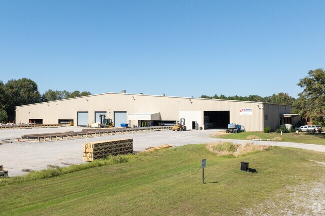


Property Detail
6955 Cary Hamilton Rd
Mobile, AL
BEGINNING AT THE NORTHEAST CORNER OF LOT 2 NORDEN PAPER S/D MAP BOOK 131 PAGE 52; THENCE RUN EAST 731.11 FEET; THENCE SOUTH
38-02-03-4-000-004.001
MOBILE
Vacantlandnec
Alabama
B and X Area of moderate flood hazard, usually the area between the limits of the 100-year and 500-year floods.
2
2025
16.11 AC
2025
Outlying Mobile County
007102
Mobile
NEARBY LISTINGS FOR SALE OR LEASE
DEMOGRAPHICS near 6955 Cary Hamilton Rd
1 mile
3 mile
5 mile
2025 Total Population
1,846
14,206
40,182
2030 Population
1,840
14,114
39,922
Pop Growth 2025-2030
(0.33%)
(0.65%)
(0.65%)
Average Age
38
39
41
2025 Total Households
727
5,621
15,797
HH Growth 2025-2030
(0.28%)
(0.68%)
(0.66%)
Median Household Inc
$68,895
$56,303
$59,558
Avg Household Size
2.50
2.50
2.50
2025 Avg HH Vehicles
2.00
2.00
2.00
Median Home Value
$173,192
$158,963
$177,186
Median Year Built
1985
1983
1984
Nearby Places
Map Layers
Map Styles
 Street
 Aerial
Transit
 Traffic
 Biking
Places
Listings with unknown addresses are not visible on the map
- Restaurants
- Banks
- Shops
- Fitness
- Groceries
PUBLIC TRANSPORTATION
AIRPORT
Mobile International
Drive
Walk
Distance
Mobile International
20 min
11.3 mi
Mobile Regional
Drive
Walk
Distance
Mobile Regional
33 min
14.5 mi
Freight Ports
Port of Mobile
Drive
Walk
Distance
Port of Mobile
23 min
14.6 mi
SALE & LEASE HISTORY
LISTING DATE
SALE/LEASE

Sep 25, 2016
For Lease
Sep 23, 2016
For Sale
Apr 24, 2020
For Lease
Nearby Properties
Address
Land Use
TOTAL SIZE
Lot Size
Zoning
Address
Land Use
TOTAL SIZE
Lot Size
Zoning
127,658 SF
52 AC
Address
Land Use
TOTAL SIZE
Lot Size
Zoning
362,880 SF
32.55 AC
Address
Land Use
TOTAL SIZE
Lot Size
Zoning
117,000 SF
Address
Land Use
TOTAL SIZE
Lot Size
Zoning
202,866 SF
8.52 AC
Address
Land Use
TOTAL SIZE
Lot Size
Zoning
155,320 SF
21.48 AC
Address
Land Use
TOTAL SIZE
Lot Size
Zoning
39,348 SF
100.44 AC
Address
Land Use
TOTAL SIZE
Lot Size
Zoning
342,598 SF
11.94 AC
Address
Land Use
TOTAL SIZE
Lot Size
Zoning
78,750 SF
27.51 AC
Address
Land Use
TOTAL SIZE
Lot Size
Zoning
167,968 SF
12.40 AC
Address
Land Use
TOTAL SIZE
Lot Size
Zoning
26,933 SF
82.37 AC
Address
Land Use
TOTAL SIZE
Lot Size
Zoning
86,168 SF
42 AC
Address
Land Use
TOTAL SIZE
Lot Size
Zoning
234,275 SF
40.29 AC
Address
Land Use
TOTAL SIZE
Lot Size
Zoning
204,868 SF
22.14 AC
Address
Land Use
TOTAL SIZE
Lot Size
Zoning
27,580 SF
4.69 AC
Address
Land Use
TOTAL SIZE
Lot Size
Zoning
132,400 SF
23 AC
Address
Land Use
TOTAL SIZE
Lot Size
Zoning
78,750 SF
24 AC
Address
Land Use
TOTAL SIZE
Lot Size
Zoning
193,452 SF
17.61 AC
Address
Land Use
TOTAL SIZE
Lot Size
Zoning
66,382 SF
1.71 AC
Address
Land Use
TOTAL SIZE
Lot Size
Zoning
47,368 SF
45.38 AC
Address
Land Use
TOTAL SIZE
Lot Size
Zoning
12,071 SF
6.87 AC
Address
Land Use
TOTAL SIZE
Lot Size
Zoning
86,820 SF
4.50 AC
Address
Land Use
TOTAL SIZE
Lot Size
Zoning
15,200 SF
79.74 AC
Address
Land Use
TOTAL SIZE
Lot Size
Zoning
94,116 SF
7.11 AC
Address
Land Use
TOTAL SIZE
Lot Size
Zoning
185.25 AC
Address
Land Use
TOTAL SIZE
Lot Size
Zoning
396.69 AC
Address
Land Use
TOTAL SIZE
Lot Size
Zoning
440 SF
19.38 AC
Address
Land Use
TOTAL SIZE
Lot Size
Zoning
76,560 SF
27.88 AC
Address
Land Use
TOTAL SIZE
Lot Size
Zoning
60,630 SF
6.70 AC
Address
Land Use
TOTAL SIZE
Lot Size
Zoning
58,306 SF
3.11 AC
Address
Land Use
TOTAL SIZE
Lot Size
Zoning
204,776 SF
39.94 AC
The World's #1 Commercial Real Estate Marketplace
Connect with us
© 2026 CoStar Group
The information above has been obtained from sources believed reliable. While we do not doubt its accuracy we have not verified it and make no guarantee, warranty or representation about it. It is your responsibility to independently confirm its accuracy and completeness. Any projections, opinions, assumptions, or estimates used are for example only and do not represent the current or future performance of the property. The value of this transaction to you depends on tax and other factors which should be evaluated by your tax, financial, and legal advisors. You and your advisors should conduct a careful, independent investigation of the property to determine to your satisfaction the suitability of the property for your needs.