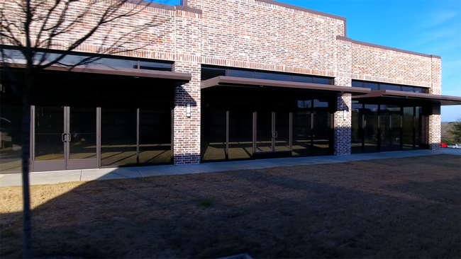
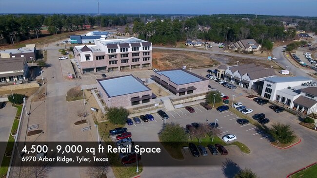
Property Record
6970 Arbor Ridge Dr, Tyler, TX 75703

NEARBY LISTINGS FOR SALE OR LEASE
Property Detail
6970 Arbor Ridge Dr
Tyler, TX
Oak Hill
1-50000-1660-01-011100
OAK HILLBLOCK 1660-A LOT 11J
Storebuilding
Smith
X
Texas
48423C0365D
11j
2024
0.45 AC
2025
Tyler & Longview
002012
Other Market Areas
8,816 SF
DEMOGRAPHICS near 6970 Arbor Ridge Dr
1 Mile
3 Mile
5 Mile
2024 Total Population
4,196
32,882
77,363
2029 Population
4,644
35,749
84,041
Pop Growth 2024-2029
+ 10.68%
+ 8.72%
+ 8.63%
Average Age
45
41
40
2024 Total Households
1,705
14,369
32,149
HH Growth 2024-2029
+ 10.44%
+ 8.21%
+ 8.05%
Median Household Inc
$101,250
$71,088
$67,396
Avg Household Size
2.40
2.20
2.30
2024 Avg HH Vehicles
2.00
2.00
2.00
Median Home Value
$450,367
$277,475
$246,923
Median Year Built
2005
1993
1987
Nearby Places
Map Layers
Map Styles
 Street
 Aerial
- Restaurants
- Banks
- Shops
- Fitness
- Groceries
PUBLIC TRANSPORTATION
AIRPORT
Tyler Pounds Regional
DRIVE
WALK
Distance
Tyler Pounds Regional
21 min
12.0 mi
Freight Ports
Port of Shreveport
DRIVE
WALK
Distance
Port of Shreveport
131 min
114.0 mi
SALE & LEASE HISTORY
LISTING DATE
SALE/LEASE

Jul 20, 2021
For Sale
Jul 13, 2022
For Lease
Dec 02, 2020
For Lease
Nearby Properties
Address
Land Use
TOTAL SIZE
Lot Size
Zoning
Address
Land Use
TOTAL SIZE
Lot Size
Zoning
50,735 SF
40.79 AC
Address
Land Use
TOTAL SIZE
Lot Size
Zoning
403,396 SF
45.40 AC
C4
Address
Land Use
TOTAL SIZE
Lot Size
Zoning
7,152 SF
19.76 AC
RMF
Address
Land Use
TOTAL SIZE
Lot Size
Zoning
4,250 SF
50.89 AC
Address
Land Use
TOTAL SIZE
Lot Size
Zoning
29.58 AC
Address
Land Use
TOTAL SIZE
Lot Size
Zoning
234,762 SF
16.68 AC
Address
Land Use
TOTAL SIZE
Lot Size
Zoning
5,068 SF
18.35 AC
RMF
Address
Land Use
TOTAL SIZE
Lot Size
Zoning
4,333 SF
13.32 AC
Address
Land Use
TOTAL SIZE
Lot Size
Zoning
3,149 SF
16.15 AC
RMF
Address
Land Use
TOTAL SIZE
Lot Size
Zoning
4,349 SF
33.26 AC
RMF
Address
Land Use
TOTAL SIZE
Lot Size
Zoning
Address
Land Use
TOTAL SIZE
Lot Size
Zoning
237,916 SF
11.17 AC
PMF
Address
Land Use
TOTAL SIZE
Lot Size
Zoning
163,161 SF
2.67 AC
Address
Land Use
TOTAL SIZE
Lot Size
Zoning
10.51 AC
Address
Land Use
TOTAL SIZE
Lot Size
Zoning
29,638 SF
18.69 AC
Address
Land Use
TOTAL SIZE
Lot Size
Zoning
1,867 SF
13.63 AC
RMF
Address
Land Use
TOTAL SIZE
Lot Size
Zoning
3,968 SF
12.04 AC
RMF
Address
Land Use
TOTAL SIZE
Lot Size
Zoning
43,692 SF
4.02 AC
Address
Land Use
TOTAL SIZE
Lot Size
Zoning
3,538 SF
9.51 AC
RMF
Address
Land Use
TOTAL SIZE
Lot Size
Zoning
90,410 SF
4.94 AC
Address
Land Use
TOTAL SIZE
Lot Size
Zoning
3,806 SF
18.86 AC
RMF
Address
Land Use
TOTAL SIZE
Lot Size
Zoning
3,477 SF
9.56 AC
RMF
Address
Land Use
TOTAL SIZE
Lot Size
Zoning
2,936 SF
9.66 AC
RMF
Address
Land Use
TOTAL SIZE
Lot Size
Zoning
17,912 SF
9.06 AC
RMF
Address
Land Use
TOTAL SIZE
Lot Size
Zoning
40,960 SF
8.90 AC
RMF
Address
Land Use
TOTAL SIZE
Lot Size
Zoning
19.16 AC
Address
Land Use
TOTAL SIZE
Lot Size
Zoning
105,407 SF
6.14 AC
C4
Address
Land Use
TOTAL SIZE
Lot Size
Zoning
34,758 SF
9.76 AC
Address
Land Use
TOTAL SIZE
Lot Size
Zoning
37,254 SF
9.52 AC
C1
Address
Land Use
TOTAL SIZE
Lot Size
Zoning
15,400 SF
4.41 AC
RMF
The World's #1 Commercial Real Estate Marketplace
Connect with us
© 2026 CoStar Group
The information above has been obtained from sources believed reliable. While we do not doubt its accuracy we have not verified it and make no guarantee, warranty or representation about it. It is your responsibility to independently confirm its accuracy and completeness. Any projections, opinions, assumptions, or estimates used are for example only and do not represent the current or future performance of the property. The value of this transaction to you depends on tax and other factors which should be evaluated by your tax, financial, and legal advisors. You and your advisors should conduct a careful, independent investigation of the property to determine to your satisfaction the suitability of the property for your needs.