Property Record
6970 Sashabaw Rd, Clarkston, MI 48348
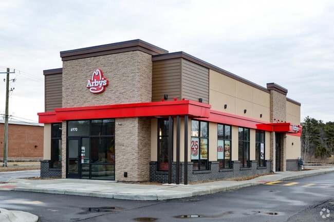


Property Detail
6970 Sashabaw Rd
08-22-402-002
T4N, R9E, SEC 22 OAKLAND COUNTY CONDOMINIUM PLAN NO 2015 SASHABAW NORTH UNIT 2 L 43528 P 124 11-3-11 FR -400-018
Commercialacreage
Oakland
C-1
Michigan
B and X Area of moderate flood hazard, usually the area between the limits of the 100-year and 500-year floods.
4.30 AC
2024
St Clair & Lapeer Counties
2021
Detroit
127600
Detroit-Warren-Dearborn, MI
NEARBY LISTINGS FOR SALE OR LEASE
DEMOGRAPHICS near 6970 Sashabaw Rd
1 mile
3 mile
5 mile
2025 Total Population
2,639
34,589
88,237
2030 Population
2,740
35,329
90,057
Pop Growth 2025-2030
+ 3.83%
+ 2.14%
+ 2.06%
Average Age
43
42
42
2025 Total Households
992
13,349
34,569
HH Growth 2025-2030
+ 3.83%
+ 2.13%
+ 2.07%
Median Household Inc
$131,399
$107,793
$99,904
Avg Household Size
2.60
2.50
2.50
2025 Avg HH Vehicles
2.00
2.00
2.00
Median Home Value
$451,376
$370,633
$330,384
Median Year Built
1993
1983
1980
Nearby Places
Map Layers
Map Styles
 Street
 Aerial
Layers
 Traffic
 Biking
Places
Listings with unknown addresses are not visible on the map
- Restaurants
- Banks
- Shops
- Fitness
- Groceries
PUBLIC TRANSPORTATION
AIRPORT
Bishop International
Drive
Walk
Distance
Bishop International
31 min
28.8 mi
Detroit City
Drive
Walk
Distance
Detroit City
41 min
37.6 mi
Freight Ports
Port of Baltimore
Drive
Walk
Distance
Port of Baltimore
1 min
427.3 mi
SALE & LEASE HISTORY
LISTING DATE
SALE/LEASE

Nov 29, 2018
For Sale
Nearby Properties
Address
Land Use
TOTAL SIZE
Lot Size
Zoning
Address
Land Use
TOTAL SIZE
Lot Size
Zoning
388,304 SF
69.09 AC
R2
Address
Land Use
TOTAL SIZE
Lot Size
Zoning
138,009 SF
8.03 AC
PUD
Address
Land Use
TOTAL SIZE
Lot Size
Zoning
327,435 SF
39.93 AC
R2
Address
Land Use
TOTAL SIZE
Lot Size
Zoning
17.63 AC
R3
Address
Land Use
TOTAL SIZE
Lot Size
Zoning
208,006 SF
1.24 AC
R2
Address
Land Use
TOTAL SIZE
Lot Size
Zoning
64,763 SF
27.90 AC
PUD
Address
Land Use
TOTAL SIZE
Lot Size
Zoning
68,725 SF
4.96 AC
PUD
Address
Land Use
TOTAL SIZE
Lot Size
Zoning
34,335 SF
74.71 AC
REC
Address
Land Use
TOTAL SIZE
Lot Size
Zoning
249,200 SF
48.39 AC
R2
Address
Land Use
TOTAL SIZE
Lot Size
Zoning
327,288 SF
19.85 AC
R2
Address
Land Use
TOTAL SIZE
Lot Size
Zoning
78,261 SF
7.80 AC
PUD
Address
Land Use
TOTAL SIZE
Lot Size
Zoning
7.18 AC
PUD
Address
Land Use
TOTAL SIZE
Lot Size
Zoning
63,331 SF
10.03 AC
R2
Address
Land Use
TOTAL SIZE
Lot Size
Zoning
35,155 SF
87.55 AC
REC
Address
Land Use
TOTAL SIZE
Lot Size
Zoning
44.10 AC
PUD
Address
Land Use
TOTAL SIZE
Lot Size
Zoning
36.32 AC
R1A
Address
Land Use
TOTAL SIZE
Lot Size
Zoning
120,673 SF
9.40 AC
IOP
Address
Land Use
TOTAL SIZE
Lot Size
Zoning
87,130 SF
9.01 AC
C-3
Address
Land Use
TOTAL SIZE
Lot Size
Zoning
9,768 SF
25.89 AC
PUD
Address
Land Use
TOTAL SIZE
Lot Size
Zoning
327,288 SF
29.09 AC
REC
Address
Land Use
TOTAL SIZE
Lot Size
Zoning
33,365 SF
320.73 AC
PRD
Address
Land Use
TOTAL SIZE
Lot Size
Zoning
Address
Land Use
TOTAL SIZE
Lot Size
Zoning
151,736 SF
26.03 AC
C-2
Address
Land Use
TOTAL SIZE
Lot Size
Zoning
48,645 SF
6.68 AC
PUD
Address
Land Use
TOTAL SIZE
Lot Size
Zoning
49,169 SF
5.02 AC
PUD
Address
Land Use
TOTAL SIZE
Lot Size
Zoning
117,980 SF
11.33 AC
IOP
Address
Land Use
TOTAL SIZE
Lot Size
Zoning
44,915 SF
0.47 AC
PUD
Address
Land Use
TOTAL SIZE
Lot Size
Zoning
31,068 SF
3 AC
PUD
Address
Land Use
TOTAL SIZE
Lot Size
Zoning
143,550 SF
11.92 AC
R2
Address
Land Use
TOTAL SIZE
Lot Size
Zoning
739 SF
5.36 AC
R1A
The World's #1 Commercial Real Estate Marketplace
Connect with us
© 2026 CoStar Group
The information above has been obtained from sources believed reliable. While we do not doubt its accuracy we have not verified it and make no guarantee, warranty or representation about it. It is your responsibility to independently confirm its accuracy and completeness. Any projections, opinions, assumptions, or estimates used are for example only and do not represent the current or future performance of the property. The value of this transaction to you depends on tax and other factors which should be evaluated by your tax, financial, and legal advisors. You and your advisors should conduct a careful, independent investigation of the property to determine to your satisfaction the suitability of the property for your needs.