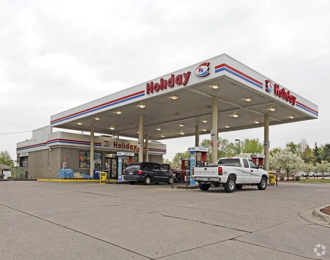
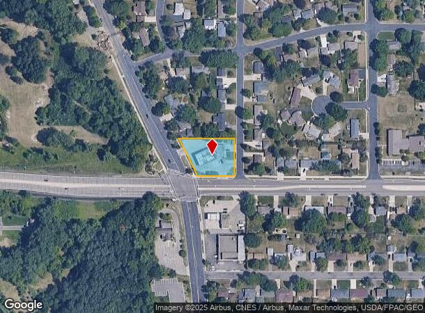
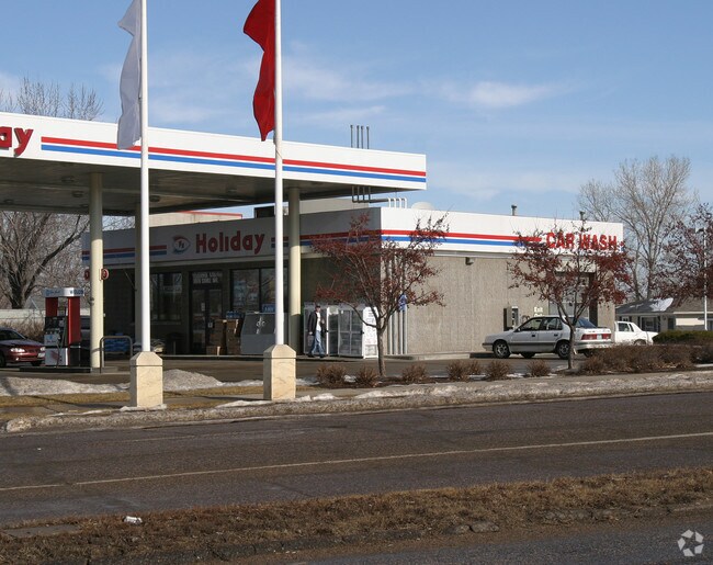
Property Record
6976 Cahill Ave, Inver Grove Heights, MN 55076
NEARBY LISTINGS FOR SALE OR LEASE
Property Detail
6976 Cahill Ave
20-00300-54-010
3 27 22 PT OF SW 1/4 OF SW 1/4 COM INT E LINE SAR #25 & CO RD #10 E ON N LINE CO RD # 10 150 FT N 150 FT W 222.97 FT TO E LINE ROAD SE 166.95 FT TO BEG SECTION 3 TWN 27 RANGE 22
Commercialnec
Dakota
X
Minnesota
27037C0110E
10
2024
0.64 AC
2024
Eagan
060502
Minneapolis/St Paul
2,599 SF
Minneapolis-St. Paul-Bloomington, MN-WI
DEMOGRAPHICS near 6976 Cahill Ave
1 Mile
3 Mile
5 Mile
2024 Total Population
9,357
50,918
120,584
2029 Population
9,500
52,394
125,306
Pop Growth 2024-2029
+ 1.53%
+ 2.90%
+ 3.92%
Average Age
43
40
40
2024 Total Households
3,851
20,498
47,267
HH Growth 2024-2029
+ 1.51%
+ 2.80%
+ 3.83%
Median Household Inc
$82,297
$79,733
$86,355
Avg Household Size
2.40
2.40
2.50
2024 Avg HH Vehicles
2.00
2.00
2.00
Median Home Value
$281,831
$284,545
$307,595
Median Year Built
1978
1980
1982
Nearby Places
Map Layers
Map Styles
 Street
 Aerial
- Restaurants
- Banks
- Shops
- Fitness
- Groceries
PUBLIC TRANSPORTATION
COMMUTER RAIL
St. Paul-Minneapolis (Empire Builder - Amtrak)
DRIVE
WALK
Distance
St. Paul-Minneapolis (Empire Builder - Amtrak)
14 min
8.9 mi
AIRPORT
Minneapolis-St Paul International/Wold-Chamberlain
DRIVE
WALK
Distance
Minneapolis-St Paul International/Wold-Chamberlain
20 min
11.5 mi
Freight Ports
Port Milwaukee
DRIVE
WALK
Distance
Port Milwaukee
366 min
331.2 mi
Nearby Properties
Address
Land Use
TOTAL SIZE
Lot Size
Zoning
Address
Land Use
TOTAL SIZE
Lot Size
Zoning
Address
Land Use
TOTAL SIZE
Lot Size
Zoning
146,085 SF
46.83 AC
Address
Land Use
TOTAL SIZE
Lot Size
Zoning
293,970 SF
31.92 AC
Address
Land Use
TOTAL SIZE
Lot Size
Zoning
605,774 SF
44.50 AC
Address
Land Use
TOTAL SIZE
Lot Size
Zoning
228,810 SF
6.30 AC
Address
Land Use
TOTAL SIZE
Lot Size
Zoning
Address
Land Use
TOTAL SIZE
Lot Size
Zoning
212,331 SF
9.27 AC
Address
Land Use
TOTAL SIZE
Lot Size
Zoning
163,985 SF
7.06 AC
Address
Land Use
TOTAL SIZE
Lot Size
Zoning
169,237 SF
23.38 AC
Address
Land Use
TOTAL SIZE
Lot Size
Zoning
482,008 SF
23.78 AC
Address
Land Use
TOTAL SIZE
Lot Size
Zoning
452,836 SF
17.81 AC
Address
Land Use
TOTAL SIZE
Lot Size
Zoning
532,778 SF
4.99 AC
Address
Land Use
TOTAL SIZE
Lot Size
Zoning
138,609 SF
3.76 AC
Address
Land Use
TOTAL SIZE
Lot Size
Zoning
Address
Land Use
TOTAL SIZE
Lot Size
Zoning
41,040 SF
11.38 AC
Address
Land Use
TOTAL SIZE
Lot Size
Zoning
236,378 SF
7.57 AC
Address
Land Use
TOTAL SIZE
Lot Size
Zoning
150,469 SF
10.73 AC
Address
Land Use
TOTAL SIZE
Lot Size
Zoning
152,098 SF
8.23 AC
Address
Land Use
TOTAL SIZE
Lot Size
Zoning
174,820 SF
7.79 AC
Address
Land Use
TOTAL SIZE
Lot Size
Zoning
28,461 SF
16.13 AC
Address
Land Use
TOTAL SIZE
Lot Size
Zoning
128,798 SF
4.22 AC
Address
Land Use
TOTAL SIZE
Lot Size
Zoning
219,438 SF
90.20 AC
Address
Land Use
TOTAL SIZE
Lot Size
Zoning
143,712 SF
9.57 AC
Address
Land Use
TOTAL SIZE
Lot Size
Zoning
117,784 SF
1.86 AC
Address
Land Use
TOTAL SIZE
Lot Size
Zoning
290,362 SF
12.83 AC
Address
Land Use
TOTAL SIZE
Lot Size
Zoning
161,676 SF
13.90 AC
Address
Land Use
TOTAL SIZE
Lot Size
Zoning
95,693 SF
3.64 AC
Address
Land Use
TOTAL SIZE
Lot Size
Zoning
87,080 SF
2.16 AC
Address
Land Use
TOTAL SIZE
Lot Size
Zoning
64,860 SF
2.65 AC
Address
Land Use
TOTAL SIZE
Lot Size
Zoning
130,171 SF
10.22 AC
The World's #1 Commercial Real Estate Marketplace
Connect with us
© 2025 CoStar Group
The information above has been obtained from sources believed reliable. While we do not doubt its accuracy we have not verified it and make no guarantee, warranty or representation about it. It is your responsibility to independently confirm its accuracy and completeness. Any projections, opinions, assumptions, or estimates used are for example only and do not represent the current or future performance of the property. The value of this transaction to you depends on tax and other factors which should be evaluated by your tax, financial, and legal advisors. You and your advisors should conduct a careful, independent investigation of the property to determine to your satisfaction the suitability of the property for your needs.