Property Record
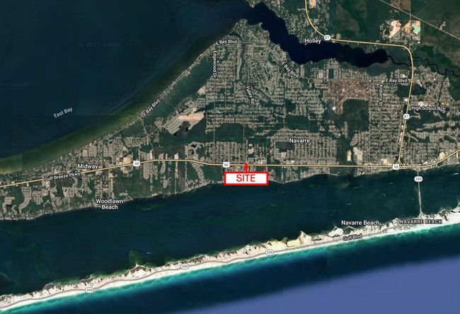
Navarre Pkwy, Navarre, FL 32566


This Property Is For Sale
NEARBY LISTINGS FOR SALE OR LEASE
Property Detail
Navarre Pkwy
Pensacola-Ferry Pass-Brent, FL
**UPDATED 2025** 23-2S-27W: PARCEL B (PREPARED BY GEOLINE SURVEYING, INC.) THAT PART OF THE COLLINS PARCEL, AS PER DESCRIPTION RECORDED IN OFFICIAL RECORD BOOK 3785, PAGE 695 OF THE PUBLIC RECORDS OF SANTA ROSA COUNTY, FLORIDA, SITUATED IN SECTION 23
23-2S-27-0000-02732-0000
Santa Rosa
Commercialacreage
Florida
2024
1.06 AC
2025
Navarre
010826
Pensacola
DEMOGRAPHICS near Navarre Pkwy
1 Mile
3 Mile
5 Mile
2024 Total Population
4,392
29,673
55,114
2029 Population
5,549
37,958
70,902
Pop Growth 2024-2029
+ 26.34%
+ 27.92%
+ 28.65%
Average Age
40
40
41
2024 Total Households
1,573
11,044
20,828
HH Growth 2024-2029
+ 26.00%
+ 27.73%
+ 28.58%
Median Household Inc
$105,171
$95,336
$93,706
Avg Household Size
2.80
2.70
2.60
2024 Avg HH Vehicles
2.00
2.00
2.00
Median Home Value
$299,435
$319,350
$323,575
Median Year Built
2003
2004
2003
Nearby Places
Map Layers
Map Styles
 Street
 Aerial
- Restaurants
- Banks
- Shops
- Fitness
- Groceries
PUBLIC TRANSPORTATION
AIRPORT
Pensacola International
DRIVE
WALK
Distance
Pensacola International
44 min
25.6 mi
Eglin AFB/Destin-Ft Walton Beach
DRIVE
WALK
Distance
Eglin AFB/Destin-Ft Walton Beach
58 min
30.3 mi
Freight Ports
Port of Mobile
DRIVE
WALK
Distance
Port of Mobile
97 min
81.4 mi
Nearby Properties
Address
Land Use
TOTAL SIZE
Lot Size
Zoning
Address
Land Use
TOTAL SIZE
Lot Size
Zoning
1.03 AC
NONE
Address
Land Use
TOTAL SIZE
Lot Size
Zoning
344,974 SF
16.11 AC
R3
Address
Land Use
TOTAL SIZE
Lot Size
Zoning
375,552 SF
10.62 AC
PBD
Address
Land Use
TOTAL SIZE
Lot Size
Zoning
242,842 SF
14.77 AC
PBD
Address
Land Use
TOTAL SIZE
Lot Size
Zoning
241,693 SF
14.28 AC
PBD
Address
Land Use
TOTAL SIZE
Lot Size
Zoning
161,438 SF
5.64 AC
HCD
Address
Land Use
TOTAL SIZE
Lot Size
Zoning
68,134 SF
21.16 AC
R1
Address
Land Use
TOTAL SIZE
Lot Size
Zoning
116,452 SF
4.55 AC
HCD
Address
Land Use
TOTAL SIZE
Lot Size
Zoning
65,936 SF
1.86 AC
PBD
Address
Land Use
TOTAL SIZE
Lot Size
Zoning
51,677 SF
17.79 AC
PBD
Address
Land Use
TOTAL SIZE
Lot Size
Zoning
85,562 SF
36.21 AC
PBD
Address
Land Use
TOTAL SIZE
Lot Size
Zoning
19,350 SF
9.10 AC
HCD
Address
Land Use
TOTAL SIZE
Lot Size
Zoning
60,854 SF
7.07 AC
HCD
Address
Land Use
TOTAL SIZE
Lot Size
Zoning
48,198 SF
1.76 AC
PBD
Address
Land Use
TOTAL SIZE
Lot Size
Zoning
130,030 SF
36.74 AC
R1A
Address
Land Use
TOTAL SIZE
Lot Size
Zoning
39,373 SF
185.18 AC
R1
Address
Land Use
TOTAL SIZE
Lot Size
Zoning
73,433 SF
33.98 AC
HCD
Address
Land Use
TOTAL SIZE
Lot Size
Zoning
24,565 SF
17.03 AC
HCD
Address
Land Use
TOTAL SIZE
Lot Size
Zoning
40,963 SF
8.36 AC
HCD
Address
Land Use
TOTAL SIZE
Lot Size
Zoning
10,506 SF
0.67 AC
PBD
Address
Land Use
TOTAL SIZE
Lot Size
Zoning
41.24 AC
R1
Address
Land Use
TOTAL SIZE
Lot Size
Zoning
19.59 AC
HCD
Address
Land Use
TOTAL SIZE
Lot Size
Zoning
20,150 SF
4.02 AC
HCD
Address
Land Use
TOTAL SIZE
Lot Size
Zoning
17,056 SF
4.17 AC
HCD
The World's #1 Commercial Real Estate Marketplace
Connect with us
© 2026 CoStar Group
The information above has been obtained from sources believed reliable. While we do not doubt its accuracy we have not verified it and make no guarantee, warranty or representation about it. It is your responsibility to independently confirm its accuracy and completeness. Any projections, opinions, assumptions, or estimates used are for example only and do not represent the current or future performance of the property. The value of this transaction to you depends on tax and other factors which should be evaluated by your tax, financial, and legal advisors. You and your advisors should conduct a careful, independent investigation of the property to determine to your satisfaction the suitability of the property for your needs.