Property Record
6980 Pikeview Dr, Thomasville, NC 27360


Property Detail
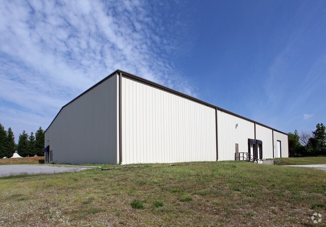
6980 Pikeview Dr
6797-19-9723
TURNPIKE IND PK;L15-16 SC 2 PL:PB31-PG35
Warehouse
Randolph
LI
North Carolina
B and X Area of moderate flood hazard, usually the area between the limits of the 100-year and 500-year floods.
15-16
2025
2.93 AC
2025
NW Randolph Cnty/Archdale
031601
Greensboro/Winston-Salem
17,000 SF
Greensboro-High Point, NC
NEARBY LISTINGS FOR SALE OR LEASE
DEMOGRAPHICS near 6980 Pikeview Dr
1 mile
3 mile
5 mile
2025 Total Population
2,289
28,020
72,027
2030 Population
2,367
29,262
74,987
Pop Growth 2025-2030
+ 3.41%
+ 4.43%
+ 4.11%
Average Age
42
40
40
2025 Total Households
922
11,201
28,837
HH Growth 2025-2030
+ 3.58%
+ 4.50%
+ 4.18%
Median Household Inc
$84,431
$62,986
$58,763
Avg Household Size
2.40
2.40
2.40
2025 Avg HH Vehicles
2.00
2.00
2.00
Median Home Value
$223,138
$194,765
$191,409
Median Year Built
1992
1978
1978
Nearby Places
Map Layers
Map Styles
 Street
 Aerial
Transit
 Traffic
 Biking
Places
Listings with unknown addresses are not visible on the map
- Restaurants
- Banks
- Shops
- Fitness
- Groceries
PUBLIC TRANSPORTATION
COMMUTER RAIL
High Point Station (Piedmont - North Carolina by Train (NC Train))
Drive
Walk
Distance
High Point Station (Piedmont - North Carolina by Train (NC Train))
14 min
7.5 mi
AIRPORT
Piedmont Triad International
Drive
Walk
Distance
Piedmont Triad International
37 min
19.6 mi
Freight Ports
Port of Wilmington
Drive
Walk
Distance
Port of Wilmington
255 min
213.0 mi
SALE & LEASE HISTORY
LISTING DATE
SALE/LEASE

May 22, 2023
For Lease
Mar 13, 2020
For Sale
Mar 10, 2020
For Sale
Nearby Properties
Address
Land Use
TOTAL SIZE
Lot Size
Zoning
Address
Land Use
TOTAL SIZE
Lot Size
Zoning
154,870 SF
62.93 AC
M1
Address
Land Use
TOTAL SIZE
Lot Size
Zoning
204,276 SF
68.51 AC
M-2
Address
Land Use
TOTAL SIZE
Lot Size
Zoning
194,644 SF
20 AC
R10
Address
Land Use
TOTAL SIZE
Lot Size
Zoning
351,736 SF
34.77 AC
HI
Address
Land Use
TOTAL SIZE
Lot Size
Zoning
3,638 SF
41.44 AC
OI
Address
Land Use
TOTAL SIZE
Lot Size
Zoning
235,230 SF
25.63 AC
C3
Address
Land Use
TOTAL SIZE
Lot Size
Zoning
13,770 SF
34.64 AC
R10
Address
Land Use
TOTAL SIZE
Lot Size
Zoning
63,936 SF
19.05 AC
R10
Address
Land Use
TOTAL SIZE
Lot Size
Zoning
426,585 SF
27.46 AC
HI
Address
Land Use
TOTAL SIZE
Lot Size
Zoning
51,230 SF
7.52 AC
C2
Address
Land Use
TOTAL SIZE
Lot Size
Zoning
56,305 SF
5.39 AC
OI
Address
Land Use
TOTAL SIZE
Lot Size
Zoning
223,806 SF
12.60 AC
HI
Address
Land Use
TOTAL SIZE
Lot Size
Zoning
82,160 SF
23.62 AC
C2
Address
Land Use
TOTAL SIZE
Lot Size
Zoning
27,310 SF
20.06 AC
HI
Address
Land Use
TOTAL SIZE
Lot Size
Zoning
72,642 SF
10.53 AC
R10
Address
Land Use
TOTAL SIZE
Lot Size
Zoning
124,326 SF
13.45 AC
C3
Address
Land Use
TOTAL SIZE
Lot Size
Zoning
60,183 SF
8.63 AC
C-2
Address
Land Use
TOTAL SIZE
Lot Size
Zoning
127,280 SF
29.10 AC
LI-CZ
Address
Land Use
TOTAL SIZE
Lot Size
Zoning
149,129 SF
15.65 AC
R10
Address
Land Use
TOTAL SIZE
Lot Size
Zoning
104,623 SF
55.13 AC
RR
Address
Land Use
TOTAL SIZE
Lot Size
Zoning
43,000 SF
15.06 AC
HI
Address
Land Use
TOTAL SIZE
Lot Size
Zoning
9.70 AC
RR
Address
Land Use
TOTAL SIZE
Lot Size
Zoning
63,643 SF
8.46 AC
M1
Address
Land Use
TOTAL SIZE
Lot Size
Zoning
38,896 SF
6.64 AC
C2
Address
Land Use
TOTAL SIZE
Lot Size
Zoning
99,649 SF
15.58 AC
HI
Address
Land Use
TOTAL SIZE
Lot Size
Zoning
162,000 SF
10.67 AC
M1
Address
Land Use
TOTAL SIZE
Lot Size
Zoning
52,466 SF
3.57 AC
C2
Address
Land Use
TOTAL SIZE
Lot Size
Zoning
39,842 SF
12.49 AC
M2
Address
Land Use
TOTAL SIZE
Lot Size
Zoning
35,132 SF
14.36 AC
R10
Address
Land Use
TOTAL SIZE
Lot Size
Zoning
35,582 SF
4.95 AC
R8
The World's #1 Commercial Real Estate Marketplace
Connect with us
© 2026 CoStar Group
The information above has been obtained from sources believed reliable. While we do not doubt its accuracy we have not verified it and make no guarantee, warranty or representation about it. It is your responsibility to independently confirm its accuracy and completeness. Any projections, opinions, assumptions, or estimates used are for example only and do not represent the current or future performance of the property. The value of this transaction to you depends on tax and other factors which should be evaluated by your tax, financial, and legal advisors. You and your advisors should conduct a careful, independent investigation of the property to determine to your satisfaction the suitability of the property for your needs.