Property Record
7 Cherry St, Leesport, PA 19533


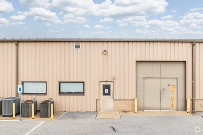
Property Detail
7 Cherry St
68-4491-04-91-0160
Berks
Storemultistory
Pennsylvania
B and X Area of moderate flood hazard, usually the area between the limits of the 100-year and 500-year floods.
8
2025
3.76 AC
2025
Berks
013501
Philadelphia
14,508 SF
Reading, PA
NEARBY LISTINGS FOR SALE OR LEASE
-
-
View all Leesport listings for sale on LoopNet.com
DEMOGRAPHICS near 7 Cherry St
1 mile
3 mile
5 mile
2025 Total Population
2,103
10,588
45,803
2030 Population
2,152
10,887
46,792
Pop Growth 2025-2030
+ 2.33%
+ 2.82%
+ 2.16%
Average Age
39
41
42
2025 Total Households
775
3,942
17,417
HH Growth 2025-2030
+ 2.32%
+ 2.79%
+ 2.17%
Median Household Inc
$98,454
$98,467
$91,495
Avg Household Size
2.70
2.70
2.60
2025 Avg HH Vehicles
2.00
2.00
2.00
Median Home Value
$264,361
$287,981
$257,661
Median Year Built
1982
1986
1977
Nearby Places
Map Layers
Map Styles
 Street
 Aerial
Layers
 Traffic
 Biking
Places
Listings with unknown addresses are not visible on the map
- Restaurants
- Banks
- Shops
- Fitness
- Groceries
PUBLIC TRANSPORTATION
AIRPORT
Lehigh Valley International
Drive
Walk
Distance
Lehigh Valley International
52 min
35.2 mi
Freight Ports
South Jersey Port
Drive
Walk
Distance
South Jersey Port
97 min
74.1 mi
Nearby Properties
Address
Land Use
TOTAL SIZE
Lot Size
Zoning
Address
Land Use
TOTAL SIZE
Lot Size
Zoning
1,681,491 SF
175.64 AC
Address
Land Use
TOTAL SIZE
Lot Size
Zoning
652,080 SF
57.73 AC
Address
Land Use
TOTAL SIZE
Lot Size
Zoning
106,045 SF
19.16 AC
Address
Land Use
TOTAL SIZE
Lot Size
Zoning
203,665 SF
17.94 AC
Address
Land Use
TOTAL SIZE
Lot Size
Zoning
207,847 SF
7.79 AC
Address
Land Use
TOTAL SIZE
Lot Size
Zoning
368,240 SF
386.47 AC
Address
Land Use
TOTAL SIZE
Lot Size
Zoning
66.29 AC
Address
Land Use
TOTAL SIZE
Lot Size
Zoning
505,536 SF
31.80 AC
Address
Land Use
TOTAL SIZE
Lot Size
Zoning
167,440 SF
13.03 AC
Address
Land Use
TOTAL SIZE
Lot Size
Zoning
170,000 SF
17.73 AC
Address
Land Use
TOTAL SIZE
Lot Size
Zoning
1,848 SF
86.20 AC
Address
Land Use
TOTAL SIZE
Lot Size
Zoning
275,932 SF
52.74 AC
Address
Land Use
TOTAL SIZE
Lot Size
Zoning
160,160 SF
7.32 AC
Address
Land Use
TOTAL SIZE
Lot Size
Zoning
141,325 SF
16.09 AC
Address
Land Use
TOTAL SIZE
Lot Size
Zoning
11,648 SF
1.01 AC
Address
Land Use
TOTAL SIZE
Lot Size
Zoning
113,220 SF
12.46 AC
Address
Land Use
TOTAL SIZE
Lot Size
Zoning
68,600 SF
11.52 AC
Address
Land Use
TOTAL SIZE
Lot Size
Zoning
253,648 SF
38.76 AC
Address
Land Use
TOTAL SIZE
Lot Size
Zoning
167,202 SF
16.08 AC
Address
Land Use
TOTAL SIZE
Lot Size
Zoning
81,488 SF
30.85 AC
Address
Land Use
TOTAL SIZE
Lot Size
Zoning
15,628 SF
83.28 AC
Address
Land Use
TOTAL SIZE
Lot Size
Zoning
175,056 SF
14.87 AC
Address
Land Use
TOTAL SIZE
Lot Size
Zoning
146,804 SF
14.87 AC
Address
Land Use
TOTAL SIZE
Lot Size
Zoning
53,727 SF
274.77 AC
Address
Land Use
TOTAL SIZE
Lot Size
Zoning
241,508 SF
25.43 AC
Address
Land Use
TOTAL SIZE
Lot Size
Zoning
52,618 SF
9.68 AC
Address
Land Use
TOTAL SIZE
Lot Size
Zoning
35,431 SF
3.89 AC
Address
Land Use
TOTAL SIZE
Lot Size
Zoning
155,579 SF
8.17 AC
Address
Land Use
TOTAL SIZE
Lot Size
Zoning
54,793 SF
13.33 AC
Address
Land Use
TOTAL SIZE
Lot Size
Zoning
175,794 SF
17.68 AC
The World's #1 Commercial Real Estate Marketplace
Connect with us
© 2026 CoStar Group
The information above has been obtained from sources believed reliable. While we do not doubt its accuracy we have not verified it and make no guarantee, warranty or representation about it. It is your responsibility to independently confirm its accuracy and completeness. Any projections, opinions, assumptions, or estimates used are for example only and do not represent the current or future performance of the property. The value of this transaction to you depends on tax and other factors which should be evaluated by your tax, financial, and legal advisors. You and your advisors should conduct a careful, independent investigation of the property to determine to your satisfaction the suitability of the property for your needs.