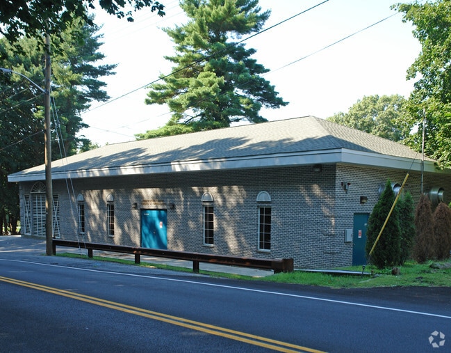
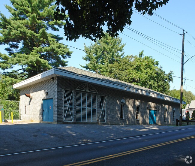
Property Record
7 Commerce St, Hawthorne, NY 10532
NEARBY LISTINGS FOR SALE OR LEASE
-
-
View all Hawthorne listings for sale on LoopNet.com
Property Detail
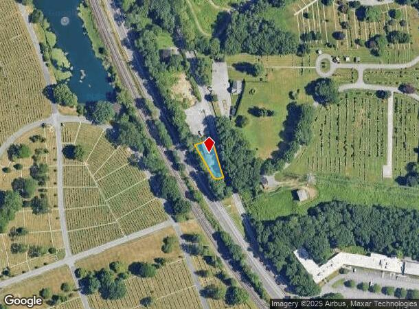
7 Commerce St
3489-117-006-00001-044-0000
Westchester
Commercialbuilding
New York
X
44.000
36119C0258F
0.26 AC
0
West I-287 Corridor
2024
Westchester/So Connecticut
012000
New York-Jersey City-White Plains, NY-NJ
1,723 SF
DEMOGRAPHICS near 7 Commerce St
1 Mile
3 Mile
5 Mile
2024 Total Population
4,041
40,278
161,995
2029 Population
3,917
39,408
159,543
Pop Growth 2024-2029
(3.07%)
(2.16%)
(1.51%)
Average Age
42
41
42
2024 Total Households
1,353
13,355
60,302
HH Growth 2024-2029
(3.40%)
(2.35%)
(1.57%)
Median Household Inc
$125,397
$130,485
$128,238
Avg Household Size
2.80
2.70
2.50
2024 Avg HH Vehicles
2.00
2.00
2.00
Median Home Value
$699,735
$676,122
$675,843
Median Year Built
1956
1961
1962
Nearby Places
Map Layers
Map Styles
 Street
 Aerial
- Restaurants
- Banks
- Shops
- Fitness
- Groceries
PUBLIC TRANSPORTATION
COMMUTER RAIL
Mount Pleasant Station (Harlem Line - Metro-North Commuter Railroad Company (Metro-North))
DRIVE
WALK
Distance
Mount Pleasant Station (Harlem Line - Metro-North Commuter Railroad Company (Metro-North))
2 min
12 min
0.6 mi
Valhalla Station (Harlem Line - Metro-North Commuter Railroad Company (Metro-North))
DRIVE
WALK
Distance
Valhalla Station (Harlem Line - Metro-North Commuter Railroad Company (Metro-North))
2 min
1.4 mi
AIRPORT
Westchester County
DRIVE
WALK
Distance
Westchester County
16 min
9.1 mi
LaGuardia
DRIVE
WALK
Distance
LaGuardia
47 min
29.1 mi
John F Kennedy International
DRIVE
WALK
Distance
John F Kennedy International
58 min
35.7 mi
Freight Ports
NY - Red Hook Container Terminal
DRIVE
WALK
Distance
NY - Red Hook Container Terminal
61 min
37.3 mi
Nearby Properties
Address
Land Use
TOTAL SIZE
Lot Size
Zoning
Address
Land Use
TOTAL SIZE
Lot Size
Zoning
358.83 AC
Address
Land Use
TOTAL SIZE
Lot Size
Zoning
4.45 AC
B
Address
Land Use
TOTAL SIZE
Lot Size
Zoning
2,760 SF
60.76 AC
Address
Land Use
TOTAL SIZE
Lot Size
Zoning
22.92 AC
Address
Land Use
TOTAL SIZE
Lot Size
Zoning
75.87 AC
R-20
Address
Land Use
TOTAL SIZE
Lot Size
Zoning
36.59 AC
Address
Land Use
TOTAL SIZE
Lot Size
Zoning
17.17 AC
Address
Land Use
TOTAL SIZE
Lot Size
Zoning
24.66 AC
Address
Land Use
TOTAL SIZE
Lot Size
Zoning
19.25 AC
Address
Land Use
TOTAL SIZE
Lot Size
Zoning
28.51 AC
Address
Land Use
TOTAL SIZE
Lot Size
Zoning
60.01 AC
Address
Land Use
TOTAL SIZE
Lot Size
Zoning
Address
Land Use
TOTAL SIZE
Lot Size
Zoning
68,000 SF
1.53 AC
B
Address
Land Use
TOTAL SIZE
Lot Size
Zoning
Address
Land Use
TOTAL SIZE
Lot Size
Zoning
1.69 AC
Address
Land Use
TOTAL SIZE
Lot Size
Zoning
29.42 AC
PUD
Address
Land Use
TOTAL SIZE
Lot Size
Zoning
Address
Land Use
TOTAL SIZE
Lot Size
Zoning
180,750 SF
22.03 AC
PD
Address
Land Use
TOTAL SIZE
Lot Size
Zoning
7.98 AC
M-14
Address
Land Use
TOTAL SIZE
Lot Size
Zoning
0.58 AC
B
Address
Land Use
TOTAL SIZE
Lot Size
Zoning
39.83 AC
Address
Land Use
TOTAL SIZE
Lot Size
Zoning
50,000 SF
9.02 AC
PD
Address
Land Use
TOTAL SIZE
Lot Size
Zoning
96,560 SF
12.76 AC
DS
Address
Land Use
TOTAL SIZE
Lot Size
Zoning
29.14 AC
PUD
Address
Land Use
TOTAL SIZE
Lot Size
Zoning
15.96 AC
OB
Address
Land Use
TOTAL SIZE
Lot Size
Zoning
3.56 AC
PD
Address
Land Use
TOTAL SIZE
Lot Size
Zoning
84,450 SF
3.19 AC
B
Address
Land Use
TOTAL SIZE
Lot Size
Zoning
100,000 SF
7.21 AC
PD
Address
Land Use
TOTAL SIZE
Lot Size
Zoning
5.43 AC
R-40
Address
Land Use
TOTAL SIZE
Lot Size
Zoning
320 SF
5.38 AC
LI
The World's #1 Commercial Real Estate Marketplace
Connect with us
© 2026 CoStar Group
The information above has been obtained from sources believed reliable. While we do not doubt its accuracy we have not verified it and make no guarantee, warranty or representation about it. It is your responsibility to independently confirm its accuracy and completeness. Any projections, opinions, assumptions, or estimates used are for example only and do not represent the current or future performance of the property. The value of this transaction to you depends on tax and other factors which should be evaluated by your tax, financial, and legal advisors. You and your advisors should conduct a careful, independent investigation of the property to determine to your satisfaction the suitability of the property for your needs.