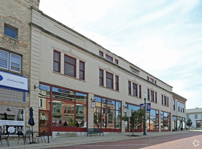
Property Record
7 E Main St, Evansville, WI 53536


Property Detail
7 E Main St
Janesville-Beloit, WI
PT SE1/4 ORIGINAL PLAT E 17.22' LOT 1 BLK 9 & LOTS 2, 3, 4 BLK 9
627-110
ROCK
Commercialnec
Wisconsin
B and X Area of moderate flood hazard, usually the area between the limits of the 100-year and 500-year floods.
1-4
2025
0.25 AC
2025
Rock County
002901
Milwaukee/Madison
28,112 SF
NEARBY LISTINGS FOR SALE OR LEASE
-
-
View all Evansville listings for sale on LoopNet.com
DEMOGRAPHICS near 7 E Main St
1 mile
3 mile
5 mile
2025 Total Population
4,346
7,384
8,733
2030 Population
4,335
7,384
8,734
Pop Growth 2025-2030
(0.25%)
0.00%
+ 0.01%
Average Age
40
40
40
2025 Total Households
1,779
2,944
3,455
HH Growth 2025-2030
(0.34%)
(0.07%)
(0.06%)
Median Household Inc
$78,631
$84,415
$86,764
Avg Household Size
2.40
2.50
2.50
2025 Avg HH Vehicles
2.00
2.00
2.00
Median Home Value
$283,396
$299,563
$306,066
Median Year Built
1969
1975
1977
Nearby Places
Map Layers
Map Styles
 Street
 Aerial
Layers
 Traffic
 Biking
Places
Listings with unknown addresses are not visible on the map
- Restaurants
- Banks
- Shops
- Fitness
- Groceries
PUBLIC TRANSPORTATION
AIRPORT
Dane County Regional/Truax Field
Drive
Walk
Distance
Dane County Regional/Truax Field
44 min
28.6 mi
Nearby Properties
Address
Land Use
TOTAL SIZE
Lot Size
Zoning
Address
Land Use
TOTAL SIZE
Lot Size
Zoning
36.71 AC
Address
Land Use
TOTAL SIZE
Lot Size
Zoning
41.40 AC
Address
Land Use
TOTAL SIZE
Lot Size
Zoning
29.47 AC
Address
Land Use
TOTAL SIZE
Lot Size
Zoning
23.51 AC
A1
Address
Land Use
TOTAL SIZE
Lot Size
Zoning
24,560 SF
2.42 AC
Address
Land Use
TOTAL SIZE
Lot Size
Zoning
Address
Land Use
TOTAL SIZE
Lot Size
Zoning
29,360 SF
3.50 AC
Address
Land Use
TOTAL SIZE
Lot Size
Zoning
35,191 SF
4.37 AC
Address
Land Use
TOTAL SIZE
Lot Size
Zoning
7,673 SF
1.50 AC
Address
Land Use
TOTAL SIZE
Lot Size
Zoning
9,204 SF
2.20 AC
Address
Land Use
TOTAL SIZE
Lot Size
Zoning
32,120 SF
1.79 AC
Address
Land Use
TOTAL SIZE
Lot Size
Zoning
11,900 SF
4.01 AC
Address
Land Use
TOTAL SIZE
Lot Size
Zoning
16,476 SF
3.03 AC
Address
Land Use
TOTAL SIZE
Lot Size
Zoning
Address
Land Use
TOTAL SIZE
Lot Size
Zoning
34,148 SF
1 AC
Address
Land Use
TOTAL SIZE
Lot Size
Zoning
Address
Land Use
TOTAL SIZE
Lot Size
Zoning
2.23 AC
Address
Land Use
TOTAL SIZE
Lot Size
Zoning
15,043 SF
1.67 AC
Address
Land Use
TOTAL SIZE
Lot Size
Zoning
0.86 AC
Address
Land Use
TOTAL SIZE
Lot Size
Zoning
5,904 SF
1.85 AC
Address
Land Use
TOTAL SIZE
Lot Size
Zoning
410.35 AC
A1
Address
Land Use
TOTAL SIZE
Lot Size
Zoning
11,780 SF
2.05 AC
Address
Land Use
TOTAL SIZE
Lot Size
Zoning
4,394 SF
1.05 AC
Address
Land Use
TOTAL SIZE
Lot Size
Zoning
9,259 SF
1 AC
Address
Land Use
TOTAL SIZE
Lot Size
Zoning
1.31 AC
Address
Land Use
TOTAL SIZE
Lot Size
Zoning
7,840 SF
2.55 AC
Address
Land Use
TOTAL SIZE
Lot Size
Zoning
Address
Land Use
TOTAL SIZE
Lot Size
Zoning
12,240 SF
1.55 AC
Address
Land Use
TOTAL SIZE
Lot Size
Zoning
0.94 AC
The World's #1 Commercial Real Estate Marketplace
Connect with us
© 2026 CoStar Group
The information above has been obtained from sources believed reliable. While we do not doubt its accuracy we have not verified it and make no guarantee, warranty or representation about it. It is your responsibility to independently confirm its accuracy and completeness. Any projections, opinions, assumptions, or estimates used are for example only and do not represent the current or future performance of the property. The value of this transaction to you depends on tax and other factors which should be evaluated by your tax, financial, and legal advisors. You and your advisors should conduct a careful, independent investigation of the property to determine to your satisfaction the suitability of the property for your needs.