Property Record
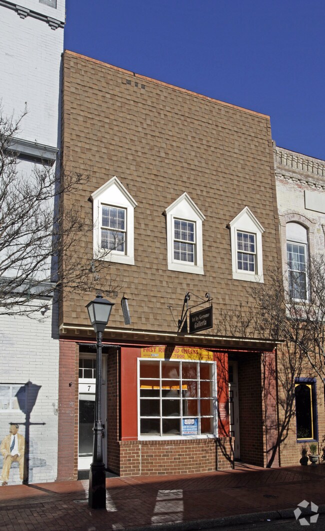
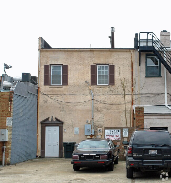
7 E Queens Way, Hampton, VA 23669

Property Detail
7 E Queens Way
2002935
OLD HAMPTON 5 LC-6-2.
Officebuilding
Hampton City
28 DT-1 DO
Virginia
C and X Area of minimal flood hazard, usually depicted on FIRMs as above the 500-year flood level.
0.05 AC
2025
Downtown Hampton
2025
Hampton Roads
010601
Virginia Beach-Chesapeake-Norfolk, VA-NC
3,466 SF
NEARBY LISTINGS FOR SALE OR LEASE
DEMOGRAPHICS near 7 E Queens Way
1 mile
3 mile
5 mile
2024 Total Population
10,792
70,831
139,246
2029 Population
10,763
70,666
139,509
Pop Growth 2024-2029
(0.27%)
(0.23%)
+ 0.19%
Average Age
36
39
39
2024 Total Households
3,887
29,607
58,681
HH Growth 2024-2029
(0.10%)
(0.08%)
+ 0.18%
Median Household Inc
$57,575
$67,614
$65,569
Avg Household Size
2.20
2.30
2.30
2024 Avg HH Vehicles
2.00
2.00
2.00
Median Home Value
$231,337
$237,259
$235,470
Median Year Built
1964
1968
1970
Nearby Places
Map Layers
Map Styles
 Street
 Aerial
Transit
 Traffic
 Biking
Places
Listings with unknown addresses are not visible on the map
- Restaurants
- Banks
- Shops
- Fitness
- Groceries
PUBLIC TRANSPORTATION
AIRPORT
Newport News/Williamsburg International
Drive
Walk
Distance
Newport News/Williamsburg International
22 min
13.5 mi
Norfolk International
Drive
Walk
Distance
Norfolk International
25 min
15.1 mi
Freight Ports
Virginia Port Authority - Newport News
Drive
Walk
Distance
Virginia Port Authority - Newport News
13 min
7.5 mi
Nearby Properties
Address
Land Use
TOTAL SIZE
Lot Size
Zoning
Address
Land Use
TOTAL SIZE
Lot Size
Zoning
1 SF
92.67 AC
5 R-13 ONE
Address
Land Use
TOTAL SIZE
Lot Size
Zoning
83.50 AC
5 R-13 ONE
Address
Land Use
TOTAL SIZE
Lot Size
Zoning
347,560 SF
31.84 AC
14 C-2 LIM
Address
Land Use
TOTAL SIZE
Lot Size
Zoning
7,644 SF
322.21 AC
19 PO-1 GE
Address
Land Use
TOTAL SIZE
Lot Size
Zoning
112,089 SF
11.95 AC
30 DT-3 DO
Address
Land Use
TOTAL SIZE
Lot Size
Zoning
199,364 SF
22.12 AC
6 R-11 ONE
Address
Land Use
TOTAL SIZE
Lot Size
Zoning
45,076 SF
9.53 AC
11 MD-4 MU
Address
Land Use
TOTAL SIZE
Lot Size
Zoning
204,584 SF
34.79 AC
6 R-11 ONE
Address
Land Use
TOTAL SIZE
Lot Size
Zoning
540,444 SF
33.66 AC
32 M-2 LIG
Address
Land Use
TOTAL SIZE
Lot Size
Zoning
240,000 SF
30.38 AC
7 R-9 ONE
Address
Land Use
TOTAL SIZE
Lot Size
Zoning
230,974 SF
42.68 AC
5 R-13 ONE
Address
Land Use
TOTAL SIZE
Lot Size
Zoning
88,941 SF
29.32 AC
11 MD-4 MU
Address
Land Use
TOTAL SIZE
Lot Size
Zoning
17,368 SF
7.08 AC
11 MD-4 MU
Address
Land Use
TOTAL SIZE
Lot Size
Zoning
7,053 SF
12.28 AC
14 C-2 LIM
Address
Land Use
TOTAL SIZE
Lot Size
Zoning
355,300 SF
19.03 AC
9 R-M MULT
Address
Land Use
TOTAL SIZE
Lot Size
Zoning
73,668 SF
3.24 AC
30 DT-3 DO
Address
Land Use
TOTAL SIZE
Lot Size
Zoning
51,372 SF
5.99 AC
14 C-2 LIM
Address
Land Use
TOTAL SIZE
Lot Size
Zoning
110,080 SF
2.21 AC
29 DT-2 DO
Address
Land Use
TOTAL SIZE
Lot Size
Zoning
7,840 SF
19.66 AC
9 R-M MULT
Address
Land Use
TOTAL SIZE
Lot Size
Zoning
4.99 AC
47 PH-2 PH
Address
Land Use
TOTAL SIZE
Lot Size
Zoning
114,040 SF
1.46 AC
28 DT-1 DO
Address
Land Use
TOTAL SIZE
Lot Size
Zoning
140,649 SF
25.29 AC
7 R-9 ONE
Address
Land Use
TOTAL SIZE
Lot Size
Zoning
35,856 SF
20.25 AC
14 C-2 LIM
Address
Land Use
TOTAL SIZE
Lot Size
Zoning
123,752 SF
10.19 AC
14 C-2 LIM
Address
Land Use
TOTAL SIZE
Lot Size
Zoning
233,296 SF
11.83 AC
14 C-2 LIM
Address
Land Use
TOTAL SIZE
Lot Size
Zoning
253,896 SF
13.32 AC
9 R-M MULT
Address
Land Use
TOTAL SIZE
Lot Size
Zoning
273,494 SF
5.48 AC
14 C-2 LIM
Address
Land Use
TOTAL SIZE
Lot Size
Zoning
123,151 SF
21.81 AC
5 R-13 ONE
Address
Land Use
TOTAL SIZE
Lot Size
Zoning
123,459 SF
29.58 AC
13 C-1 NEI
Address
Land Use
TOTAL SIZE
Lot Size
Zoning
127,600 SF
27.95 AC
5 R-13 ONE
The World's #1 Commercial Real Estate Marketplace
Connect with us
© 2026 CoStar Group
The information above has been obtained from sources believed reliable. While we do not doubt its accuracy we have not verified it and make no guarantee, warranty or representation about it. It is your responsibility to independently confirm its accuracy and completeness. Any projections, opinions, assumptions, or estimates used are for example only and do not represent the current or future performance of the property. The value of this transaction to you depends on tax and other factors which should be evaluated by your tax, financial, and legal advisors. You and your advisors should conduct a careful, independent investigation of the property to determine to your satisfaction the suitability of the property for your needs.