Property Record
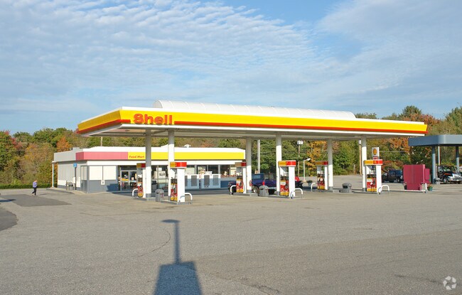
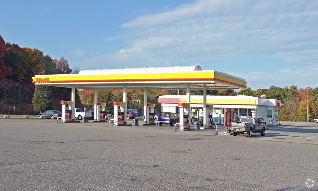
7 Exeter Rd, Epping, NH 03042
Property Detail
7 Exeter Rd
Gasolinefuelbulkstorage
ROCKINGHAM
HC
New Hampshire
B and X Area of moderate flood hazard, usually the area between the limits of the 100-year and 500-year floods.
2.21 AC
2024
Rockingham
2024
Boston
059000
Boston-Cambridge-Newton, MA-NH
3,048 SF
EPPI-000030-000000-000003
NEARBY LISTINGS FOR SALE OR LEASE
DEMOGRAPHICS near 7 Exeter Rd
1 mile
3 mile
5 mile
2025 Total Population
2,680
9,237
20,165
2030 Population
2,768
9,427
20,402
Pop Growth 2025-2030
+ 3.28%
+ 2.06%
+ 1.18%
Average Age
43
43
43
2025 Total Households
1,056
3,471
7,528
HH Growth 2025-2030
+ 3.22%
+ 1.96%
+ 1.09%
Median Household Inc
$96,292
$106,427
$112,652
Avg Household Size
2.50
2.60
2.60
2025 Avg HH Vehicles
2.00
2.00
2.00
Median Home Value
$452,739
$465,495
$479,047
Median Year Built
1992
1991
1990
Nearby Places
Map Layers
Map Styles
 Street
 Aerial
Transit
 Traffic
 Biking
Places
Listings with unknown addresses are not visible on the map
- Restaurants
- Banks
- Shops
- Fitness
- Groceries
PUBLIC TRANSPORTATION
COMMUTER RAIL
Drive
Walk
Distance
14 min
8.0 mi
AIRPORT
Portsmouth International at Pease
Drive
Walk
Distance
Portsmouth International at Pease
36 min
25.2 mi
Manchester Boston Regional
Drive
Walk
Distance
Manchester Boston Regional
39 min
27.0 mi
Freight Ports
Port of Boston
Drive
Walk
Distance
Port of Boston
83 min
62.5 mi
Nearby Properties
Address
Land Use
TOTAL SIZE
Lot Size
Zoning
Address
Land Use
TOTAL SIZE
Lot Size
Zoning
258,254 SF
80.96 AC
MF/P
Address
Land Use
TOTAL SIZE
Lot Size
Zoning
103,028 SF
3.03 AC
IC
Address
Land Use
TOTAL SIZE
Lot Size
Zoning
149,874 SF
23 AC
HDR
Address
Land Use
TOTAL SIZE
Lot Size
Zoning
204,175 SF
57.27 AC
IC
Address
Land Use
TOTAL SIZE
Lot Size
Zoning
40,693 SF
5 AC
IC
Address
Land Use
TOTAL SIZE
Lot Size
Zoning
135,037 SF
14.81 AC
IC
Address
Land Use
TOTAL SIZE
Lot Size
Zoning
75,308 SF
1.77 AC
IC
Address
Land Use
TOTAL SIZE
Lot Size
Zoning
39,648 SF
8.80 AC
IC
Address
Land Use
TOTAL SIZE
Lot Size
Zoning
25,960 SF
4.86 AC
HC
Address
Land Use
TOTAL SIZE
Lot Size
Zoning
53,502 SF
HDR
Address
Land Use
TOTAL SIZE
Lot Size
Zoning
34,128 SF
6.42 AC
HDR
Address
Land Use
TOTAL SIZE
Lot Size
Zoning
79,013 SF
36.08 AC
IC
Address
Land Use
TOTAL SIZE
Lot Size
Zoning
1,056 SF
27.36 AC
HC
Address
Land Use
TOTAL SIZE
Lot Size
Zoning
77,724 SF
3.90 AC
IC
Address
Land Use
TOTAL SIZE
Lot Size
Zoning
13,624 SF
6.49 AC
IC
Address
Land Use
TOTAL SIZE
Lot Size
Zoning
77,568 SF
2.02 AC
IC
Address
Land Use
TOTAL SIZE
Lot Size
Zoning
4,248 SF
241.80 AC
IC
Address
Land Use
TOTAL SIZE
Lot Size
Zoning
8,200 SF
72.89 AC
IC
Address
Land Use
TOTAL SIZE
Lot Size
Zoning
18,496 SF
2.21 AC
HDR
Address
Land Use
TOTAL SIZE
Lot Size
Zoning
28,704 SF
0.66 AC
IC
Address
Land Use
TOTAL SIZE
Lot Size
Zoning
330 AC
C/I
Address
Land Use
TOTAL SIZE
Lot Size
Zoning
55,275 SF
9.45 AC
C/I
Address
Land Use
TOTAL SIZE
Lot Size
Zoning
62,500 SF
27.86 AC
C/I
Address
Land Use
TOTAL SIZE
Lot Size
Zoning
5,579 SF
11 AC
HDR
Address
Land Use
TOTAL SIZE
Lot Size
Zoning
1,323 SF
93.62 AC
RES
Address
Land Use
TOTAL SIZE
Lot Size
Zoning
10,112 SF
5.51 AC
R
Address
Land Use
TOTAL SIZE
Lot Size
Zoning
13,888 SF
1.27 AC
IC
Address
Land Use
TOTAL SIZE
Lot Size
Zoning
23,320 SF
8.46 AC
HC
Address
Land Use
TOTAL SIZE
Lot Size
Zoning
58,784 SF
8.37 AC
CP
Address
Land Use
TOTAL SIZE
Lot Size
Zoning
15,043 SF
1.40 AC
CBD
The World's #1 Commercial Real Estate Marketplace
Connect with us
© 2026 CoStar Group
The information above has been obtained from sources believed reliable. While we do not doubt its accuracy we have not verified it and make no guarantee, warranty or representation about it. It is your responsibility to independently confirm its accuracy and completeness. Any projections, opinions, assumptions, or estimates used are for example only and do not represent the current or future performance of the property. The value of this transaction to you depends on tax and other factors which should be evaluated by your tax, financial, and legal advisors. You and your advisors should conduct a careful, independent investigation of the property to determine to your satisfaction the suitability of the property for your needs.