Property Record
7 Gurnet Rd, Brunswick, ME 04011


NEARBY LISTINGS FOR SALE OR LEASE
-
-
View all Brunswick listings for sale on LoopNet.com
Property Detail
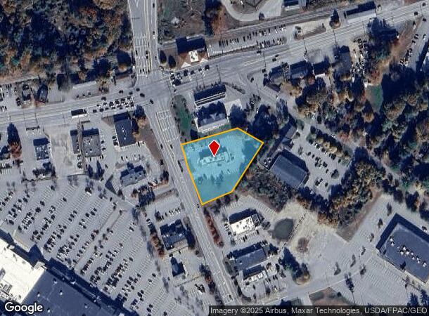
7 Gurnet Rd
BRUN-000001-000000-000029AC
Cumberland
Storebuilding
Maine
X
29-a
23005C0366F
1.33 AC
2024
NE Cumberland County
2024
Portland/South Portland
011100
Portland-South Portland, ME
3,386 SF
DEMOGRAPHICS near 7 Gurnet Rd
1 Mile
3 Mile
5 Mile
2024 Total Population
2,265
18,167
37,271
2029 Population
2,439
18,986
38,847
Pop Growth 2024-2029
+ 7.68%
+ 4.51%
+ 4.23%
Average Age
42
43
44
2024 Total Households
985
7,517
16,309
HH Growth 2024-2029
+ 8.12%
+ 4.70%
+ 4.26%
Median Household Inc
$55,882
$64,717
$68,502
Avg Household Size
2.20
2.10
2.10
2024 Avg HH Vehicles
1.00
2.00
2.00
Median Home Value
$222,222
$320,191
$314,830
Median Year Built
1996
1976
1973
Nearby Places
Map Layers
Map Styles
 Street
 Aerial
- Restaurants
- Banks
- Shops
- Fitness
- Groceries
PUBLIC TRANSPORTATION
COMMUTER RAIL
DRIVE
WALK
Distance
5 min
2.6 mi
AIRPORT
Portland International Jetport
DRIVE
WALK
Distance
Portland International Jetport
48 min
34.7 mi
Freight Ports
Portland, ME
DRIVE
WALK
Distance
Portland, ME
41 min
31.7 mi
Nearby Properties
Address
Land Use
TOTAL SIZE
Lot Size
Zoning
Address
Land Use
TOTAL SIZE
Lot Size
Zoning
21,788 SF
34.10 AC
RA
Address
Land Use
TOTAL SIZE
Lot Size
Zoning
7,500 SF
712.04 AC
Address
Land Use
TOTAL SIZE
Lot Size
Zoning
Address
Land Use
TOTAL SIZE
Lot Size
Zoning
132,504 SF
113.20 AC
Address
Land Use
TOTAL SIZE
Lot Size
Zoning
252,409 SF
24.20 AC
Address
Land Use
TOTAL SIZE
Lot Size
Zoning
17,228 SF
67.60 AC
Address
Land Use
TOTAL SIZE
Lot Size
Zoning
203,981 SF
28.41 AC
Address
Land Use
TOTAL SIZE
Lot Size
Zoning
5.77 AC
Address
Land Use
TOTAL SIZE
Lot Size
Zoning
96,823 SF
13 AC
Address
Land Use
TOTAL SIZE
Lot Size
Zoning
166,328 SF
29.13 AC
Address
Land Use
TOTAL SIZE
Lot Size
Zoning
193,840 SF
11.61 AC
Address
Land Use
TOTAL SIZE
Lot Size
Zoning
160,000 SF
49.64 AC
GI
Address
Land Use
TOTAL SIZE
Lot Size
Zoning
111,099 SF
10.40 AC
Address
Land Use
TOTAL SIZE
Lot Size
Zoning
11,760 SF
5.68 AC
Address
Land Use
TOTAL SIZE
Lot Size
Zoning
5,238 SF
3.99 AC
Address
Land Use
TOTAL SIZE
Lot Size
Zoning
413,793 SF
4.94 AC
Address
Land Use
TOTAL SIZE
Lot Size
Zoning
206,533 SF
28 AC
Address
Land Use
TOTAL SIZE
Lot Size
Zoning
74,778 SF
23.51 AC
Address
Land Use
TOTAL SIZE
Lot Size
Zoning
137,400 SF
34.70 AC
Address
Land Use
TOTAL SIZE
Lot Size
Zoning
73,164 SF
5.94 AC
GI
Address
Land Use
TOTAL SIZE
Lot Size
Zoning
101,903 SF
7.25 AC
NO
Address
Land Use
TOTAL SIZE
Lot Size
Zoning
168,560 SF
11.61 AC
Address
Land Use
TOTAL SIZE
Lot Size
Zoning
49,175 SF
6.70 AC
Address
Land Use
TOTAL SIZE
Lot Size
Zoning
Address
Land Use
TOTAL SIZE
Lot Size
Zoning
75,860 SF
0.72 AC
Address
Land Use
TOTAL SIZE
Lot Size
Zoning
44,245 SF
2.81 AC
Address
Land Use
TOTAL SIZE
Lot Size
Zoning
900 SF
100.78 AC
Address
Land Use
TOTAL SIZE
Lot Size
Zoning
1,946 SF
2.46 AC
Address
Land Use
TOTAL SIZE
Lot Size
Zoning
8,432 SF
8.80 AC
Address
Land Use
TOTAL SIZE
Lot Size
Zoning
47,305 SF
9.30 AC
The World's #1 Commercial Real Estate Marketplace
Connect with us
© 2025 CoStar Group
The information above has been obtained from sources believed reliable. While we do not doubt its accuracy we have not verified it and make no guarantee, warranty or representation about it. It is your responsibility to independently confirm its accuracy and completeness. Any projections, opinions, assumptions, or estimates used are for example only and do not represent the current or future performance of the property. The value of this transaction to you depends on tax and other factors which should be evaluated by your tax, financial, and legal advisors. You and your advisors should conduct a careful, independent investigation of the property to determine to your satisfaction the suitability of the property for your needs.