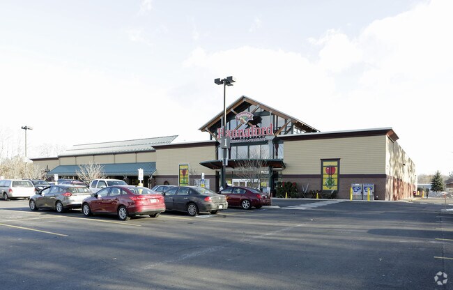
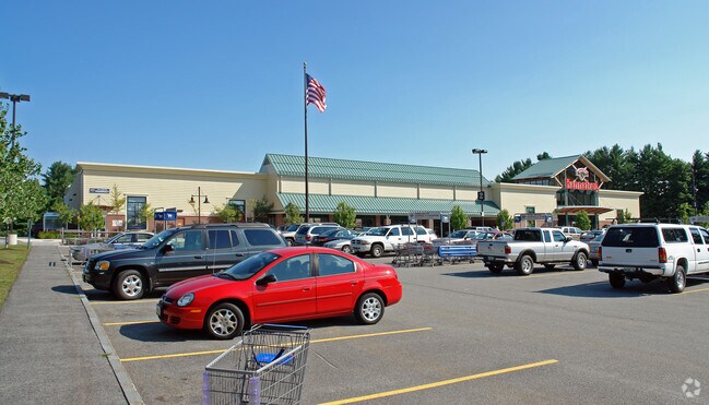
Property Record
7 Hannaford Dr, Westbrook, ME 04092

Save to a Folder
{{folder.Name}}
{{folder.ListingIds.length}} Properties
{{folder.ListingIds.length}} Property
Create a New Folder
Property Detail
7 Hannaford Dr
WSBR-000033-000000-000057
Cumberland
Departmentstore
Maine
21
57
B and X Area of moderate flood hazard, usually the area between the limits of the 100-year and 500-year floods.
8.16 AC
2023
SW Cumberland County
2023
Portland/South Portland
002800
Portland-South Portland, ME
57,820 SF
NEARBY LISTINGS FOR SALE OR LEASE
DEMOGRAPHICS near 7 Hannaford Dr
1 mile
3 mile
5 mile
2025 Total Population
10,642
30,906
103,448
2030 Population
10,820
31,308
105,270
Pop Growth 2025-2030
+ 1.67%
+ 1.30%
+ 1.76%
Average Age
39
41
41
2025 Total Households
4,633
13,002
45,215
HH Growth 2025-2030
+ 1.86%
+ 1.49%
+ 1.81%
Median Household Inc
$87,297
$95,517
$93,635
Avg Household Size
2.20
2.30
2.20
2025 Avg HH Vehicles
2.00
2.00
2.00
Median Home Value
$396,283
$411,184
$458,765
Median Year Built
1961
1966
1962
Nearby Places
Map Layers
Map Styles
 Street
 Aerial
Layers
 Traffic
 Biking
Places
Listings with unknown addresses are not visible on the map
- Restaurants
- Banks
- Shops
- Fitness
- Groceries
PUBLIC TRANSPORTATION
COMMUTER RAIL
Drive
Walk
Distance
11 min
5.2 mi
AIRPORT
Portland International Jetport
Drive
Walk
Distance
Portland International Jetport
12 min
4.6 mi
Freight Ports
Portland, ME
Drive
Walk
Distance
Portland, ME
15 min
7.3 mi
Nearby Properties
Address
Land Use
TOTAL SIZE
Lot Size
Zoning
Address
Land Use
TOTAL SIZE
Lot Size
Zoning
86.50 AC
Address
Land Use
TOTAL SIZE
Lot Size
Zoning
45.50 AC
Address
Land Use
TOTAL SIZE
Lot Size
Zoning
84,636 SF
31.70 AC
22
Address
Land Use
TOTAL SIZE
Lot Size
Zoning
408.26 AC
Address
Land Use
TOTAL SIZE
Lot Size
Zoning
20.35 AC
Address
Land Use
TOTAL SIZE
Lot Size
Zoning
53.27 AC
22
Address
Land Use
TOTAL SIZE
Lot Size
Zoning
20.61 AC
TIFD
Address
Land Use
TOTAL SIZE
Lot Size
Zoning
13.20 AC
I
Address
Land Use
TOTAL SIZE
Lot Size
Zoning
176,100 SF
128 AC
Z
Address
Land Use
TOTAL SIZE
Lot Size
Zoning
125,719 SF
18.79 AC
Address
Land Use
TOTAL SIZE
Lot Size
Zoning
115,965 SF
123 AC
Z
Address
Land Use
TOTAL SIZE
Lot Size
Zoning
9.23 AC
Address
Land Use
TOTAL SIZE
Lot Size
Zoning
20.33 AC
Z
Address
Land Use
TOTAL SIZE
Lot Size
Zoning
139,588 SF
0.85 AC
16
Address
Land Use
TOTAL SIZE
Lot Size
Zoning
33.07 AC
Address
Land Use
TOTAL SIZE
Lot Size
Zoning
17.95 AC
11
Address
Land Use
TOTAL SIZE
Lot Size
Zoning
17.72 AC
Address
Land Use
TOTAL SIZE
Lot Size
Zoning
217,672 SF
17.80 AC
Z
Address
Land Use
TOTAL SIZE
Lot Size
Zoning
11.94 AC
Address
Land Use
TOTAL SIZE
Lot Size
Zoning
152,378 SF
29.34 AC
21
Address
Land Use
TOTAL SIZE
Lot Size
Zoning
103,048 SF
2.78 AC
Address
Land Use
TOTAL SIZE
Lot Size
Zoning
14.51 AC
Z
Address
Land Use
TOTAL SIZE
Lot Size
Zoning
116,600 SF
12.37 AC
Z
Address
Land Use
TOTAL SIZE
Lot Size
Zoning
144,304 SF
10.01 AC
Z
Address
Land Use
TOTAL SIZE
Lot Size
Zoning
88,032 SF
11.98 AC
Address
Land Use
TOTAL SIZE
Lot Size
Zoning
194,830 SF
19.33 AC
Address
Land Use
TOTAL SIZE
Lot Size
Zoning
88,887 SF
21.44 AC
Address
Land Use
TOTAL SIZE
Lot Size
Zoning
96,050 SF
12.90 AC
Z
Address
Land Use
TOTAL SIZE
Lot Size
Zoning
5.15 AC
MM
Address
Land Use
TOTAL SIZE
Lot Size
Zoning
11.96 AC
The World's #1 Commercial Real Estate Marketplace
Connect with us
© 2026 CoStar Group
The information above has been obtained from sources believed reliable. While we do not doubt its accuracy we have not verified it and make no guarantee, warranty or representation about it. It is your responsibility to independently confirm its accuracy and completeness. Any projections, opinions, assumptions, or estimates used are for example only and do not represent the current or future performance of the property. The value of this transaction to you depends on tax and other factors which should be evaluated by your tax, financial, and legal advisors. You and your advisors should conduct a careful, independent investigation of the property to determine to your satisfaction the suitability of the property for your needs.