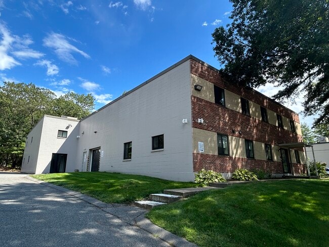
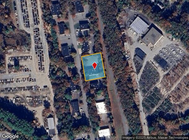
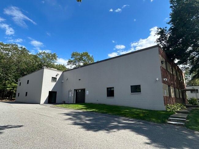
Property Record
7 Kane Industrial Dr, Hudson, MA 01749
Current Lease Availabilities
NEARBY LISTINGS FOR SALE OR LEASE
Property Detail
7 Kane Industrial Dr
HUDS-000035-000000-000097
Middlesex
Manufacturinglight
Massachusetts
X
97
25017C0344F
0.92 AC
2025
Concord/Maynard
2025
Boston
322100
Boston-Cambridge-Newton, MA-NH
12,684 SF
DEMOGRAPHICS near 7 Kane Industrial Dr
1 Mile
3 Mile
5 Mile
2024 Total Population
1,828
25,443
92,457
2029 Population
1,812
25,225
91,462
Pop Growth 2024-2029
(0.88%)
(0.86%)
(1.08%)
Average Age
44
43
42
2024 Total Households
696
9,648
36,008
HH Growth 2024-2029
(1.01%)
(0.90%)
(1.17%)
Median Household Inc
$166,737
$126,664
$112,053
Avg Household Size
2.60
2.60
2.50
2024 Avg HH Vehicles
2.00
2.00
2.00
Median Home Value
$755,244
$562,314
$518,809
Median Year Built
1986
1978
1972
Nearby Places
- Restaurants
- Banks
- Shops
- Fitness
- Groceries
PUBLIC TRANSPORTATION
COMMUTER RAIL
South Acton (Fitchburg/South Acton Line - Massachusetts Bay Transportation Authority Commuter Rail (Purple Line))
DRIVE
WALK
Distance
South Acton (Fitchburg/South Acton Line - Massachusetts Bay Transportation Authority Commuter Rail (Purple Line))
20 min
9.1 mi
AIRPORT
Worcester Regional
DRIVE
WALK
Distance
Worcester Regional
40 min
24.7 mi
General Edward Lawrence Logan International
DRIVE
WALK
Distance
General Edward Lawrence Logan International
51 min
29.7 mi
Freight Ports
Port of Boston
DRIVE
WALK
Distance
Port of Boston
50 min
28.0 mi
Nearby Properties
Address
Land Use
TOTAL SIZE
Lot Size
Zoning
Address
Land Use
TOTAL SIZE
Lot Size
Zoning
284,231 SF
62.04 AC
A2
Address
Land Use
TOTAL SIZE
Lot Size
Zoning
23,890 SF
36.39 AC
A3
Address
Land Use
TOTAL SIZE
Lot Size
Zoning
720 SF
632 AC
SA8
Address
Land Use
TOTAL SIZE
Lot Size
Zoning
121,434 SF
21.35 AC
SA8
Address
Land Use
TOTAL SIZE
Lot Size
Zoning
22.74 AC
A1
Address
Land Use
TOTAL SIZE
Lot Size
Zoning
9.66 AC
A1
Address
Land Use
TOTAL SIZE
Lot Size
Zoning
21.17 AC
A1
Address
Land Use
TOTAL SIZE
Lot Size
Zoning
85,958 SF
13.52 AC
A3
Address
Land Use
TOTAL SIZE
Lot Size
Zoning
46.82 AC
RC
Address
Land Use
TOTAL SIZE
Lot Size
Zoning
16.84 AC
M5
Address
Land Use
TOTAL SIZE
Lot Size
Zoning
71.89 AC
RR
Address
Land Use
TOTAL SIZE
Lot Size
Zoning
148.66 AC
M6
Address
Land Use
TOTAL SIZE
Lot Size
Zoning
16.51 AC
SA7
Address
Land Use
TOTAL SIZE
Lot Size
Zoning
990.40 AC
RC
Address
Land Use
TOTAL SIZE
Lot Size
Zoning
122.98 AC
SA8
Address
Land Use
TOTAL SIZE
Lot Size
Zoning
159,720 SF
16.05 AC
M6
Address
Land Use
TOTAL SIZE
Lot Size
Zoning
22.48 AC
SA8
Address
Land Use
TOTAL SIZE
Lot Size
Zoning
28.09 AC
R
Address
Land Use
TOTAL SIZE
Lot Size
Zoning
100 AC
SA8
Address
Land Use
TOTAL SIZE
Lot Size
Zoning
70,246 SF
16.48 AC
I
Address
Land Use
TOTAL SIZE
Lot Size
Zoning
12.30 AC
B
Address
Land Use
TOTAL SIZE
Lot Size
Zoning
60,290 SF
20.50 AC
SA8
Address
Land Use
TOTAL SIZE
Lot Size
Zoning
107,683 SF
5.59 AC
M5
Address
Land Use
TOTAL SIZE
Lot Size
Zoning
71,873 SF
22.53 AC
RR
Address
Land Use
TOTAL SIZE
Lot Size
Zoning
80,494 SF
5.12 AC
M4
Address
Land Use
TOTAL SIZE
Lot Size
Zoning
40,928 SF
28.46 AC
M5
Address
Land Use
TOTAL SIZE
Lot Size
Zoning
106,778 SF
8.58 AC
M6
Address
Land Use
TOTAL SIZE
Lot Size
Zoning
208.81 AC
M6
Address
Land Use
TOTAL SIZE
Lot Size
Zoning
23 AC
SB
Address
Land Use
TOTAL SIZE
Lot Size
Zoning
217 AC
WI
The World's #1 Commercial Real Estate Marketplace
Connect with us
© 2025 CoStar Group
The information above has been obtained from sources believed reliable. While we do not doubt its accuracy we have not verified it and make no guarantee, warranty or representation about it. It is your responsibility to independently confirm its accuracy and completeness. Any projections, opinions, assumptions, or estimates used are for example only and do not represent the current or future performance of the property. The value of this transaction to you depends on tax and other factors which should be evaluated by your tax, financial, and legal advisors. You and your advisors should conduct a careful, independent investigation of the property to determine to your satisfaction the suitability of the property for your needs.