Property Record
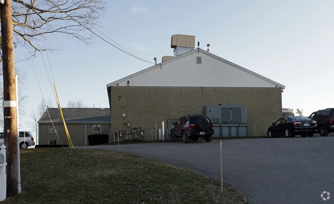
7 Kidder Rd, Chelmsford, MA 01824

Property Detail
7 Kidder Rd
CHEL-000099-000403-000003
Middlesex
Warehouse
Massachusetts
CB
3
B and X Area of moderate flood hazard, usually the area between the limits of the 100-year and 500-year floods.
1.07 AC
2025
Lowell/Chelmsford
2025
Boston
317101
Boston-Cambridge-Newton, MA-NH
12,611 SF
NEARBY LISTINGS FOR SALE OR LEASE
-
-
View all Chelmsford listings for sale on LoopNet.com
DEMOGRAPHICS near 7 Kidder Rd
1 mile
3 mile
5 mile
2025 Total Population
5,557
36,082
119,404
2030 Population
5,759
37,513
124,025
Pop Growth 2025-2030
+ 3.64%
+ 3.97%
+ 3.87%
Average Age
42
43
41
2025 Total Households
2,263
13,425
42,818
HH Growth 2025-2030
+ 3.62%
+ 4.06%
+ 4.03%
Median Household Inc
$118,284
$156,418
$125,023
Avg Household Size
2.40
2.60
2.70
2025 Avg HH Vehicles
2.00
2.00
2.00
Median Home Value
$619,565
$697,087
$642,903
Median Year Built
1979
1970
1970
Nearby Places
Map Layers
Map Styles
 Street
 Aerial
Layers
 Traffic
 Biking
Places
Listings with unknown addresses are not visible on the map
- Restaurants
- Banks
- Shops
- Fitness
- Groceries
PUBLIC TRANSPORTATION
COMMUTER RAIL
Lowell (Lowell Line - Massachusetts Bay Transportation Authority Commuter Rail (Purple Line))
Drive
Walk
Distance
Lowell (Lowell Line - Massachusetts Bay Transportation Authority Commuter Rail (Purple Line))
11 min
5.9 mi
North Billerica (Lowell Line - Massachusetts Bay Transportation Authority Commuter Rail (Purple Line))
Drive
Walk
Distance
North Billerica (Lowell Line - Massachusetts Bay Transportation Authority Commuter Rail (Purple Line))
13 min
6.8 mi
AIRPORT
Manchester Boston Regional
Drive
Walk
Distance
Manchester Boston Regional
49 min
31.6 mi
General Edward Lawrence Logan International
Drive
Walk
Distance
General Edward Lawrence Logan International
50 min
37.2 mi
Freight Ports
Port of Boston
Drive
Walk
Distance
Port of Boston
51 min
37.0 mi
Nearby Properties
Address
Land Use
TOTAL SIZE
Lot Size
Zoning
Address
Land Use
TOTAL SIZE
Lot Size
Zoning
205,340 SF
44.73 AC
RA
Address
Land Use
TOTAL SIZE
Lot Size
Zoning
255,627 SF
82.71 AC
RA
Address
Land Use
TOTAL SIZE
Lot Size
Zoning
174 SF
IA
Address
Land Use
TOTAL SIZE
Lot Size
Zoning
269,952 SF
18.11 AC
P
Address
Land Use
TOTAL SIZE
Lot Size
Zoning
220,257 SF
24.17 AC
CH
Address
Land Use
TOTAL SIZE
Lot Size
Zoning
38.26 AC
P
Address
Land Use
TOTAL SIZE
Lot Size
Zoning
7.41 AC
CB
Address
Land Use
TOTAL SIZE
Lot Size
Zoning
161,850 SF
18.41 AC
CH
Address
Land Use
TOTAL SIZE
Lot Size
Zoning
85,450 SF
32.07 AC
RA
Address
Land Use
TOTAL SIZE
Lot Size
Zoning
9.48 AC
RB
Address
Land Use
TOTAL SIZE
Lot Size
Zoning
230,037 SF
18.85 AC
IH
Address
Land Use
TOTAL SIZE
Lot Size
Zoning
64,542 SF
4.67 AC
CH
Address
Land Use
TOTAL SIZE
Lot Size
Zoning
73,576 SF
26.14 AC
P
Address
Land Use
TOTAL SIZE
Lot Size
Zoning
95,220 SF
6.31 AC
CC
Address
Land Use
TOTAL SIZE
Lot Size
Zoning
82,182 SF
13.86 AC
P
Address
Land Use
TOTAL SIZE
Lot Size
Zoning
58,766 SF
21.98 AC
RA
Address
Land Use
TOTAL SIZE
Lot Size
Zoning
181,578 SF
11.40 AC
IH
Address
Land Use
TOTAL SIZE
Lot Size
Zoning
59,848 SF
6.30 AC
P
Address
Land Use
TOTAL SIZE
Lot Size
Zoning
62,620 SF
13.20 AC
P
Address
Land Use
TOTAL SIZE
Lot Size
Zoning
87,430 SF
9.30 AC
CH
Address
Land Use
TOTAL SIZE
Lot Size
Zoning
130,524 SF
19.74 AC
IH
Address
Land Use
TOTAL SIZE
Lot Size
Zoning
8.54 AC
CB
Address
Land Use
TOTAL SIZE
Lot Size
Zoning
27.80 AC
P
Address
Land Use
TOTAL SIZE
Lot Size
Zoning
37.75 AC
RMH
Address
Land Use
TOTAL SIZE
Lot Size
Zoning
57,700 SF
8.27 AC
CH
Address
Land Use
TOTAL SIZE
Lot Size
Zoning
43,775 SF
8.69 AC
P
Address
Land Use
TOTAL SIZE
Lot Size
Zoning
4.53 AC
CB
Address
Land Use
TOTAL SIZE
Lot Size
Zoning
72,854 SF
1.96 AC
RM
Address
Land Use
TOTAL SIZE
Lot Size
Zoning
80,974 SF
14.36 AC
CH
Address
Land Use
TOTAL SIZE
Lot Size
Zoning
114,706 SF
7.35 AC
IA
The World's #1 Commercial Real Estate Marketplace
Connect with us
© 2026 CoStar Group
The information above has been obtained from sources believed reliable. While we do not doubt its accuracy we have not verified it and make no guarantee, warranty or representation about it. It is your responsibility to independently confirm its accuracy and completeness. Any projections, opinions, assumptions, or estimates used are for example only and do not represent the current or future performance of the property. The value of this transaction to you depends on tax and other factors which should be evaluated by your tax, financial, and legal advisors. You and your advisors should conduct a careful, independent investigation of the property to determine to your satisfaction the suitability of the property for your needs.