Property Record
7 Marshall Rd, Upper Darby, PA 19082

Property Detail
7 Marshall Rd
Philadelphia-Camden-Wilmington, PA-NJ-DE-MD
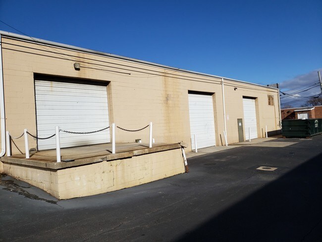
1 STY BLDG 95 X 118 LOT 3
11-00-01807-00
DELAWARE
Warehouse
Pennsylvania
B and X Area of moderate flood hazard, usually the area between the limits of the 100-year and 500-year floods.
3
2024
0.16 AC
2025
Delaware County
403104
Philadelphia
3,800 SF
NEARBY LISTINGS FOR SALE OR LEASE
DEMOGRAPHICS near 7 Marshall Rd
1 mile
3 mile
5 mile
2025 Total Population
29,344
217,774
545,427
2030 Population
29,686
218,573
546,940
Pop Growth 2025-2030
+ 1.17%
+ 0.37%
+ 0.28%
Average Age
37
39
39
2025 Total Households
10,496
82,901
210,797
HH Growth 2025-2030
+ 1.17%
+ 0.43%
+ 0.22%
Median Household Inc
$52,762
$59,797
$61,178
Avg Household Size
2.70
2.60
2.50
2025 Avg HH Vehicles
1.00
1.00
1.00
Median Home Value
$155,634
$199,419
$229,678
Median Year Built
1951
1951
1949
Nearby Places
Map Layers
Map Styles
 Street
 Aerial
Transit
 Traffic
 Biking
Places
Listings with unknown addresses are not visible on the map
- Restaurants
- Banks
- Shops
- Fitness
- Groceries
PUBLIC TRANSPORTATION
TRANSIT/SUBWAY
Macdade Blvd (Route 102 - SEPTA)
Drive
Walk
Distance
Macdade Blvd (Route 102 - SEPTA)
2 min
12 min
0.6 mi
Andrews Av (Route 102 - SEPTA)
Drive
Walk
Distance
Andrews Av (Route 102 - SEPTA)
2 min
14 min
0.7 mi
Main Street And Powell Street (Route 11 - Southeastern Pennsylvania Transportation Authority Rapid Transit (SEPTA Subway & Trolley))
Drive
Walk
Distance
Main Street And Powell Street (Route 11 - Southeastern Pennsylvania Transportation Authority Rapid Transit (SEPTA Subway & Trolley))
2 min
15 min
0.8 mi
Sharon Hill (Route 102 - SEPTA)
Drive
Walk
Distance
Sharon Hill (Route 102 - SEPTA)
3 min
15 min
0.8 mi
10Th Street And Main Street (Route 11 - SEPTA, Route 13 - SEPTA)
Drive
Walk
Distance
10Th Street And Main Street (Route 11 - SEPTA, Route 13 - SEPTA)
3 min
15 min
0.8 mi
COMMUTER RAIL
Sharon Hill (R2 - Southeastern Pennsylvania Transportation Authority Regional Rail (SEPTA Regional Rail))
Drive
Walk
Distance
Sharon Hill (R2 - Southeastern Pennsylvania Transportation Authority Regional Rail (SEPTA Regional Rail))
3 min
20 min
1.0 mi
Curtis Park (R2 - Southeastern Pennsylvania Transportation Authority Regional Rail (SEPTA Regional Rail))
Drive
Walk
Distance
Curtis Park (R2 - Southeastern Pennsylvania Transportation Authority Regional Rail (SEPTA Regional Rail))
4 min
1.4 mi
AIRPORT
Philadelphia International
Drive
Walk
Distance
Philadelphia International
14 min
5.6 mi
Freight Ports
South Jersey Port
Drive
Walk
Distance
South Jersey Port
27 min
12.2 mi
SALE & LEASE HISTORY
LISTING DATE
SALE/LEASE

Oct 13, 2020
For Lease
Dec 23, 2019
For Lease
Nearby Properties
Address
Land Use
TOTAL SIZE
Lot Size
Zoning
Address
Land Use
TOTAL SIZE
Lot Size
Zoning
678,227 SF
850.40 AC
SPAIR
Address
Land Use
TOTAL SIZE
Lot Size
Zoning
762,100 SF
Address
Land Use
TOTAL SIZE
Lot Size
Zoning
685,000 SF
47.69 AC
CMX3
Address
Land Use
TOTAL SIZE
Lot Size
Zoning
910,000 SF
70 AC
I2
Address
Land Use
TOTAL SIZE
Lot Size
Zoning
488,254 SF
31.56 AC
I2
Address
Land Use
TOTAL SIZE
Lot Size
Zoning
89,456 SF
27.06 AC
Address
Land Use
TOTAL SIZE
Lot Size
Zoning
164,182 SF
Address
Land Use
TOTAL SIZE
Lot Size
Zoning
323,248 SF
2.90 AC
SPAIR
Address
Land Use
TOTAL SIZE
Lot Size
Zoning
975.62 AC
Address
Land Use
TOTAL SIZE
Lot Size
Zoning
226,764 SF
5.72 AC
CMX3
Address
Land Use
TOTAL SIZE
Lot Size
Zoning
63.81 AC
I2
Address
Land Use
TOTAL SIZE
Lot Size
Zoning
6,040 SF
16.45 AC
Address
Land Use
TOTAL SIZE
Lot Size
Zoning
63.53 AC
CMX3
Address
Land Use
TOTAL SIZE
Lot Size
Zoning
156,079 SF
13.44 AC
Address
Land Use
TOTAL SIZE
Lot Size
Zoning
25,680 SF
31.64 AC
Address
Land Use
TOTAL SIZE
Lot Size
Zoning
136,972 SF
27 AC
Address
Land Use
TOTAL SIZE
Lot Size
Zoning
33,200 SF
19.55 AC
I2
Address
Land Use
TOTAL SIZE
Lot Size
Zoning
3,600 SF
6.61 AC
SPPOA
Address
Land Use
TOTAL SIZE
Lot Size
Zoning
454,536 SF
26.63 AC
Address
Land Use
TOTAL SIZE
Lot Size
Zoning
164,184 SF
14.62 AC
I2
Address
Land Use
TOTAL SIZE
Lot Size
Zoning
96,500 SF
6.11 AC
CMX3
Address
Land Use
TOTAL SIZE
Lot Size
Zoning
363,215 SF
7.27 AC
RM1
Address
Land Use
TOTAL SIZE
Lot Size
Zoning
131,980 SF
9.17 AC
Address
Land Use
TOTAL SIZE
Lot Size
Zoning
16,990 SF
221.09 AC
SPPOA
Address
Land Use
TOTAL SIZE
Lot Size
Zoning
40,572 SF
6.52 AC
Address
Land Use
TOTAL SIZE
Lot Size
Zoning
192,000 SF
6.40 AC
CMX3
Address
Land Use
TOTAL SIZE
Lot Size
Zoning
246,296 SF
10.78 AC
RM2
Address
Land Use
TOTAL SIZE
Lot Size
Zoning
246,303 SF
11 AC
RM2
Address
Land Use
TOTAL SIZE
Lot Size
Zoning
68,096 SF
7.78 AC
Address
Land Use
TOTAL SIZE
Lot Size
Zoning
307,425 SF
18.88 AC
I3
The World's #1 Commercial Real Estate Marketplace
Connect with us
© 2026 CoStar Group
The information above has been obtained from sources believed reliable. While we do not doubt its accuracy we have not verified it and make no guarantee, warranty or representation about it. It is your responsibility to independently confirm its accuracy and completeness. Any projections, opinions, assumptions, or estimates used are for example only and do not represent the current or future performance of the property. The value of this transaction to you depends on tax and other factors which should be evaluated by your tax, financial, and legal advisors. You and your advisors should conduct a careful, independent investigation of the property to determine to your satisfaction the suitability of the property for your needs.