Property Record
304 Putnam Rd, Danielson, CT 06239
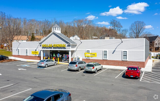

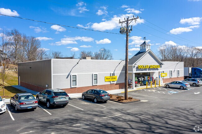
Property Detail
304 Putnam Rd
PLAI-000013-000085-000007
WINDHAM
Departmentstore
Connecticut
C1
7
B and X Area of moderate flood hazard, usually the area between the limits of the 100-year and 500-year floods.
1.64 AC
2024
Windham County
2025
Hartford
904500
Willimantic, CT
9,100 SF
NEARBY LISTINGS FOR SALE OR LEASE
-
-
View all Danielson listings for sale on LoopNet.com
DEMOGRAPHICS near 304 Putnam Rd
1 mile
3 mile
5 mile
2025 Total Population
1,506
11,364
29,744
2030 Population
1,518
11,658
30,501
Pop Growth 2025-2030
+ 0.80%
+ 2.59%
+ 2.55%
Average Age
39
41
42
2025 Total Households
559
4,425
11,671
HH Growth 2025-2030
+ 0.89%
+ 2.73%
+ 2.68%
Median Household Inc
$85,994
$89,151
$80,205
Avg Household Size
2.60
2.50
2.40
2025 Avg HH Vehicles
2.00
2.00
2.00
Median Home Value
$257,474
$298,454
$279,102
Median Year Built
1965
1969
1968
Nearby Places
Map Layers
Map Styles
 Street
 Aerial
Transit
 Traffic
 Biking
Places
Listings with unknown addresses are not visible on the map
- Restaurants
- Banks
- Shops
- Fitness
- Groceries
PUBLIC TRANSPORTATION
AIRPORT
Rhode Island Tf Green International
Drive
Walk
Distance
Rhode Island Tf Green International
49 min
35.6 mi
Freight Ports
Port of Davisville, RI
Drive
Walk
Distance
Port of Davisville, RI
61 min
44.8 mi
SALE & LEASE HISTORY
LISTING DATE
SALE/LEASE

Sep 16, 2020
For Sale
Nearby Properties
Address
Land Use
TOTAL SIZE
Lot Size
Zoning
Address
Land Use
TOTAL SIZE
Lot Size
Zoning
186,583 SF
87.26 AC
RA60
Address
Land Use
TOTAL SIZE
Lot Size
Zoning
55,128 SF
5 AC
RA19
Address
Land Use
TOTAL SIZE
Lot Size
Zoning
10.29 AC
RA19
Address
Land Use
TOTAL SIZE
Lot Size
Zoning
23.55 AC
I
Address
Land Use
TOTAL SIZE
Lot Size
Zoning
11.29 AC
C
Address
Land Use
TOTAL SIZE
Lot Size
Zoning
139.70 AC
RA60
Address
Land Use
TOTAL SIZE
Lot Size
Zoning
96,848 SF
13.88 AC
IND-1
Address
Land Use
TOTAL SIZE
Lot Size
Zoning
11.50 AC
RA60
Address
Land Use
TOTAL SIZE
Lot Size
Zoning
233,322 SF
13.60 AC
I
Address
Land Use
TOTAL SIZE
Lot Size
Zoning
38.06 AC
Address
Land Use
TOTAL SIZE
Lot Size
Zoning
334 AC
RA60
Address
Land Use
TOTAL SIZE
Lot Size
Zoning
1,475 SF
148.80 AC
I
Address
Land Use
TOTAL SIZE
Lot Size
Zoning
1.40 AC
RA30
Address
Land Use
TOTAL SIZE
Lot Size
Zoning
5.18 AC
IND
Address
Land Use
TOTAL SIZE
Lot Size
Zoning
9,066 SF
1.20 AC
C2
Address
Land Use
TOTAL SIZE
Lot Size
Zoning
3,146 SF
9.93 AC
RA19
Address
Land Use
TOTAL SIZE
Lot Size
Zoning
21,582 SF
2.10 AC
GC
Address
Land Use
TOTAL SIZE
Lot Size
Zoning
21,424 SF
3.97 AC
LI
Address
Land Use
TOTAL SIZE
Lot Size
Zoning
25,000 SF
5.60 AC
IND
Address
Land Use
TOTAL SIZE
Lot Size
Zoning
6.70 AC
RA19
Address
Land Use
TOTAL SIZE
Lot Size
Zoning
Address
Land Use
TOTAL SIZE
Lot Size
Zoning
0.82 AC
C2
Address
Land Use
TOTAL SIZE
Lot Size
Zoning
18,224 SF
0.75 AC
RA19
Address
Land Use
TOTAL SIZE
Lot Size
Zoning
2.10 AC
C2
Address
Land Use
TOTAL SIZE
Lot Size
Zoning
90,915 SF
1.78 AC
IND-1
Address
Land Use
TOTAL SIZE
Lot Size
Zoning
18,238 SF
2.31 AC
RA60
Address
Land Use
TOTAL SIZE
Lot Size
Zoning
12,700 SF
4.02 AC
CI
Address
Land Use
TOTAL SIZE
Lot Size
Zoning
10 AC
RA
Address
Land Use
TOTAL SIZE
Lot Size
Zoning
17,285 SF
1.25 AC
C2
The World's #1 Commercial Real Estate Marketplace
Connect with us
© 2026 CoStar Group
The information above has been obtained from sources believed reliable. While we do not doubt its accuracy we have not verified it and make no guarantee, warranty or representation about it. It is your responsibility to independently confirm its accuracy and completeness. Any projections, opinions, assumptions, or estimates used are for example only and do not represent the current or future performance of the property. The value of this transaction to you depends on tax and other factors which should be evaluated by your tax, financial, and legal advisors. You and your advisors should conduct a careful, independent investigation of the property to determine to your satisfaction the suitability of the property for your needs.