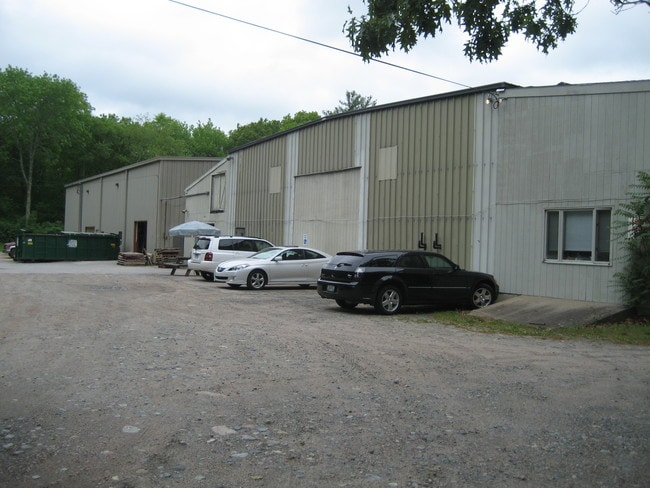
Property Record
7 Pendleton Hill Rd, North Stonington, CT 06359


NEARBY LISTINGS FOR SALE OR LEASE
Property Detail
7 Pendleton Hill Rd
NSTO-000126-000000-008381
New London
Industrialgeneral
Connecticut
AE
8381
09011C0411H
7.02 AC
2025
SE New London
2025
Hartford
707100
Norwich-New London-Willimantic, CT
DEMOGRAPHICS near 7 Pendleton Hill Rd
1 Mile
3 Mile
5 Mile
2024 Total Population
1,046
17,266
30,591
2029 Population
1,037
16,904
30,139
Pop Growth 2024-2029
(0.86%)
(2.10%)
(1.48%)
Average Age
43
43
44
2024 Total Households
409
7,488
13,096
HH Growth 2024-2029
(0.98%)
(2.38%)
(1.69%)
Median Household Inc
$101,541
$70,533
$79,587
Avg Household Size
2.60
2.20
2.30
2024 Avg HH Vehicles
2.00
2.00
2.00
Median Home Value
$396,728
$335,114
$348,337
Median Year Built
1982
1964
1967
Nearby Places
Map Layers
Map Styles
 Street
 Aerial
- Restaurants
- Banks
- Shops
- Fitness
- Groceries
PUBLIC TRANSPORTATION
AIRPORT
Rhode Island Tf Green International
DRIVE
WALK
Distance
Rhode Island Tf Green International
48 min
36.0 mi
Freight Ports
Port of Davisville, RI
DRIVE
WALK
Distance
Port of Davisville, RI
50 min
36.2 mi
SALE & LEASE HISTORY
LISTING DATE
SALE/LEASE

Dec 02, 2019
For Lease
Nearby Properties
Address
Land Use
TOTAL SIZE
Lot Size
Zoning
Address
Land Use
TOTAL SIZE
Lot Size
Zoning
58,752 SF
3.88 AC
R60
Address
Land Use
TOTAL SIZE
Lot Size
Zoning
154,316 SF
4.57 AC
Address
Land Use
TOTAL SIZE
Lot Size
Zoning
96,882 SF
13.12 AC
Address
Land Use
TOTAL SIZE
Lot Size
Zoning
14.71 AC
Address
Land Use
TOTAL SIZE
Lot Size
Zoning
66,003 SF
44.50 AC
GBR-13
Address
Land Use
TOTAL SIZE
Lot Size
Zoning
0.55 AC
Address
Land Use
TOTAL SIZE
Lot Size
Zoning
46,532 SF
7.67 AC
R40
Address
Land Use
TOTAL SIZE
Lot Size
Zoning
5,055 SF
24.56 AC
GBR-13
Address
Land Use
TOTAL SIZE
Lot Size
Zoning
40,943 SF
25.78 AC
Address
Land Use
TOTAL SIZE
Lot Size
Zoning
40,705 SF
1.07 AC
Address
Land Use
TOTAL SIZE
Lot Size
Zoning
64,166 SF
12 AC
HI-60
Address
Land Use
TOTAL SIZE
Lot Size
Zoning
60,968 SF
8 AC
RA-15
Address
Land Use
TOTAL SIZE
Lot Size
Zoning
11.40 AC
RFR8
Address
Land Use
TOTAL SIZE
Lot Size
Zoning
46,362 SF
7.43 AC
Address
Land Use
TOTAL SIZE
Lot Size
Zoning
3,000 SF
50.36 AC
HI-60
Address
Land Use
TOTAL SIZE
Lot Size
Zoning
31,288 SF
2.30 AC
Address
Land Use
TOTAL SIZE
Lot Size
Zoning
100,124 SF
14.28 AC
EDD
Address
Land Use
TOTAL SIZE
Lot Size
Zoning
25,252 SF
3.87 AC
CS-5
Address
Land Use
TOTAL SIZE
Lot Size
Zoning
23,642 SF
0.26 AC
Address
Land Use
TOTAL SIZE
Lot Size
Zoning
3.75 AC
Address
Land Use
TOTAL SIZE
Lot Size
Zoning
41,290 SF
11.28 AC
Address
Land Use
TOTAL SIZE
Lot Size
Zoning
70.31 AC
Address
Land Use
TOTAL SIZE
Lot Size
Zoning
40.46 AC
I
Address
Land Use
TOTAL SIZE
Lot Size
Zoning
5.62 AC
Address
Land Use
TOTAL SIZE
Lot Size
Zoning
9,600 SF
2.86 AC
CH
Address
Land Use
TOTAL SIZE
Lot Size
Zoning
2.17 AC
Address
Land Use
TOTAL SIZE
Lot Size
Zoning
2.23 AC
Address
Land Use
TOTAL SIZE
Lot Size
Zoning
47,657 SF
10.90 AC
GC-60
Address
Land Use
TOTAL SIZE
Lot Size
Zoning
13,509 SF
8 AC
R40
Address
Land Use
TOTAL SIZE
Lot Size
Zoning
36,069 SF
2.40 AC
RH-10
The World's #1 Commercial Real Estate Marketplace
Connect with us
© 2026 CoStar Group
The information above has been obtained from sources believed reliable. While we do not doubt its accuracy we have not verified it and make no guarantee, warranty or representation about it. It is your responsibility to independently confirm its accuracy and completeness. Any projections, opinions, assumptions, or estimates used are for example only and do not represent the current or future performance of the property. The value of this transaction to you depends on tax and other factors which should be evaluated by your tax, financial, and legal advisors. You and your advisors should conduct a careful, independent investigation of the property to determine to your satisfaction the suitability of the property for your needs.