Property Record
7 Pullen Dr, Oakland, ME 04963
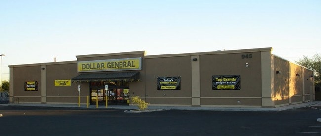


Property Detail
7 Pullen Dr
OAKL-000015-000000-000007-000002
Kennebec
Storebuilding
Maine
HIGHWA
7-2
B and X Area of moderate flood hazard, usually the area between the limits of the 100-year and 500-year floods.
2.60 AC
2025
Maine South & Augusta
2025
Other Market Areas
025002
Augusta-Waterville, ME
9,220 SF
NEARBY LISTINGS FOR SALE OR LEASE
DEMOGRAPHICS near 7 Pullen Dr
1 mile
3 mile
5 mile
2025 Total Population
2,146
10,729
30,904
2030 Population
2,197
11,043
31,413
Pop Growth 2025-2030
+ 2.38%
+ 2.93%
+ 1.65%
Average Age
42
43
42
2025 Total Households
941
4,259
12,894
HH Growth 2025-2030
+ 2.66%
+ 2.68%
+ 1.47%
Median Household Inc
$63,333
$68,479
$59,894
Avg Household Size
2.30
2.20
2.10
2025 Avg HH Vehicles
2.00
2.00
2.00
Median Home Value
$200,633
$245,432
$227,310
Median Year Built
1989
1985
1971
Nearby Places
Map Layers
Map Styles
 Street
 Aerial
Layers
 Traffic
 Biking
Places
Listings with unknown addresses are not visible on the map
- Restaurants
- Banks
- Shops
- Fitness
- Groceries
SALE & LEASE HISTORY
LISTING DATE
SALE/LEASE

Dec 20, 2016
For Sale
Nearby Properties
Address
Land Use
TOTAL SIZE
Lot Size
Zoning
Address
Land Use
TOTAL SIZE
Lot Size
Zoning
115.09 AC
Address
Land Use
TOTAL SIZE
Lot Size
Zoning
DOWNTO
Address
Land Use
TOTAL SIZE
Lot Size
Zoning
Address
Land Use
TOTAL SIZE
Lot Size
Zoning
2,388 SF
63.68 AC
SUBURB
Address
Land Use
TOTAL SIZE
Lot Size
Zoning
26.20 AC
HIGHWA
Address
Land Use
TOTAL SIZE
Lot Size
Zoning
20.88 AC
Address
Land Use
TOTAL SIZE
Lot Size
Zoning
10.25 AC
Address
Land Use
TOTAL SIZE
Lot Size
Zoning
Address
Land Use
TOTAL SIZE
Lot Size
Zoning
90,966 SF
26.70 AC
Address
Land Use
TOTAL SIZE
Lot Size
Zoning
12,516 SF
19.09 AC
Address
Land Use
TOTAL SIZE
Lot Size
Zoning
59,261 SF
56 AC
Address
Land Use
TOTAL SIZE
Lot Size
Zoning
92,224 SF
16.68 AC
Address
Land Use
TOTAL SIZE
Lot Size
Zoning
5.41 AC
DOWNTO
Address
Land Use
TOTAL SIZE
Lot Size
Zoning
20,410 SF
6.80 AC
HIGHWA
Address
Land Use
TOTAL SIZE
Lot Size
Zoning
36,194 SF
174 SF
Address
Land Use
TOTAL SIZE
Lot Size
Zoning
10.74 AC
NEIGHB
Address
Land Use
TOTAL SIZE
Lot Size
Zoning
Address
Land Use
TOTAL SIZE
Lot Size
Zoning
35,000 SF
4.58 AC
HIGHWA
Address
Land Use
TOTAL SIZE
Lot Size
Zoning
46,578 SF
3.68 AC
Address
Land Use
TOTAL SIZE
Lot Size
Zoning
52,927 SF
9.20 AC
DOWNTO
Address
Land Use
TOTAL SIZE
Lot Size
Zoning
41,308 SF
11.40 AC
Address
Land Use
TOTAL SIZE
Lot Size
Zoning
Address
Land Use
TOTAL SIZE
Lot Size
Zoning
1,782 SF
62.85 AC
Address
Land Use
TOTAL SIZE
Lot Size
Zoning
Address
Land Use
TOTAL SIZE
Lot Size
Zoning
45,176 SF
1.05 AC
Address
Land Use
TOTAL SIZE
Lot Size
Zoning
25 AC
NEIGHB
Address
Land Use
TOTAL SIZE
Lot Size
Zoning
1,500 SF
354.03 AC
Address
Land Use
TOTAL SIZE
Lot Size
Zoning
17,689 SF
2.57 AC
HIGHWA
Address
Land Use
TOTAL SIZE
Lot Size
Zoning
32,136 SF
5.01 AC
Address
Land Use
TOTAL SIZE
Lot Size
Zoning
23,976 SF
174 SF
The World's #1 Commercial Real Estate Marketplace
Connect with us
© 2026 CoStar Group
The information above has been obtained from sources believed reliable. While we do not doubt its accuracy we have not verified it and make no guarantee, warranty or representation about it. It is your responsibility to independently confirm its accuracy and completeness. Any projections, opinions, assumptions, or estimates used are for example only and do not represent the current or future performance of the property. The value of this transaction to you depends on tax and other factors which should be evaluated by your tax, financial, and legal advisors. You and your advisors should conduct a careful, independent investigation of the property to determine to your satisfaction the suitability of the property for your needs.