Property Record
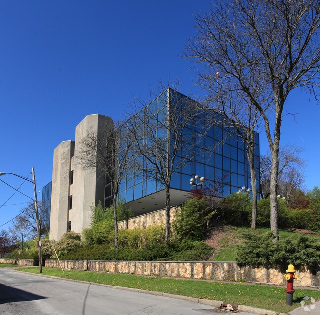
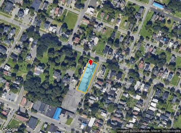
310 Rutger St, Utica, NY 13501
NEARBY LISTINGS FOR SALE OR LEASE
Property Detail
310 Rutger St
318-059-0005-001-000-0000
3-19-05-006 92X306 CO 318.059-0005-001.000/0000
Officebuilding
Oneida
X
New York
36065C0751F
1.000
2025
0.65 AC
2024
Utica
021201
Utica/Rome
19,960 SF
Utica-Rome, NY
DEMOGRAPHICS near 310 Rutger St
1 Mile
3 Mile
5 Mile
2024 Total Population
24,450
69,434
101,838
2029 Population
23,819
67,936
99,875
Pop Growth 2024-2029
(2.58%)
(2.16%)
(1.93%)
Average Age
35
39
40
2024 Total Households
9,417
27,625
41,836
HH Growth 2024-2029
(2.38%)
(2.08%)
(1.91%)
Median Household Inc
$31,906
$44,078
$53,668
Avg Household Size
2.50
2.30
2.30
2024 Avg HH Vehicles
1.00
1.00
1.00
Median Home Value
$83,142
$135,074
$154,824
Median Year Built
1946
1948
1952
Nearby Places
Map Layers
Map Styles
 Street
 Aerial
- Restaurants
- Banks
- Shops
- Fitness
- Groceries
SALE & LEASE HISTORY
LISTING DATE
SALE/LEASE

Sep 22, 2017
For Lease
Nearby Properties
Address
Land Use
TOTAL SIZE
Lot Size
Zoning
Address
Land Use
TOTAL SIZE
Lot Size
Zoning
271,000 SF
16.50 AC
Address
Land Use
TOTAL SIZE
Lot Size
Zoning
742,550 SF
2.03 AC
Address
Land Use
TOTAL SIZE
Lot Size
Zoning
446,163 SF
24.07 AC
05 - COMME
Address
Land Use
TOTAL SIZE
Lot Size
Zoning
127,002 SF
89.68 AC
Address
Land Use
TOTAL SIZE
Lot Size
Zoning
9.79 AC
Address
Land Use
TOTAL SIZE
Lot Size
Zoning
98,832 SF
1.61 AC
Address
Land Use
TOTAL SIZE
Lot Size
Zoning
279,786 SF
121 AC
Address
Land Use
TOTAL SIZE
Lot Size
Zoning
236,597 SF
2.10 AC
Address
Land Use
TOTAL SIZE
Lot Size
Zoning
109,000 SF
13.56 AC
01 - NOT Z
Address
Land Use
TOTAL SIZE
Lot Size
Zoning
8,600 SF
8.33 AC
05 - COMME
Address
Land Use
TOTAL SIZE
Lot Size
Zoning
131,534 SF
16 AC
05 - COMME
Address
Land Use
TOTAL SIZE
Lot Size
Zoning
55,172 SF
81.24 AC
Address
Land Use
TOTAL SIZE
Lot Size
Zoning
61,465 SF
4.64 AC
05 - COMME
Address
Land Use
TOTAL SIZE
Lot Size
Zoning
6,000 SF
1.46 AC
Address
Land Use
TOTAL SIZE
Lot Size
Zoning
12,692 SF
20.24 AC
Address
Land Use
TOTAL SIZE
Lot Size
Zoning
205,097 SF
7.90 AC
Address
Land Use
TOTAL SIZE
Lot Size
Zoning
53,777 SF
Address
Land Use
TOTAL SIZE
Lot Size
Zoning
55,916 SF
4.50 AC
Address
Land Use
TOTAL SIZE
Lot Size
Zoning
129,948 SF
6.90 AC
Address
Land Use
TOTAL SIZE
Lot Size
Zoning
132,972 SF
30.76 AC
Address
Land Use
TOTAL SIZE
Lot Size
Zoning
87,120 SF
2.31 AC
Address
Land Use
TOTAL SIZE
Lot Size
Zoning
64,016 SF
57.30 AC
05 - COMME
Address
Land Use
TOTAL SIZE
Lot Size
Zoning
12,544 SF
21.80 AC
Address
Land Use
TOTAL SIZE
Lot Size
Zoning
3,472 SF
1.06 AC
Address
Land Use
TOTAL SIZE
Lot Size
Zoning
163,404 SF
2.58 AC
Address
Land Use
TOTAL SIZE
Lot Size
Zoning
65,120 SF
1.79 AC
Address
Land Use
TOTAL SIZE
Lot Size
Zoning
118,048 SF
32.59 AC
05 - COMME
Address
Land Use
TOTAL SIZE
Lot Size
Zoning
47,732 SF
0.86 AC
DS
Address
Land Use
TOTAL SIZE
Lot Size
Zoning
209,608 SF
2.10 AC
Address
Land Use
TOTAL SIZE
Lot Size
Zoning
142,770 SF
34.25 AC
The World's #1 Commercial Real Estate Marketplace
Connect with us
© 2026 CoStar Group
The information above has been obtained from sources believed reliable. While we do not doubt its accuracy we have not verified it and make no guarantee, warranty or representation about it. It is your responsibility to independently confirm its accuracy and completeness. Any projections, opinions, assumptions, or estimates used are for example only and do not represent the current or future performance of the property. The value of this transaction to you depends on tax and other factors which should be evaluated by your tax, financial, and legal advisors. You and your advisors should conduct a careful, independent investigation of the property to determine to your satisfaction the suitability of the property for your needs.