Property Record
7 S Main St, Doylestown, PA 18901
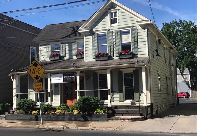


Property Detail
7 S Main St
54-003-098
W S S MAIN ST 1050 N W COLLEGE AVE 40X120
Commercialofficeresidentialmixeduse
BUCKS
C1
Pennsylvania
B and X Area of moderate flood hazard, usually the area between the limits of the 100-year and 500-year floods.
0.10 AC
2025
Lower Bucks County
2026
Philadelphia
104702
Philadelphia-Camden-Wilmington, PA-NJ-DE-MD
2,290 SF
NEARBY LISTINGS FOR SALE OR LEASE
DEMOGRAPHICS near 7 S Main St
1 mile
3 mile
5 mile
2025 Total Population
7,131
57,987
179,121
2030 Population
7,141
59,058
183,337
Pop Growth 2025-2030
+ 0.14%
+ 1.85%
+ 2.35%
Average Age
45
44
42
2025 Total Households
3,072
22,768
69,023
HH Growth 2025-2030
+ 0.26%
+ 2.44%
+ 2.58%
Median Household Inc
$129,094
$114,380
$91,129
Avg Household Size
2.30
2.40
2.50
2025 Avg HH Vehicles
2.00
2.00
2.00
Median Home Value
$614,794
$494,505
$416,508
Median Year Built
1966
1971
1964
Nearby Places
Map Layers
Map Styles
 Street
 Aerial
Layers
 Traffic
 Biking
Places
Listings with unknown addresses are not visible on the map
- Restaurants
- Banks
- Shops
- Fitness
- Groceries
PUBLIC TRANSPORTATION
COMMUTER RAIL
Yardley (R3 - Southeastern Pennsylvania Transportation Authority Regional Rail (SEPTA Regional Rail))
Drive
Walk
Distance
Yardley (R3 - Southeastern Pennsylvania Transportation Authority Regional Rail (SEPTA Regional Rail))
2 min
15 min
0.8 mi
West Trenton (R3 - Southeastern Pennsylvania Transportation Authority Regional Rail (SEPTA Regional Rail))
Drive
Walk
Distance
West Trenton (R3 - Southeastern Pennsylvania Transportation Authority Regional Rail (SEPTA Regional Rail))
9 min
4.9 mi
AIRPORT
Trenton Mercer
Drive
Walk
Distance
Trenton Mercer
8 min
4.3 mi
Freight Ports
Port of Philadelphia
Drive
Walk
Distance
Port of Philadelphia
39 min
27.0 mi
SALE & LEASE HISTORY
LISTING DATE
SALE/LEASE

Dec 24, 2020
For Lease
Nearby Properties
Address
Land Use
TOTAL SIZE
Lot Size
Zoning
Address
Land Use
TOTAL SIZE
Lot Size
Zoning
225.40 AC
R-1
Address
Land Use
TOTAL SIZE
Lot Size
Zoning
1,996 SF
125 AC
RA
Address
Land Use
TOTAL SIZE
Lot Size
Zoning
4,320 SF
12.06 AC
PRO
Address
Land Use
TOTAL SIZE
Lot Size
Zoning
96.60 AC
OP-2
Address
Land Use
TOTAL SIZE
Lot Size
Zoning
117.50 AC
OP-1
Address
Land Use
TOTAL SIZE
Lot Size
Zoning
60,000 SF
42.80 AC
IP-1
Address
Land Use
TOTAL SIZE
Lot Size
Zoning
27.21 AC
PRO
Address
Land Use
TOTAL SIZE
Lot Size
Zoning
104.60 AC
IP-1
Address
Land Use
TOTAL SIZE
Lot Size
Zoning
23.50 AC
R-2
Address
Land Use
TOTAL SIZE
Lot Size
Zoning
11.40 AC
Address
Land Use
TOTAL SIZE
Lot Size
Zoning
64.33 AC
R-2
Address
Land Use
TOTAL SIZE
Lot Size
Zoning
12.54 AC
IP-1
Address
Land Use
TOTAL SIZE
Lot Size
Zoning
8.93 AC
Address
Land Use
TOTAL SIZE
Lot Size
Zoning
5,254 SF
245.70 AC
R-1
Address
Land Use
TOTAL SIZE
Lot Size
Zoning
11.09 AC
Address
Land Use
TOTAL SIZE
Lot Size
Zoning
26.20 AC
OP-1
Address
Land Use
TOTAL SIZE
Lot Size
Zoning
63.40 AC
R-1
Address
Land Use
TOTAL SIZE
Lot Size
Zoning
1.30 AC
Address
Land Use
TOTAL SIZE
Lot Size
Zoning
8.46 AC
RA
Address
Land Use
TOTAL SIZE
Lot Size
Zoning
35.41 AC
R-M
Address
Land Use
TOTAL SIZE
Lot Size
Zoning
1.81 AC
IP-1
Address
Land Use
TOTAL SIZE
Lot Size
Zoning
17,832 SF
26.01 AC
RM
Address
Land Use
TOTAL SIZE
Lot Size
Zoning
896 SF
20.71 AC
R-2
Address
Land Use
TOTAL SIZE
Lot Size
Zoning
27.82 AC
R-M
Address
Land Use
TOTAL SIZE
Lot Size
Zoning
Address
Land Use
TOTAL SIZE
Lot Size
Zoning
34.18 AC
R-2
Address
Land Use
TOTAL SIZE
Lot Size
Zoning
44.90 AC
R-2
Address
Land Use
TOTAL SIZE
Lot Size
Zoning
6,444 SF
44.01 AC
RA
Address
Land Use
TOTAL SIZE
Lot Size
Zoning
30.72 AC
R-1
Address
Land Use
TOTAL SIZE
Lot Size
Zoning
21,400 SF
25.20 AC
IP-1
The World's #1 Commercial Real Estate Marketplace
Connect with us
© 2026 CoStar Group
The information above has been obtained from sources believed reliable. While we do not doubt its accuracy we have not verified it and make no guarantee, warranty or representation about it. It is your responsibility to independently confirm its accuracy and completeness. Any projections, opinions, assumptions, or estimates used are for example only and do not represent the current or future performance of the property. The value of this transaction to you depends on tax and other factors which should be evaluated by your tax, financial, and legal advisors. You and your advisors should conduct a careful, independent investigation of the property to determine to your satisfaction the suitability of the property for your needs.