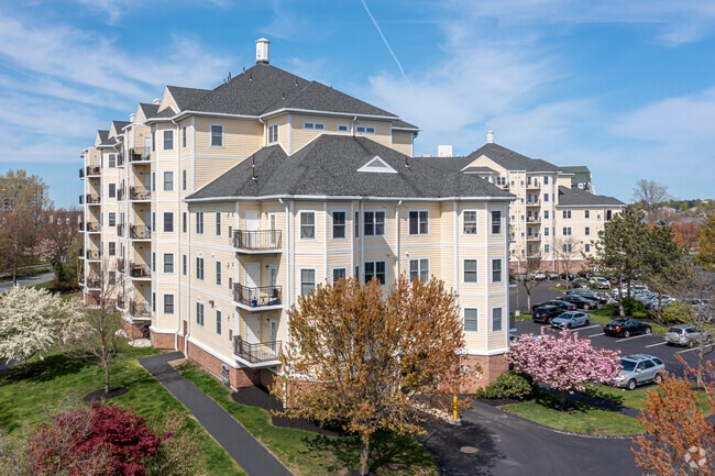
Property Record
7 Seaport Dr, Quincy, MA 02171


NEARBY LISTINGS FOR SALE OR LEASE
Property Detail
7 Seaport Dr
QUIN-006076E-000053-000061
Plan 27744V
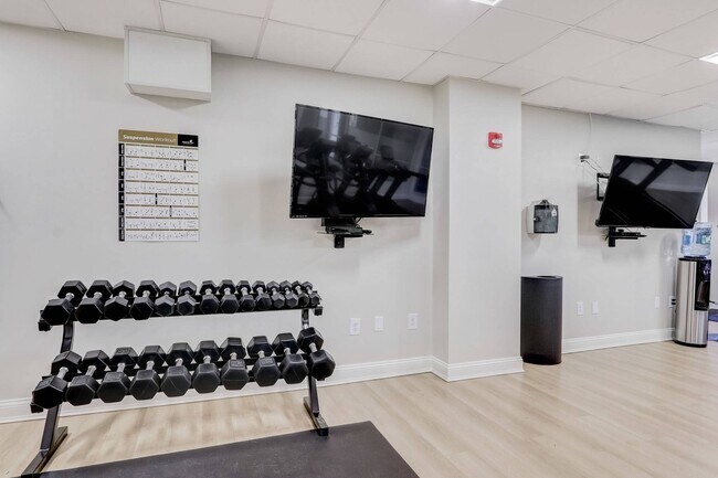
Apartment
Norfolk
AE
Massachusetts
25025C0092J
61
2025
6.90 AC
2025
Marina Bay
417300
Boston
150,987 SF
Boston-Cambridge-Newton, MA-NH
DEMOGRAPHICS near 7 Seaport Dr
1 Mile
3 Mile
5 Mile
2024 Total Population
11,434
189,097
537,383
2029 Population
11,289
180,271
517,272
Pop Growth 2024-2029
(1.27%)
(4.67%)
(3.74%)
Average Age
44
39
39
2024 Total Households
5,316
73,151
223,146
HH Growth 2024-2029
(1.30%)
(5.01%)
(3.98%)
Median Household Inc
$115,247
$83,122
$82,653
Avg Household Size
2.10
2.50
2.20
2024 Avg HH Vehicles
1.00
1.00
1.00
Median Home Value
$650,733
$676,172
$712,702
Median Year Built
1975
1948
1950
Nearby Places
Map Layers
Map Styles
 Street
 Aerial
- Restaurants
- Banks
- Shops
- Fitness
- Groceries
PUBLIC TRANSPORTATION
COMMUTER RAIL
Talbot Avenue (Fairmount Line - MBTA, Franklin/Foxboro Line - MBTA)
DRIVE
WALK
Distance
Talbot Avenue (Fairmount Line - MBTA, Franklin/Foxboro Line - MBTA)
9 min
4.2 mi
Jfk/Umass (Greenbush Line - Massachusetts Bay Transportation Authority Commuter Rail (Purple Line), Kingston/Plymouth Line - Massachusetts Bay Transportation Authority Commuter Rail (Purple Line), Middleborough/Lakeville Line - Massachusetts Bay Transportation Authority Commuter Rail (Purple Line), Red Line - Massachusetts Bay Transportation Authority Commuter Rail (Purple Line))
DRIVE
WALK
Distance
Jfk/Umass (Greenbush Line - Massachusetts Bay Transportation Authority Commuter Rail (Purple Line), Kingston/Plymouth Line - Massachusetts Bay Transportation Authority Commuter Rail (Purple Line), Middleborough/Lakeville Line - Massachusetts Bay Transportation Authority Commuter Rail (Purple Line), Red Line - Massachusetts Bay Transportation Authority Commuter Rail (Purple Line))
9 min
4.5 mi
AIRPORT
General Edward Lawrence Logan International
DRIVE
WALK
Distance
General Edward Lawrence Logan International
18 min
9.5 mi
Freight Ports
Port of Boston
DRIVE
WALK
Distance
Port of Boston
15 min
7.3 mi
Nearby Properties
Address
Land Use
TOTAL SIZE
Lot Size
Zoning
Address
Land Use
TOTAL SIZE
Lot Size
Zoning
259,990 SF
2.84 AC
E
Address
Land Use
TOTAL SIZE
Lot Size
Zoning
303,055 SF
2.15 AC
RC
Address
Land Use
TOTAL SIZE
Lot Size
Zoning
251,272 SF
3.77 AC
BUSC
Address
Land Use
TOTAL SIZE
Lot Size
Zoning
254,856 SF
4.05 AC
BUSC
Address
Land Use
TOTAL SIZE
Lot Size
Zoning
255,257 SF
2.34 AC
A
Address
Land Use
TOTAL SIZE
Lot Size
Zoning
681,518 SF
34.52 AC
Address
Land Use
TOTAL SIZE
Lot Size
Zoning
291,918 SF
1.99 AC
RC
Address
Land Use
TOTAL SIZE
Lot Size
Zoning
728,348 SF
11.71 AC
C
Address
Land Use
TOTAL SIZE
Lot Size
Zoning
219,966 SF
1.37 AC
RC
Address
Land Use
TOTAL SIZE
Lot Size
Zoning
526,040 SF
27.79 AC
E
Address
Land Use
TOTAL SIZE
Lot Size
Zoning
383,811 SF
5.86 AC
RESB
Address
Land Use
TOTAL SIZE
Lot Size
Zoning
132,321 SF
3.94 AC
RC
Address
Land Use
TOTAL SIZE
Lot Size
Zoning
88.20 AC
E
Address
Land Use
TOTAL SIZE
Lot Size
Zoning
173,630 SF
4.46 AC
E
Address
Land Use
TOTAL SIZE
Lot Size
Zoning
17.85 AC
BUSC
Address
Land Use
TOTAL SIZE
Lot Size
Zoning
201,924 SF
2.17 AC
RC
Address
Land Use
TOTAL SIZE
Lot Size
Zoning
560,065 SF
28.20 AC
Address
Land Use
TOTAL SIZE
Lot Size
Zoning
275,752 SF
39.06 AC
E
Address
Land Use
TOTAL SIZE
Lot Size
Zoning
133,254 SF
4.21 AC
Address
Land Use
TOTAL SIZE
Lot Size
Zoning
167,236 SF
13.61 AC
C
Address
Land Use
TOTAL SIZE
Lot Size
Zoning
247,316 SF
2.75 AC
E
Address
Land Use
TOTAL SIZE
Lot Size
Zoning
284,196 SF
2 AC
E
Address
Land Use
TOTAL SIZE
Lot Size
Zoning
24,156 SF
7.65 AC
RESB
Address
Land Use
TOTAL SIZE
Lot Size
Zoning
4.81 AC
RESC
Address
Land Use
TOTAL SIZE
Lot Size
Zoning
62.81 AC
E
Address
Land Use
TOTAL SIZE
Lot Size
Zoning
147,560 SF
1.10 AC
A
Address
Land Use
TOTAL SIZE
Lot Size
Zoning
341,694 SF
3.23 AC
C
Address
Land Use
TOTAL SIZE
Lot Size
Zoning
14.14 AC
Address
Land Use
TOTAL SIZE
Lot Size
Zoning
212,427 SF
2.86 AC
E
The World's #1 Commercial Real Estate Marketplace
Connect with us
© 2025 CoStar Group
The information above has been obtained from sources believed reliable. While we do not doubt its accuracy we have not verified it and make no guarantee, warranty or representation about it. It is your responsibility to independently confirm its accuracy and completeness. Any projections, opinions, assumptions, or estimates used are for example only and do not represent the current or future performance of the property. The value of this transaction to you depends on tax and other factors which should be evaluated by your tax, financial, and legal advisors. You and your advisors should conduct a careful, independent investigation of the property to determine to your satisfaction the suitability of the property for your needs.