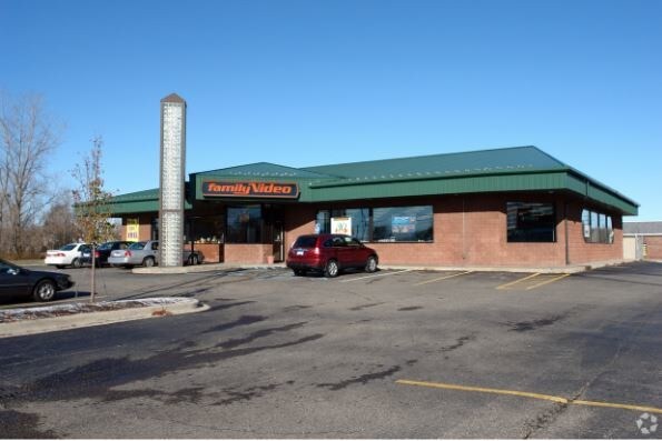
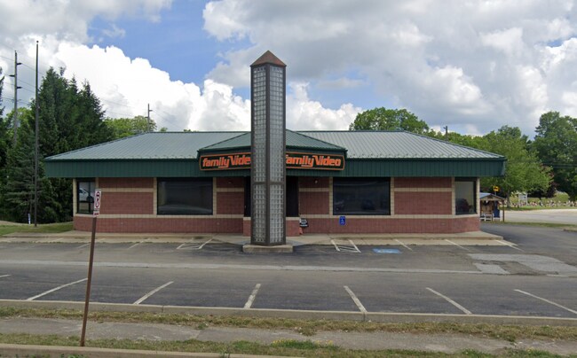
Property Record
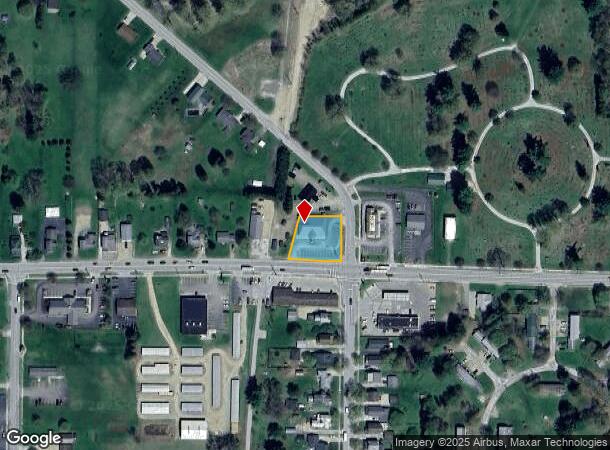
7 W Columbus Ave, Corry, PA 16407
NEARBY LISTINGS FOR SALE OR LEASE
Property Detail
7 W Columbus Ave
07-002-004.1-004.00
7 W COLUMBUS AVE 153 X 133 IRR
Storebuilding
Erie
X
Pennsylvania
42049C0467D
0.42 AC
2025
Outlying Erie County
2025
Erie
011900
Erie, PA
3,973 SF
DEMOGRAPHICS near 7 W Columbus Ave
1 mile
3 mile
5 mile
2024 Total Population
2,800
7,961
9,566
2029 Population
2,776
7,858
9,404
Pop Growth 2024-2029
(0.86%)
(1.29%)
(1.69%)
Average Age
41
41
42
2024 Total Households
1,164
3,256
3,897
HH Growth 2024-2029
(1.03%)
(1.44%)
(1.85%)
Median Household Inc
$55,172
$46,871
$49,593
Avg Household Size
2.30
2.40
2.40
2024 Avg HH Vehicles
1.00
2.00
2.00
Median Home Value
$83,690
$93,342
$103,350
Median Year Built
1948
1951
1953
Nearby Places
Map Layers
Map Styles
 Street
 Aerial
Transit
 Traffic
 Biking
Places
Listings with unknown addresses are not visible on the map
- Restaurants
- Banks
- Shops
- Fitness
- Groceries
PUBLIC TRANSPORTATION
AIRPORT
Erie International/Tom Ridge Field
Drive
Walk
Distance
Erie International/Tom Ridge Field
57 min
36.6 mi
SALE & LEASE HISTORY
LISTING DATE
SALE/LEASE

Dec 06, 2018
For Sale
Apr 13, 2018
For Lease
Nearby Properties
Address
Land Use
TOTAL SIZE
Lot Size
Zoning
Address
Land Use
TOTAL SIZE
Lot Size
Zoning
78,300 SF
16.69 AC
Address
Land Use
TOTAL SIZE
Lot Size
Zoning
2,240 SF
54.20 AC
R1
Address
Land Use
TOTAL SIZE
Lot Size
Zoning
9.97 AC
R1
Address
Land Use
TOTAL SIZE
Lot Size
Zoning
111,300 SF
11.84 AC
C2
Address
Land Use
TOTAL SIZE
Lot Size
Zoning
2.50 AC
R2
Address
Land Use
TOTAL SIZE
Lot Size
Zoning
34,012 SF
6.77 AC
R2
Address
Land Use
TOTAL SIZE
Lot Size
Zoning
312,396 SF
38.21 AC
R2
Address
Land Use
TOTAL SIZE
Lot Size
Zoning
8.23 AC
R1
Address
Land Use
TOTAL SIZE
Lot Size
Zoning
2.50 AC
I1
Address
Land Use
TOTAL SIZE
Lot Size
Zoning
4.25 AC
C2
Address
Land Use
TOTAL SIZE
Lot Size
Zoning
479,968 SF
28.04 AC
I2
Address
Land Use
TOTAL SIZE
Lot Size
Zoning
43,255 SF
5.70 AC
R1
Address
Land Use
TOTAL SIZE
Lot Size
Zoning
1.56 AC
R1
Address
Land Use
TOTAL SIZE
Lot Size
Zoning
4.15 AC
R1
Address
Land Use
TOTAL SIZE
Lot Size
Zoning
17,784 SF
2.26 AC
Address
Land Use
TOTAL SIZE
Lot Size
Zoning
2.07 AC
R2
Address
Land Use
TOTAL SIZE
Lot Size
Zoning
1,834 SF
186.56 AC
Address
Land Use
TOTAL SIZE
Lot Size
Zoning
155,406 SF
11.06 AC
Address
Land Use
TOTAL SIZE
Lot Size
Zoning
1.85 AC
S1
Address
Land Use
TOTAL SIZE
Lot Size
Zoning
121,836 SF
3.78 AC
I2
Address
Land Use
TOTAL SIZE
Lot Size
Zoning
45,680 SF
4.61 AC
R1
Address
Land Use
TOTAL SIZE
Lot Size
Zoning
44,380 SF
1.42 AC
C2
Address
Land Use
TOTAL SIZE
Lot Size
Zoning
1.26 AC
I1
Address
Land Use
TOTAL SIZE
Lot Size
Zoning
33,900 SF
3.72 AC
Address
Land Use
TOTAL SIZE
Lot Size
Zoning
0.34 AC
R2
Address
Land Use
TOTAL SIZE
Lot Size
Zoning
1,884 SF
8.35 AC
C2
Address
Land Use
TOTAL SIZE
Lot Size
Zoning
34,641 SF
2.89 AC
C2
Address
Land Use
TOTAL SIZE
Lot Size
Zoning
0.79 AC
C2
Address
Land Use
TOTAL SIZE
Lot Size
Zoning
0.43 AC
I1
Address
Land Use
TOTAL SIZE
Lot Size
Zoning
5,192 SF
7.84 AC
R1
The World's #1 Commercial Real Estate Marketplace
Connect with us
© 2026 CoStar Group
The information above has been obtained from sources believed reliable. While we do not doubt its accuracy we have not verified it and make no guarantee, warranty or representation about it. It is your responsibility to independently confirm its accuracy and completeness. Any projections, opinions, assumptions, or estimates used are for example only and do not represent the current or future performance of the property. The value of this transaction to you depends on tax and other factors which should be evaluated by your tax, financial, and legal advisors. You and your advisors should conduct a careful, independent investigation of the property to determine to your satisfaction the suitability of the property for your needs.