Property Record
7 W Main St, Erving, MA 01344


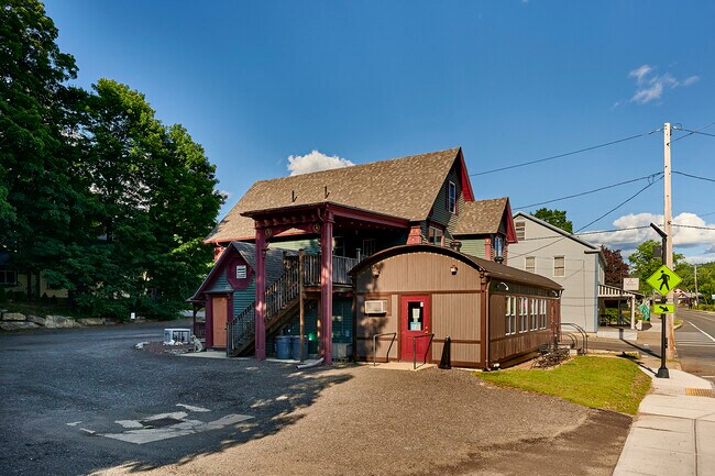
Property Detail
7 W Main St
ERVI-000006-000004-000010
Franklin
Commercialofficeresidentialmixeduse
Massachusetts
CV
10
2024
0.31 AC
2025
Franklin County
040400
Hartford
2,712 SF
Greenfield, MA
NEARBY LISTINGS FOR SALE OR LEASE
-
-
View all Erving listings for sale on LoopNet.com
DEMOGRAPHICS near 7 W Main St
1 mile
3 mile
5 mile
2025 Total Population
426
1,255
7,132
2030 Population
432
1,271
7,176
Pop Growth 2025-2030
+ 1.41%
+ 1.27%
+ 0.62%
Average Age
45
46
45
2025 Total Households
176
529
2,994
HH Growth 2025-2030
+ 1.14%
+ 1.32%
+ 0.60%
Median Household Inc
$75,463
$73,845
$65,160
Avg Household Size
2.40
2.40
2.40
2025 Avg HH Vehicles
2.00
2.00
2.00
Median Home Value
$278,999
$285,516
$291,849
Median Year Built
1958
1970
1954
Nearby Places
Map Layers
Map Styles
 Street
 Aerial
Transit
 Traffic
 Biking
Places
Listings with unknown addresses are not visible on the map
- Restaurants
- Banks
- Shops
- Fitness
- Groceries
SALE & LEASE HISTORY
LISTING DATE
SALE/LEASE

Jul 18, 2022
For Sale
Nearby Properties
Address
Land Use
TOTAL SIZE
Lot Size
Zoning
Address
Land Use
TOTAL SIZE
Lot Size
Zoning
6,080 SF
19.84 AC
CV
Address
Land Use
TOTAL SIZE
Lot Size
Zoning
1,407 SF
1,895.04 AC
RR
Address
Land Use
TOTAL SIZE
Lot Size
Zoning
979 SF
12.50 AC
R1
Address
Land Use
TOTAL SIZE
Lot Size
Zoning
192 SF
33.51 AC
RR
Address
Land Use
TOTAL SIZE
Lot Size
Zoning
1,170 SF
54.40 AC
Address
Land Use
TOTAL SIZE
Lot Size
Zoning
240 SF
127.78 AC
RR
Address
Land Use
TOTAL SIZE
Lot Size
Zoning
509.51 AC
RR
Address
Land Use
TOTAL SIZE
Lot Size
Zoning
149,567 SF
2.80 AC
CV
Address
Land Use
TOTAL SIZE
Lot Size
Zoning
1.50 AC
CV
Address
Land Use
TOTAL SIZE
Lot Size
Zoning
846 AC
Address
Land Use
TOTAL SIZE
Lot Size
Zoning
73.30 AC
D
Address
Land Use
TOTAL SIZE
Lot Size
Zoning
360 SF
96.32 AC
RR
Address
Land Use
TOTAL SIZE
Lot Size
Zoning
714 SF
63 AC
R1
Address
Land Use
TOTAL SIZE
Lot Size
Zoning
1,763 SF
7.62 AC
RR
Address
Land Use
TOTAL SIZE
Lot Size
Zoning
1,248 SF
2.30 AC
R1
Address
Land Use
TOTAL SIZE
Lot Size
Zoning
18,760 SF
4.29 AC
CV
Address
Land Use
TOTAL SIZE
Lot Size
Zoning
14,300 SF
1.11 AC
CV
Address
Land Use
TOTAL SIZE
Lot Size
Zoning
4,963 SF
0.44 AC
CV
Address
Land Use
TOTAL SIZE
Lot Size
Zoning
1,694 SF
0.50 AC
CV
Address
Land Use
TOTAL SIZE
Lot Size
Zoning
5.50 AC
VR
Address
Land Use
TOTAL SIZE
Lot Size
Zoning
2,170 SF
25 AC
R1
Address
Land Use
TOTAL SIZE
Lot Size
Zoning
169.50 AC
RR
Address
Land Use
TOTAL SIZE
Lot Size
Zoning
2,226 SF
0.96 AC
VR
Address
Land Use
TOTAL SIZE
Lot Size
Zoning
1,900 SF
0.09 AC
CV
Address
Land Use
TOTAL SIZE
Lot Size
Zoning
0.38 AC
CV
Address
Land Use
TOTAL SIZE
Lot Size
Zoning
108 AC
RR
Address
Land Use
TOTAL SIZE
Lot Size
Zoning
2,609 SF
0.60 AC
R1
Address
Land Use
TOTAL SIZE
Lot Size
Zoning
1,088 SF
RR
Address
Land Use
TOTAL SIZE
Lot Size
Zoning
0.34 AC
RR
The World's #1 Commercial Real Estate Marketplace
Connect with us
© 2026 CoStar Group
The information above has been obtained from sources believed reliable. While we do not doubt its accuracy we have not verified it and make no guarantee, warranty or representation about it. It is your responsibility to independently confirm its accuracy and completeness. Any projections, opinions, assumptions, or estimates used are for example only and do not represent the current or future performance of the property. The value of this transaction to you depends on tax and other factors which should be evaluated by your tax, financial, and legal advisors. You and your advisors should conduct a careful, independent investigation of the property to determine to your satisfaction the suitability of the property for your needs.