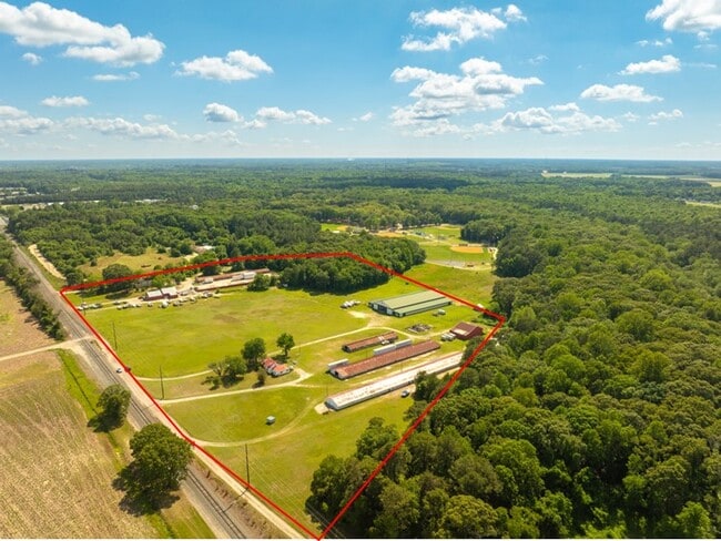
Property Record
7 W Naylor Mill Rd, Salisbury, MD 21801

Property Detail
7 W Naylor Mill Rd
09-076549
47.57 ACRES N/S NAYLOR MILL RD RESUB WICO CO AND CITY O
Taxexempt
WICOMICO
C
Maryland
B and X Area of moderate flood hazard, usually the area between the limits of the 100-year and 500-year floods.
47.57 AC
0
Chesapeake Bay/Salisbury
2025
Other Market Areas
010300
Salisbury, MD
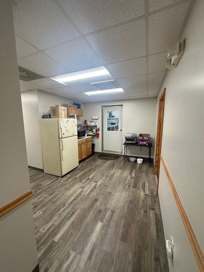
3,766 SF
NEARBY LISTINGS FOR SALE OR LEASE
DEMOGRAPHICS near 7 W Naylor Mill Rd
1 mile
3 mile
5 mile
2025 Total Population
870
27,022
64,674
2030 Population
879
27,718
66,348
Pop Growth 2025-2030
+ 1.03%
+ 2.58%
+ 2.59%
Average Age
41
39
38
2025 Total Households
347
10,424
25,242
HH Growth 2025-2030
+ 1.15%
+ 2.71%
+ 2.60%
Median Household Inc
$64,166
$64,451
$63,517
Avg Household Size
2.40
2.50
2.40
2025 Avg HH Vehicles
2.00
2.00
2.00
Median Home Value
$233,333
$229,191
$236,297
Median Year Built
1985
1979
1979
Nearby Places
Map Layers
Map Styles
 Street
 Aerial
Layers
 Traffic
 Biking
Places
Listings with unknown addresses are not visible on the map
- Restaurants
- Banks
- Shops
- Fitness
- Groceries
PUBLIC TRANSPORTATION
AIRPORT
Salisbury-Ocean City Wicomico Regional
Drive
Walk
Distance
Salisbury-Ocean City Wicomico Regional
21 min
10.5 mi
Freight Ports
Port of Baltimore
Drive
Walk
Distance
Port of Baltimore
154 min
104.1 mi
Nearby Properties
Address
Land Use
TOTAL SIZE
Lot Size
Zoning
Address
Land Use
TOTAL SIZE
Lot Size
Zoning
28,442 SF
34.88 AC
GC
Address
Land Use
TOTAL SIZE
Lot Size
Zoning
25,000 SF
23.46 AC
I-2
Address
Land Use
TOTAL SIZE
Lot Size
Zoning
79,596 SF
21.52 AC
Address
Land Use
TOTAL SIZE
Lot Size
Zoning
9,222 SF
36.49 AC
R2
Address
Land Use
TOTAL SIZE
Lot Size
Zoning
27,570 SF
25.81 AC
R2
Address
Land Use
TOTAL SIZE
Lot Size
Zoning
219,584 SF
23.60 AC
PRD
Address
Land Use
TOTAL SIZE
Lot Size
Zoning
488,450 SF
28.70 AC
GC
Address
Land Use
TOTAL SIZE
Lot Size
Zoning
105,626 SF
53.26 AC
R-8
Address
Land Use
TOTAL SIZE
Lot Size
Zoning
28,365 SF
11.21 AC
R1A
Address
Land Use
TOTAL SIZE
Lot Size
Zoning
15,531 SF
15.26 AC
GC
Address
Land Use
TOTAL SIZE
Lot Size
Zoning
92,168 SF
13.40 AC
Address
Land Use
TOTAL SIZE
Lot Size
Zoning
6,136 SF
52.49 AC
R-10
Address
Land Use
TOTAL SIZE
Lot Size
Zoning
40,690 SF
9.02 AC
PDD
Address
Land Use
TOTAL SIZE
Lot Size
Zoning
76,999 SF
7.72 AC
R-8
Address
Land Use
TOTAL SIZE
Lot Size
Zoning
60,949 SF
14.13 AC
R-8
Address
Land Use
TOTAL SIZE
Lot Size
Zoning
88,872 SF
8.48 AC
PRD
Address
Land Use
TOTAL SIZE
Lot Size
Zoning
213,442 SF
17.91 AC
GC
Address
Land Use
TOTAL SIZE
Lot Size
Zoning
5,151 SF
13.23 AC
LI
Address
Land Use
TOTAL SIZE
Lot Size
Zoning
92,232 SF
20.83 AC
C
Address
Land Use
TOTAL SIZE
Lot Size
Zoning
56,301 SF
26.25 AC
Address
Land Use
TOTAL SIZE
Lot Size
Zoning
9,600 SF
19.27 AC
ARR
Address
Land Use
TOTAL SIZE
Lot Size
Zoning
37,645 SF
16.43 AC
IP
Address
Land Use
TOTAL SIZE
Lot Size
Zoning
4,181 SF
4.45 AC
GC
Address
Land Use
TOTAL SIZE
Lot Size
Zoning
22,583 SF
7.54 AC
Address
Land Use
TOTAL SIZE
Lot Size
Zoning
44,260 SF
4.62 AC
C
Address
Land Use
TOTAL SIZE
Lot Size
Zoning
134,313 SF
12.90 AC
GC
Address
Land Use
TOTAL SIZE
Lot Size
Zoning
73,424 SF
2.90 AC
R1A
Address
Land Use
TOTAL SIZE
Lot Size
Zoning
20,970 SF
3.52 AC
Address
Land Use
TOTAL SIZE
Lot Size
Zoning
27,432 SF
6.40 AC
Address
Land Use
TOTAL SIZE
Lot Size
Zoning
171,072 SF
15.19 AC
R-8A
The World's #1 Commercial Real Estate Marketplace
Connect with us
© 2026 CoStar Group
The information above has been obtained from sources believed reliable. While we do not doubt its accuracy we have not verified it and make no guarantee, warranty or representation about it. It is your responsibility to independently confirm its accuracy and completeness. Any projections, opinions, assumptions, or estimates used are for example only and do not represent the current or future performance of the property. The value of this transaction to you depends on tax and other factors which should be evaluated by your tax, financial, and legal advisors. You and your advisors should conduct a careful, independent investigation of the property to determine to your satisfaction the suitability of the property for your needs.