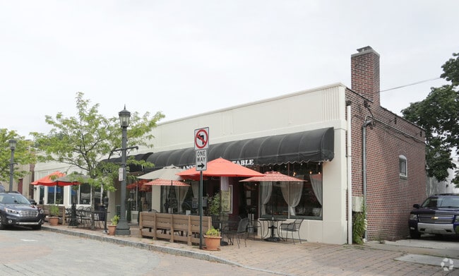
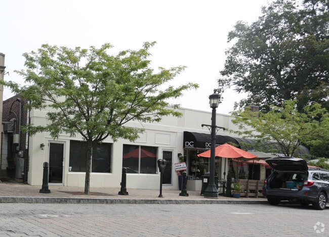
Property Record
7 Wesley Ave, Glenside, PA 19038
NEARBY LISTINGS FOR SALE OR LEASE
Property Detail
7 Wesley Ave
31-00-28393-007
ASSESSOR BLOCK-UNIT NUMBER 129-1
Storemultistory
Montgomery
X
Pennsylvania
42091C0382G
1
2024
0.13 AC
2025
Horsham/Willow Grove
202603
Philadelphia
7,254 SF
Philadelphia-Camden-Wilmington, PA-NJ-DE-MD
DEMOGRAPHICS near 7 Wesley Ave
1 Mile
3 Mile
5 Mile
2024 Total Population
13,930
148,623
399,063
2029 Population
14,132
148,659
393,305
Pop Growth 2024-2029
+ 1.45%
+ 0.02%
(1.44%)
Average Age
40
42
41
2024 Total Households
5,155
59,302
157,626
HH Growth 2024-2029
+ 1.34%
(0.04%)
(1.63%)
Median Household Inc
$119,713
$83,668
$70,822
Avg Household Size
2.60
2.40
2.40
2024 Avg HH Vehicles
2.00
2.00
1.00
Median Home Value
$358,257
$300,320
$274,700
Median Year Built
1948
1953
1952
Nearby Places
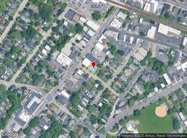
Map Layers
Map Styles
 Street
 Aerial
- Restaurants
- Banks
- Shops
- Fitness
- Groceries
PUBLIC TRANSPORTATION
TRANSIT/SUBWAY
Glenside (R1 - Southeastern Pennsylvania Transportation Authority Regional Rail (SEPTA Regional Rail), R2 - Southeastern Pennsylvania Transportation Authority Regional Rail (SEPTA Regional Rail), R5 - Southeastern Pennsylvania Transportation Authority Regional Rail (SEPTA Regional Rail))
DRIVE
WALK
Distance
Glenside (R1 - Southeastern Pennsylvania Transportation Authority Regional Rail (SEPTA Regional Rail), R2 - Southeastern Pennsylvania Transportation Authority Regional Rail (SEPTA Regional Rail), R5 - Southeastern Pennsylvania Transportation Authority Regional Rail (SEPTA Regional Rail))
3 min
5 min
0.2 mi
AIRPORT
Philadelphia International
DRIVE
WALK
Distance
Philadelphia International
32 min
22.8 mi
SALE & LEASE HISTORY
LISTING DATE
SALE/LEASE

Feb 19, 2020
For Lease
Nearby Properties
Address
Land Use
TOTAL SIZE
Lot Size
Zoning
Address
Land Use
TOTAL SIZE
Lot Size
Zoning
1,556,628 SF
7.70 AC
AO
Address
Land Use
TOTAL SIZE
Lot Size
Zoning
638,776 SF
20 AC
RM2
Address
Land Use
TOTAL SIZE
Lot Size
Zoning
2,146,150 SF
119.95 AC
M1
Address
Land Use
TOTAL SIZE
Lot Size
Zoning
649,400 SF
55.03 AC
R1
Address
Land Use
TOTAL SIZE
Lot Size
Zoning
487,936 SF
58.50 AC
T
Address
Land Use
TOTAL SIZE
Lot Size
Zoning
148,293 SF
7.45 AC
RM2
Address
Land Use
TOTAL SIZE
Lot Size
Zoning
705,687 SF
19.89 AC
C1
Address
Land Use
TOTAL SIZE
Lot Size
Zoning
263,000 SF
5.31 AC
RM2
Address
Land Use
TOTAL SIZE
Lot Size
Zoning
234,934 SF
43.63 AC
AA
Address
Land Use
TOTAL SIZE
Lot Size
Zoning
635,387 SF
10.12 AC
C1
Address
Land Use
TOTAL SIZE
Lot Size
Zoning
131,720 SF
4.33 AC
RM2
Address
Land Use
TOTAL SIZE
Lot Size
Zoning
316,163 SF
45.32 AC
T
Address
Land Use
TOTAL SIZE
Lot Size
Zoning
557,091 SF
21.87 AC
AO
Address
Land Use
TOTAL SIZE
Lot Size
Zoning
222,235 SF
29.23 AC
A
Address
Land Use
TOTAL SIZE
Lot Size
Zoning
582,294 SF
9.07 AC
C1
Address
Land Use
TOTAL SIZE
Lot Size
Zoning
615,217 SF
33.52 AC
C2
Address
Land Use
TOTAL SIZE
Lot Size
Zoning
182,130 SF
6.45 AC
RSA3
Address
Land Use
TOTAL SIZE
Lot Size
Zoning
435,888 SF
16.35 AC
MD
Address
Land Use
TOTAL SIZE
Lot Size
Zoning
336,650 SF
61.74 AC
R3
Address
Land Use
TOTAL SIZE
Lot Size
Zoning
232,190 SF
34.16 AC
R4
Address
Land Use
TOTAL SIZE
Lot Size
Zoning
259,505 SF
42.19 AC
V
Address
Land Use
TOTAL SIZE
Lot Size
Zoning
130,115 SF
10.45 AC
PB
Address
Land Use
TOTAL SIZE
Lot Size
Zoning
139,087 SF
2.76 AC
V
Address
Land Use
TOTAL SIZE
Lot Size
Zoning
232,000 SF
13.71 AC
RSA3
Address
Land Use
TOTAL SIZE
Lot Size
Zoning
103,898 SF
10.23 AC
CA2
Address
Land Use
TOTAL SIZE
Lot Size
Zoning
566,988 SF
29.69 AC
C2
Address
Land Use
TOTAL SIZE
Lot Size
Zoning
574,944 SF
5.45 AC
F2
Address
Land Use
TOTAL SIZE
Lot Size
Zoning
336,463 SF
7.52 AC
Address
Land Use
TOTAL SIZE
Lot Size
Zoning
193,334 SF
32.50 AC
NR
Address
Land Use
TOTAL SIZE
Lot Size
Zoning
250,749 SF
47.90 AC
V
The World's #1 Commercial Real Estate Marketplace
Connect with us
© 2025 CoStar Group
The information above has been obtained from sources believed reliable. While we do not doubt its accuracy we have not verified it and make no guarantee, warranty or representation about it. It is your responsibility to independently confirm its accuracy and completeness. Any projections, opinions, assumptions, or estimates used are for example only and do not represent the current or future performance of the property. The value of this transaction to you depends on tax and other factors which should be evaluated by your tax, financial, and legal advisors. You and your advisors should conduct a careful, independent investigation of the property to determine to your satisfaction the suitability of the property for your needs.