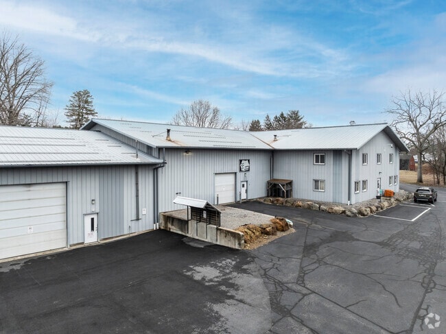
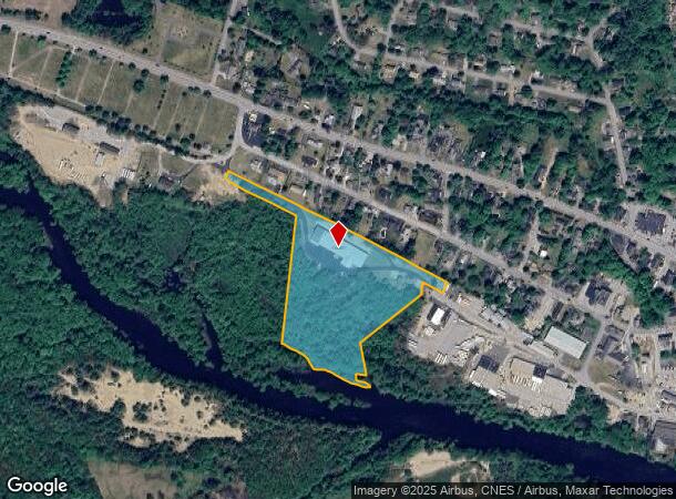
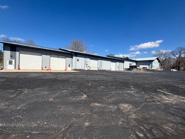
Property Record
70 Depot St, Goffstown, NH 03045
Current Lease Availabilities
NEARBY LISTINGS FOR SALE OR LEASE
-
-
View all Goffstown listings for lease on LoopNet.com
Property Detail
70 Depot St
Warehouse
Hillsborough
AE
New Hampshire
33013C0665E
11.40 AC
2024
Hillsborough
2024
Boston
002701
Manchester-Nashua, NH
23,040 SF
GOFF-000037-000003
DEMOGRAPHICS near 70 Depot St
1 Mile
3 Mile
5 Mile
2024 Total Population
2,998
8,400
24,309
2029 Population
3,070
8,574
24,874
Pop Growth 2024-2029
+ 2.40%
+ 2.07%
+ 2.32%
Average Age
41
41
41
2024 Total Households
1,151
3,081
8,470
HH Growth 2024-2029
+ 2.43%
+ 2.11%
+ 2.49%
Median Household Inc
$120,097
$125,309
$117,703
Avg Household Size
2.60
2.70
2.70
2024 Avg HH Vehicles
2.00
2.00
2.00
Median Home Value
$376,730
$385,293
$382,147
Median Year Built
1971
1976
1983
Nearby Places
Map Layers
Map Styles
 Street
 Aerial
- Restaurants
- Banks
- Shops
- Fitness
- Groceries
PUBLIC TRANSPORTATION
AIRPORT
Manchester Boston Regional
DRIVE
WALK
Distance
Manchester Boston Regional
29 min
13.6 mi
Freight Ports
Port of Boston
DRIVE
WALK
Distance
Port of Boston
101 min
66.0 mi
Nearby Properties
Address
Land Use
TOTAL SIZE
Lot Size
Zoning
Address
Land Use
TOTAL SIZE
Lot Size
Zoning
177,600 SF
30 AC
R1
Address
Land Use
TOTAL SIZE
Lot Size
Zoning
121,464 SF
60.30 AC
A
Address
Land Use
TOTAL SIZE
Lot Size
Zoning
61,250 SF
11.24 AC
CIFZ
Address
Land Use
TOTAL SIZE
Lot Size
Zoning
12,579 SF
1.73 AC
VCD
Address
Land Use
TOTAL SIZE
Lot Size
Zoning
38,440 SF
4 AC
R1
Address
Land Use
TOTAL SIZE
Lot Size
Zoning
5,417 SF
141.99 AC
A
Address
Land Use
TOTAL SIZE
Lot Size
Zoning
17,326 SF
25.79 AC
A
Address
Land Use
TOTAL SIZE
Lot Size
Zoning
16,622 SF
5.20 AC
CIFZ
Address
Land Use
TOTAL SIZE
Lot Size
Zoning
2,096 SF
70.66 AC
A
Address
Land Use
TOTAL SIZE
Lot Size
Zoning
22,192 SF
4.54 AC
C
Address
Land Use
TOTAL SIZE
Lot Size
Zoning
3,226 SF
3.49 AC
CIFZ
Address
Land Use
TOTAL SIZE
Lot Size
Zoning
14,946 SF
1.29 AC
VCD
Address
Land Use
TOTAL SIZE
Lot Size
Zoning
45,420 SF
1.13 AC
VCD
Address
Land Use
TOTAL SIZE
Lot Size
Zoning
18,066 SF
6.34 AC
R1
Address
Land Use
TOTAL SIZE
Lot Size
Zoning
11,624 SF
0.88 AC
VCD
Address
Land Use
TOTAL SIZE
Lot Size
Zoning
17,760 SF
6.35 AC
R1
Address
Land Use
TOTAL SIZE
Lot Size
Zoning
620 SF
9 AC
R1
Address
Land Use
TOTAL SIZE
Lot Size
Zoning
6,064 SF
2.67 AC
CIFZ
Address
Land Use
TOTAL SIZE
Lot Size
Zoning
465 AC
CON
Address
Land Use
TOTAL SIZE
Lot Size
Zoning
10,688 SF
1.05 AC
VCD
Address
Land Use
TOTAL SIZE
Lot Size
Zoning
8,400 SF
1.02 AC
RSB1
Address
Land Use
TOTAL SIZE
Lot Size
Zoning
2,692 SF
63.91 AC
CIFZ
Address
Land Use
TOTAL SIZE
Lot Size
Zoning
1,728 SF
3.23 AC
R1
Address
Land Use
TOTAL SIZE
Lot Size
Zoning
3,830 SF
1.33 AC
CIFZ
Address
Land Use
TOTAL SIZE
Lot Size
Zoning
37,777 SF
9.84 AC
COMMER
Address
Land Use
TOTAL SIZE
Lot Size
Zoning
18 AC
R1
Address
Land Use
TOTAL SIZE
Lot Size
Zoning
16,200 SF
1.13 AC
CIFZ
Address
Land Use
TOTAL SIZE
Lot Size
Zoning
15,240 SF
1.20 AC
VCD
Address
Land Use
TOTAL SIZE
Lot Size
Zoning
27,324 SF
13.70 AC
A
The World's #1 Commercial Real Estate Marketplace
Connect with us
© 2026 CoStar Group
The information above has been obtained from sources believed reliable. While we do not doubt its accuracy we have not verified it and make no guarantee, warranty or representation about it. It is your responsibility to independently confirm its accuracy and completeness. Any projections, opinions, assumptions, or estimates used are for example only and do not represent the current or future performance of the property. The value of this transaction to you depends on tax and other factors which should be evaluated by your tax, financial, and legal advisors. You and your advisors should conduct a careful, independent investigation of the property to determine to your satisfaction the suitability of the property for your needs.