Property Record
70 E 91St St, Indianapolis, IN 46240


Current Lease Availabilities
Property Detail
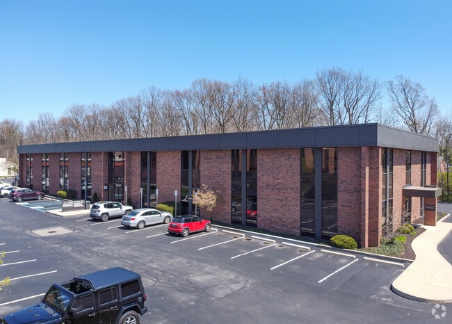
70 E 91St St
49-03-14-101-025.000-800
DE VORS NORTH MERIDIAN ST ADD L1 & PT L2, L3 &L4 BEG SE COR OF L1; W284.14 N186.03 E156.5N215.97 W153.5 S402 TO BEG & 35 VAC ST E &ADJ
Officebuilding
Marion
ZO01
Indiana
B and X Area of moderate flood hazard, usually the area between the limits of the 100-year and 500-year floods.
1
2024
2.34 AC
2025
Meridian Corridor
320107
Indianapolis
27,200 SF
Indianapolis-Carmel-Greenwood, IN
NEARBY LISTINGS FOR SALE OR LEASE
DEMOGRAPHICS near 70 E 91St St
1 mile
3 mile
5 mile
2025 Total Population
7,284
61,594
183,384
2030 Population
7,394
63,273
189,015
Pop Growth 2025-2030
+ 1.51%
+ 2.73%
+ 3.07%
Average Age
41
41
40
2025 Total Households
3,722
28,627
81,371
HH Growth 2025-2030
+ 1.34%
+ 2.54%
+ 2.97%
Median Household Inc
$63,725
$84,916
$93,367
Avg Household Size
1.90
2.10
2.20
2025 Avg HH Vehicles
2.00
2.00
2.00
Median Home Value
$362,333
$369,220
$381,123
Median Year Built
1977
1980
1982
Nearby Places
Map Layers
Map Styles
 Street
 Aerial
Transit
 Traffic
 Biking
Places
Listings with unknown addresses are not visible on the map
- Restaurants
- Banks
- Shops
- Fitness
- Groceries
PUBLIC TRANSPORTATION
AIRPORT
Indianapolis International
Drive
Walk
Distance
Indianapolis International
46 min
27.8 mi
Freight Ports
Port of Toledo
Drive
Walk
Distance
Port of Toledo
263 min
221.0 mi
Nearby Properties
Address
Land Use
TOTAL SIZE
Lot Size
Zoning
Address
Land Use
TOTAL SIZE
Lot Size
Zoning
303,520 SF
61.51 AC
ZO01
Address
Land Use
TOTAL SIZE
Lot Size
Zoning
239,161 SF
12.12 AC
Address
Land Use
TOTAL SIZE
Lot Size
Zoning
4,146 SF
45.91 AC
ZO01
Address
Land Use
TOTAL SIZE
Lot Size
Zoning
317,335 SF
4.14 AC
Address
Land Use
TOTAL SIZE
Lot Size
Zoning
315,968 SF
0.06 AC
ZO01
Address
Land Use
TOTAL SIZE
Lot Size
Zoning
117,212 SF
2.81 AC
ZO01
Address
Land Use
TOTAL SIZE
Lot Size
Zoning
372,408 SF
12.49 AC
Address
Land Use
TOTAL SIZE
Lot Size
Zoning
408,298 SF
15.67 AC
Address
Land Use
TOTAL SIZE
Lot Size
Zoning
267,771 SF
13.10 AC
Address
Land Use
TOTAL SIZE
Lot Size
Zoning
337,250 SF
18.54 AC
Address
Land Use
TOTAL SIZE
Lot Size
Zoning
428,056 SF
20.27 AC
Address
Land Use
TOTAL SIZE
Lot Size
Zoning
345 SF
6.39 AC
ZO01
Address
Land Use
TOTAL SIZE
Lot Size
Zoning
107,078 SF
15.66 AC
ZO01
Address
Land Use
TOTAL SIZE
Lot Size
Zoning
158,839 SF
0.06 AC
Address
Land Use
TOTAL SIZE
Lot Size
Zoning
10,514 SF
15.75 AC
ZO01
Address
Land Use
TOTAL SIZE
Lot Size
Zoning
288 SF
7.35 AC
ZO01
Address
Land Use
TOTAL SIZE
Lot Size
Zoning
8,157 SF
113.93 AC
ZO01
Address
Land Use
TOTAL SIZE
Lot Size
Zoning
3,316 SF
8.91 AC
ZO01
Address
Land Use
TOTAL SIZE
Lot Size
Zoning
229,554 SF
11.78 AC
ZO01
Address
Land Use
TOTAL SIZE
Lot Size
Zoning
162,462 SF
2 AC
Address
Land Use
TOTAL SIZE
Lot Size
Zoning
83,446 SF
67.68 AC
Address
Land Use
TOTAL SIZE
Lot Size
Zoning
2,544 SF
37.75 AC
ZO01
Address
Land Use
TOTAL SIZE
Lot Size
Zoning
1,700 SF
33.14 AC
ZO01
Address
Land Use
TOTAL SIZE
Lot Size
Zoning
127,922 SF
3.35 AC
ZO01
Address
Land Use
TOTAL SIZE
Lot Size
Zoning
4,267 SF
21.06 AC
ZO01
Address
Land Use
TOTAL SIZE
Lot Size
Zoning
9,076 SF
18 AC
ZO01
Address
Land Use
TOTAL SIZE
Lot Size
Zoning
229,856 SF
7 AC
Address
Land Use
TOTAL SIZE
Lot Size
Zoning
50,698 SF
13.58 AC
Address
Land Use
TOTAL SIZE
Lot Size
Zoning
182,869 SF
7 AC
ZO01
Address
Land Use
TOTAL SIZE
Lot Size
Zoning
117,664 SF
7.51 AC
The World's #1 Commercial Real Estate Marketplace
Connect with us
© 2026 CoStar Group
The information above has been obtained from sources believed reliable. While we do not doubt its accuracy we have not verified it and make no guarantee, warranty or representation about it. It is your responsibility to independently confirm its accuracy and completeness. Any projections, opinions, assumptions, or estimates used are for example only and do not represent the current or future performance of the property. The value of this transaction to you depends on tax and other factors which should be evaluated by your tax, financial, and legal advisors. You and your advisors should conduct a careful, independent investigation of the property to determine to your satisfaction the suitability of the property for your needs.