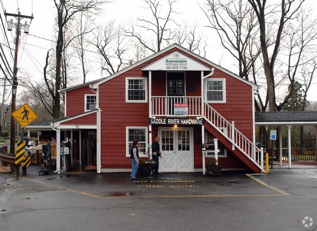
Property Record
70 E Allendale Rd, Saddle River, NJ 07458


NEARBY LISTINGS FOR SALE OR LEASE
Property Detail
70 E Allendale Rd
58-01607-0000-00002
.4AC (18,2)
Commercialnec
Bergen
AE
New Jersey
34003C0086J
2
2024
0.40 AC
2025
North 17 Corridor
053100
Northern New Jersey
3,684 SF
New York-Jersey City-White Plains, NY-NJ
DEMOGRAPHICS near 70 E Allendale Rd
1 mile
3 mile
5 mile
2024 Total Population
2,319
65,520
214,820
2029 Population
2,346
65,756
214,785
Pop Growth 2024-2029
+ 1.16%
+ 0.36%
(0.02%)
Average Age
48
42
42
2024 Total Households
861
22,575
74,920
HH Growth 2024-2029
+ 1.05%
+ 0.28%
(0.07%)
Median Household Inc
$207,383
$169,247
$147,055
Avg Household Size
2.60
2.80
2.80
2024 Avg HH Vehicles
2.00
2.00
2.00
Median Home Value
$1,112,435
$772,173
$723,413
Median Year Built
1986
1963
1963
Nearby Places
Map Layers
Map Styles
 Street
 Aerial
Transit
 Traffic
 Biking
Places
Listings with unknown addresses are not visible on the map
- Restaurants
- Banks
- Shops
- Fitness
- Groceries
PUBLIC TRANSPORTATION
COMMUTER RAIL
Allendale (Bergen County/Port Jervis Line - NJ Transit Commuter Rail (NJ Transit), Main/Port Jervis Line - NJ Transit Commuter Rail (NJ Transit))
Drive
Walk
Distance
Allendale (Bergen County/Port Jervis Line - NJ Transit Commuter Rail (NJ Transit), Main/Port Jervis Line - NJ Transit Commuter Rail (NJ Transit))
4 min
1.8 mi
Waldwick (Bergen County/Port Jervis Line - NJ Transit Commuter Rail (NJ Transit), Main/Port Jervis Line - NJ Transit Commuter Rail (NJ Transit))
Drive
Walk
Distance
Waldwick (Bergen County/Port Jervis Line - NJ Transit Commuter Rail (NJ Transit), Main/Port Jervis Line - NJ Transit Commuter Rail (NJ Transit))
7 min
2.7 mi
AIRPORT
LaGuardia
Drive
Walk
Distance
LaGuardia
42 min
27.8 mi
Newark Liberty International
Drive
Walk
Distance
Newark Liberty International
38 min
29.6 mi
Westchester County
Drive
Walk
Distance
Westchester County
40 min
31.1 mi
Freight Ports
Port Newark Container Terminal
Drive
Walk
Distance
Port Newark Container Terminal
1 min
23.8 mi
SALE & LEASE HISTORY
LISTING DATE
SALE/LEASE

Nov 15, 2016
For Lease
Jul 29, 2020
For Lease
Nearby Properties
Address
Land Use
TOTAL SIZE
Lot Size
Zoning
Address
Land Use
TOTAL SIZE
Lot Size
Zoning
131,384 SF
65 AC
EO
Address
Land Use
TOTAL SIZE
Lot Size
Zoning
Address
Land Use
TOTAL SIZE
Lot Size
Zoning
205,580 SF
21.18 AC
EO
Address
Land Use
TOTAL SIZE
Lot Size
Zoning
40.40 AC
PU
Address
Land Use
TOTAL SIZE
Lot Size
Zoning
2,379 SF
1.09 AC
LI
Address
Land Use
TOTAL SIZE
Lot Size
Zoning
7.11 AC
Address
Land Use
TOTAL SIZE
Lot Size
Zoning
7.04 AC
SED
Address
Land Use
TOTAL SIZE
Lot Size
Zoning
Address
Land Use
TOTAL SIZE
Lot Size
Zoning
Address
Land Use
TOTAL SIZE
Lot Size
Zoning
23.19 AC
R1
Address
Land Use
TOTAL SIZE
Lot Size
Zoning
13 AC
EAO
Address
Land Use
TOTAL SIZE
Lot Size
Zoning
16.02 AC
R3
Address
Land Use
TOTAL SIZE
Lot Size
Zoning
22.75 AC
Address
Land Use
TOTAL SIZE
Lot Size
Zoning
11.48 AC
OR-3
Address
Land Use
TOTAL SIZE
Lot Size
Zoning
9.29 AC
SED
Address
Land Use
TOTAL SIZE
Lot Size
Zoning
17 AC
OR1
Address
Land Use
TOTAL SIZE
Lot Size
Zoning
Address
Land Use
TOTAL SIZE
Lot Size
Zoning
36.49 AC
OR-2
Address
Land Use
TOTAL SIZE
Lot Size
Zoning
20.30 AC
Address
Land Use
TOTAL SIZE
Lot Size
Zoning
31.79 AC
OR2
Address
Land Use
TOTAL SIZE
Lot Size
Zoning
3,165 SF
2.07 AC
VC2
Address
Land Use
TOTAL SIZE
Lot Size
Zoning
Address
Land Use
TOTAL SIZE
Lot Size
Zoning
38.65 AC
Address
Land Use
TOTAL SIZE
Lot Size
Zoning
10.64 AC
AAA
Address
Land Use
TOTAL SIZE
Lot Size
Zoning
6.52 AC
Address
Land Use
TOTAL SIZE
Lot Size
Zoning
2,374 SF
1.80 AC
SOII
Address
Land Use
TOTAL SIZE
Lot Size
Zoning
71,166 SF
7.26 AC
B3
Address
Land Use
TOTAL SIZE
Lot Size
Zoning
124,528 SF
8.87 AC
EM
Address
Land Use
TOTAL SIZE
Lot Size
Zoning
3.63 AC
Address
Land Use
TOTAL SIZE
Lot Size
Zoning
The World's #1 Commercial Real Estate Marketplace
Connect with us
© 2026 CoStar Group
The information above has been obtained from sources believed reliable. While we do not doubt its accuracy we have not verified it and make no guarantee, warranty or representation about it. It is your responsibility to independently confirm its accuracy and completeness. Any projections, opinions, assumptions, or estimates used are for example only and do not represent the current or future performance of the property. The value of this transaction to you depends on tax and other factors which should be evaluated by your tax, financial, and legal advisors. You and your advisors should conduct a careful, independent investigation of the property to determine to your satisfaction the suitability of the property for your needs.